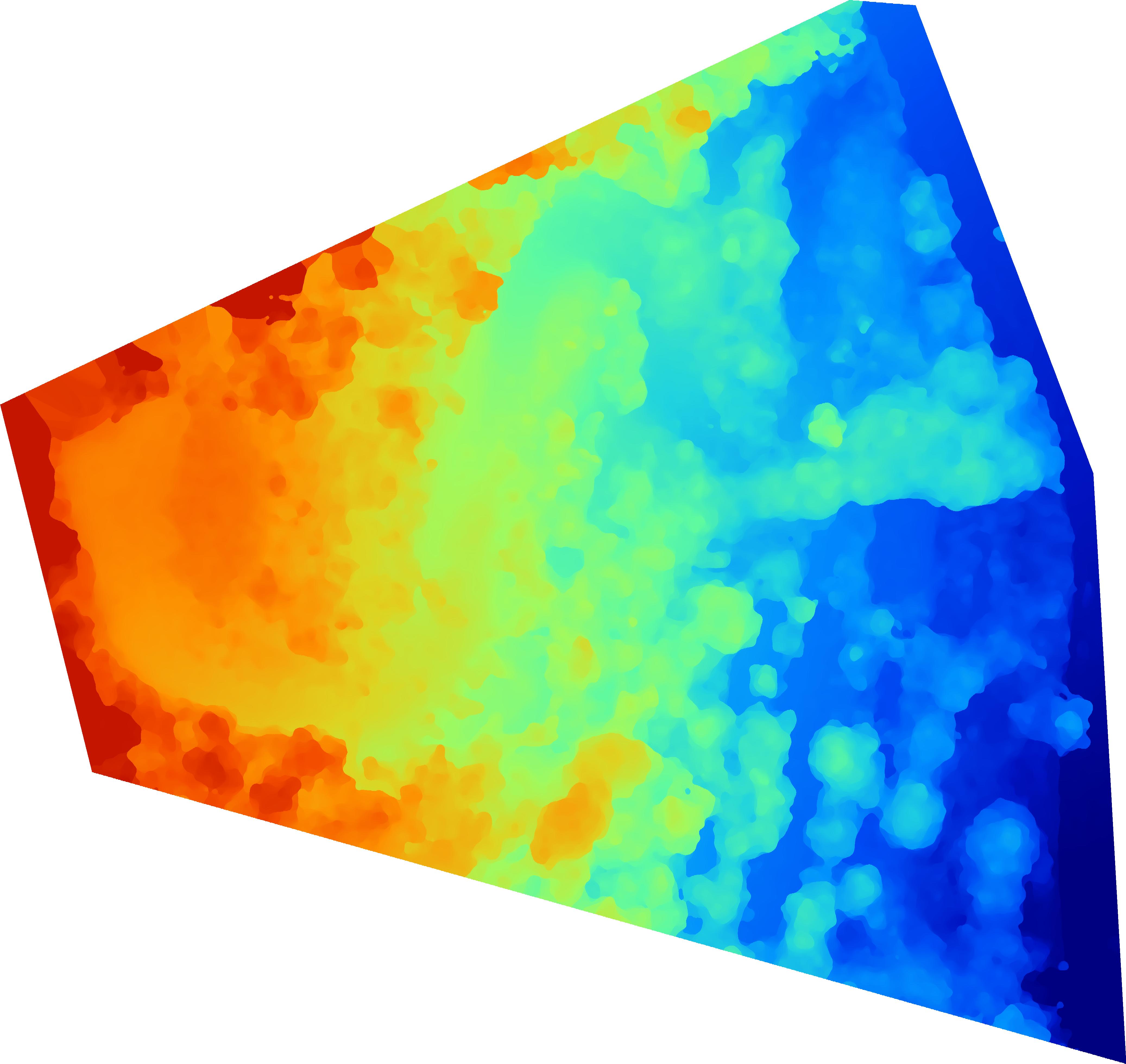
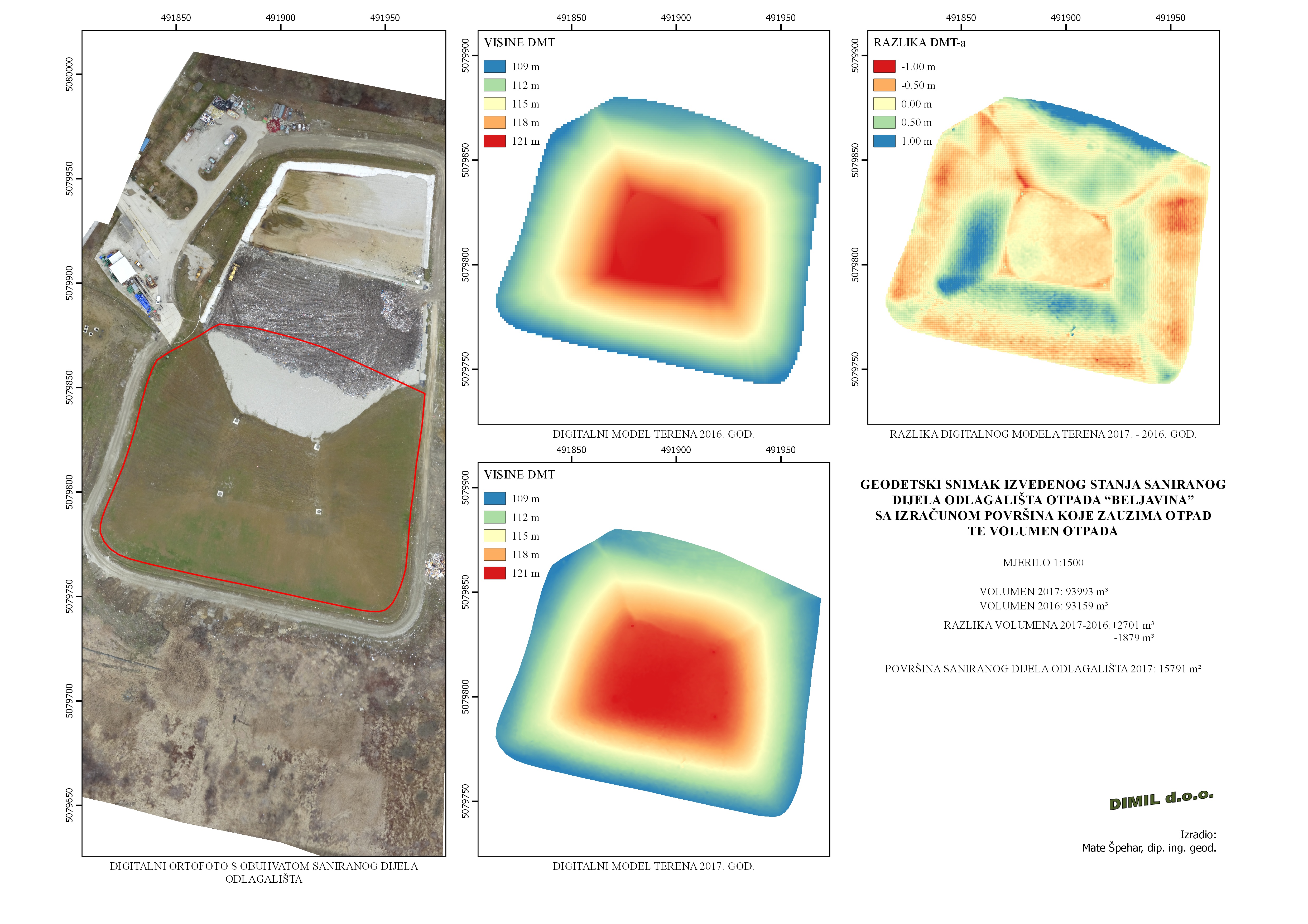
Modeling landfill "Beljavina"
Beljavina
10 ha
97
4 cm/pixel
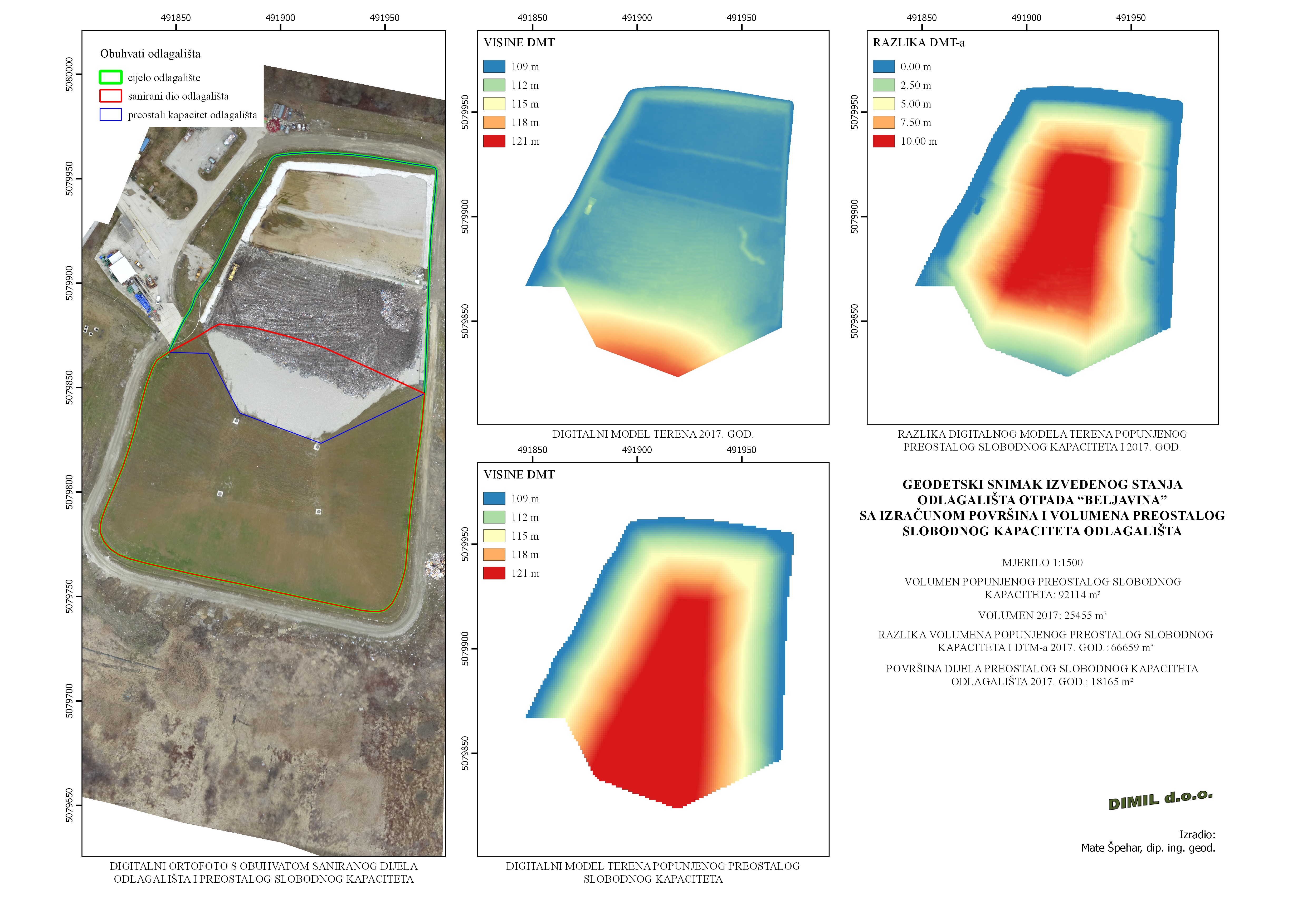
Geodetic survey for sanitized part of landfill "Beljavina" with calculation of it's area and volume, and calculation of the remaining available capacity of landfill has been made. Subsiding of the crown area for sanitized part of landfill has been observed, along with it's shape changing due to settling of material on the top and spreading on the middle parts.
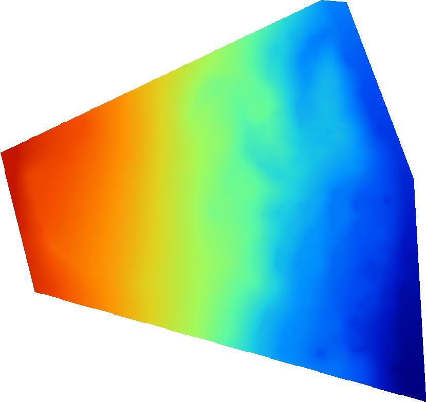
Modeling shoreline
Crikvenica
1 ha
22
4.5 cm/pixel
The project has provided an insight into the possibility of modeling shoreline with modeling the sea depth. One of the key prerequisites is the clean and clear sea.
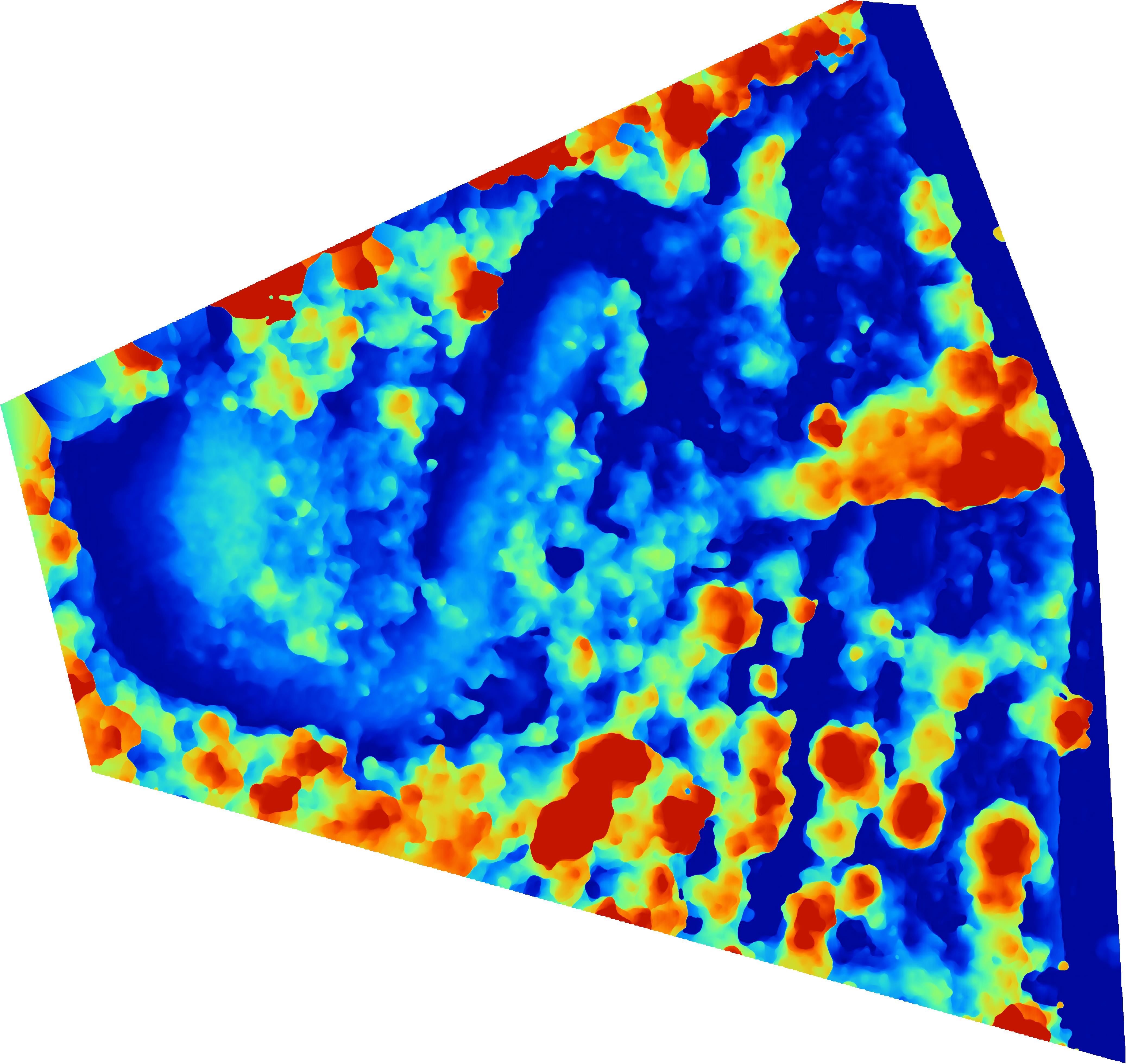
Extracting the trees from the terrain
Oprić
7 ha
96
3.3 cm/pixel
We've tested tool for creating DTM available in Pix4Dmapper-Pro 3.1.14, at developed DSM. On the basis of the DSM and DTM layer containing only objects has been made, and which is further used for the preparation of the tree map.