Geodetic survey
The basis of creating every quality preliminary / main project or planning serious activities in the landscape are accurate and updated geodetic surveys, which create as much as possible realistic insight into the area of operations in the landscape. We deliver created geodetic surveys in all formats supported by most modern software solutions.

Stake out
According to the architectural project placed on the cadastral plan facility is staked out (placed) using geodetic methods actually in the field. Depending on the type of project and the required accuracy we implement appropriate methods of staking. With sole staking out of the building we provide staking report.

Monitoring construction
Various influences on the built objects cause their relative movement in space (usually subsidence). In order to determinate these movements the planned and systematic monitoring of the construction is necessary, within which we create the project of geodetic basis and from it we observe movements and changes.

Supervision
We own the consent for professional supervision of geodetic works in construction. For the construction of large and complex structures constant control and supervision are required in order to avoid mistakes that can have a significant impact on the construction of the building, resulting in an cost increase of the project.

Geospatial analysis
Acquiring 1D, 2D or 3D data we conduct all kinds of their spatial (relative) analysis, but also observe them in fourth dimension (4D) in the case of repeated observations. We provide full support and development of complete products with a visualization in spatiotemporal analysis.
PROJECTS
Monitoring the removal of the facility and earthworks with volumetrics calculations of terrain change
SENSA NEKRETNINE d.o.o.
k.o. Vrapče
The project included the development of a digital terrain model based on aerial photogrammetric images in a total of 10 observations. The volumes of terrain change were calculated from the differences of the digital terrain model.
Monitoring the displacement of the construction pit, subsidence of the foundation plate and the slope of the constructed road
FEAL IN d.o.o.
k.o. Središće
The project included the observation and monitoring of benchmarks placed on the main beam of the construction pit; monitoring the subsidence of the foundation plate of the building with precise leveling and calculating the slope of the constructed road.
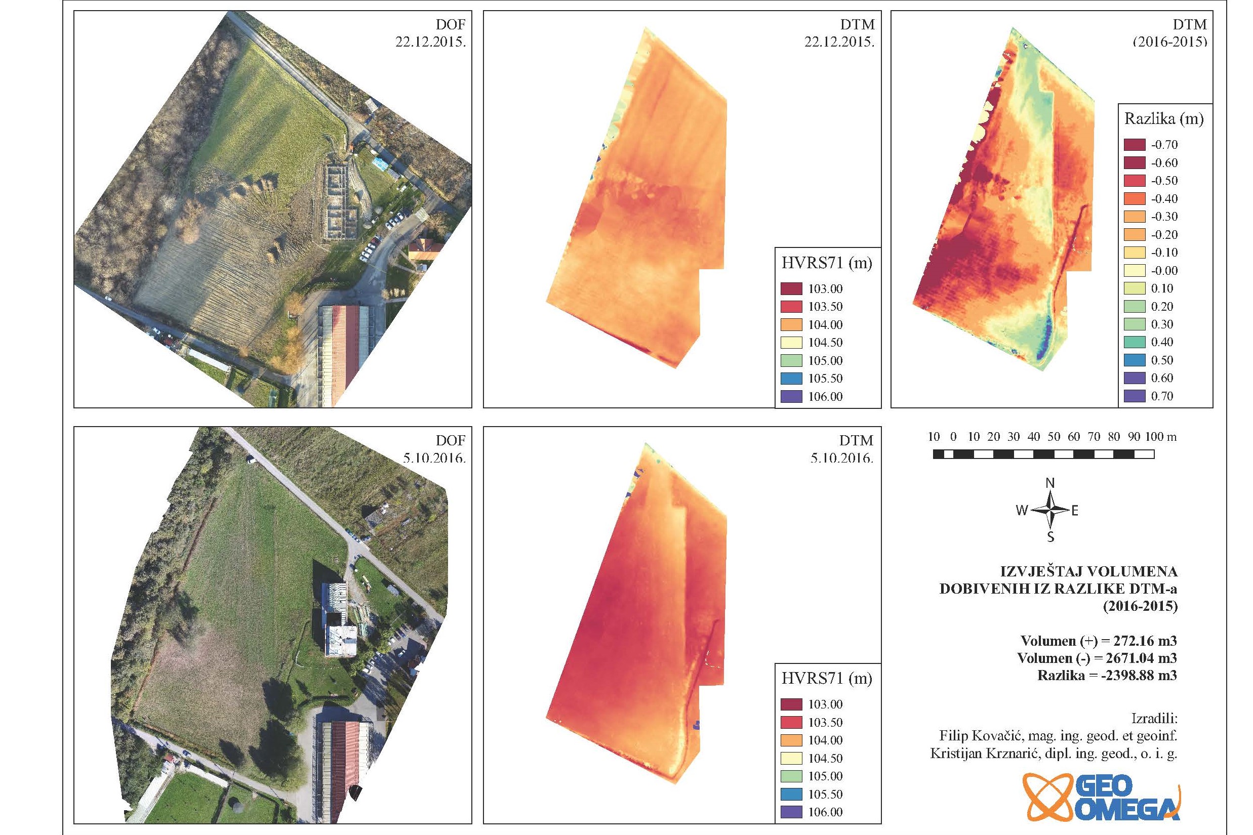
Terrain difference volumetrics calculation
Grad Zagreb
cadastral municipality Sesvetski Kraljevec
The project included the development of two digital terrain models based on aerial photography. Digital terrain models are made with a lag of 10 months, and their difference calculated volume difference on the terrain (subsidence and new materials).
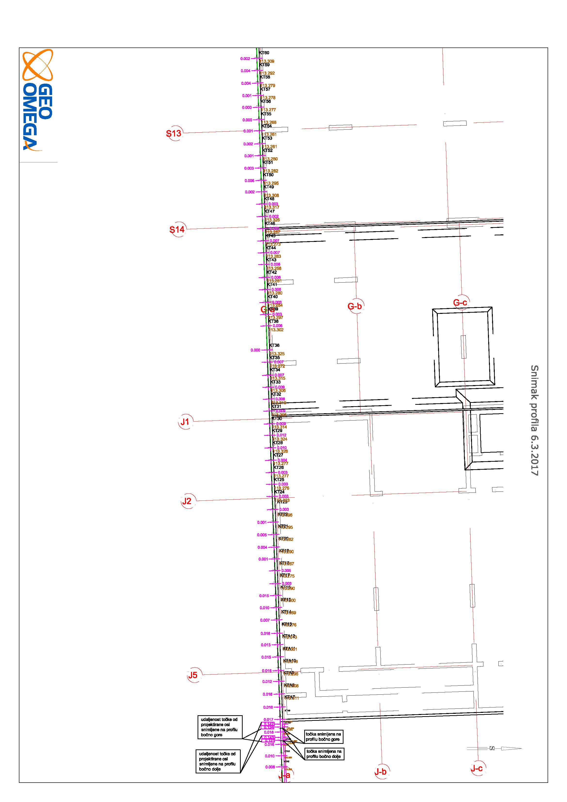
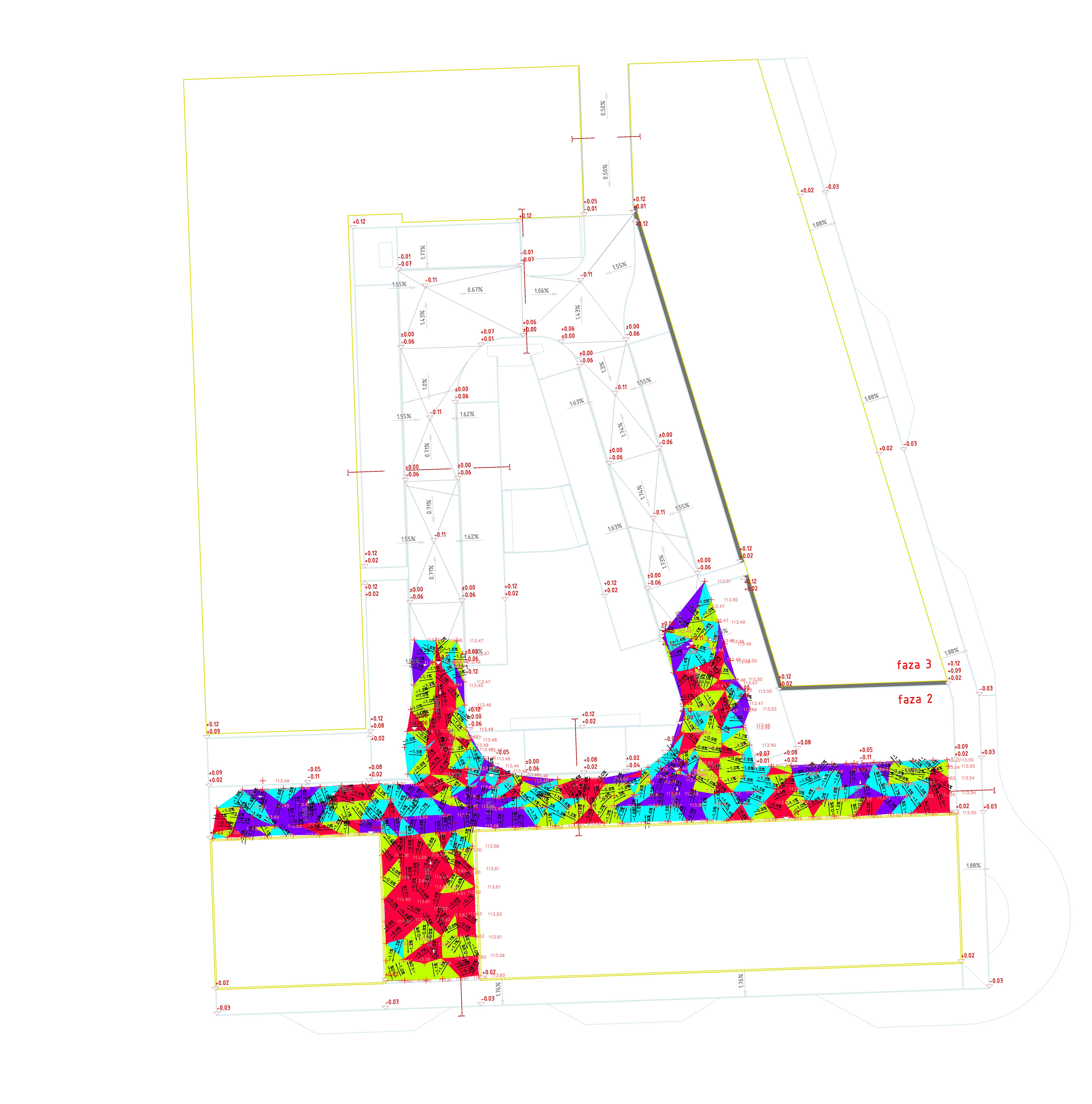
Monitoring shoping mall construction
Zagreb beton d.o.o.
cadastral municipality Pešćenica
While monitoring construction complete geodetic support in construction works has been provided. We've set geodetic base on the site that was used for the setting out on the batter boards and referencing 3D models. Every week we've made a 3D model of the site that was used to calculate the cut and fill volumes of materials, and creating profile lines.
Monitoring residential building construction
Nivogradnja d.o.o.
cadastral municipality Trnje
The project included development of geodetic survey, staking out the building on the terrain and on the batter boards and creation of 3D model from which we removed the object for the purpose of calculating the volume of excavation.
The transition of the main pipeline Rogatec-Zabok over the river Sutla
PLINACRO d.d.
cadastral municipality Hum na Sutli
The project included a detailed altitude site map and Sutla river profiles development in the transition region of the main gas pipeline Rogatec-Zabok across the Croatian border with Slovenia. During the project, the identical points on the terrain in GK5 projection were observed that enabled connection of our data with colleagues from Slovenia. As a part of the project characteristic points on the ground were staked out.
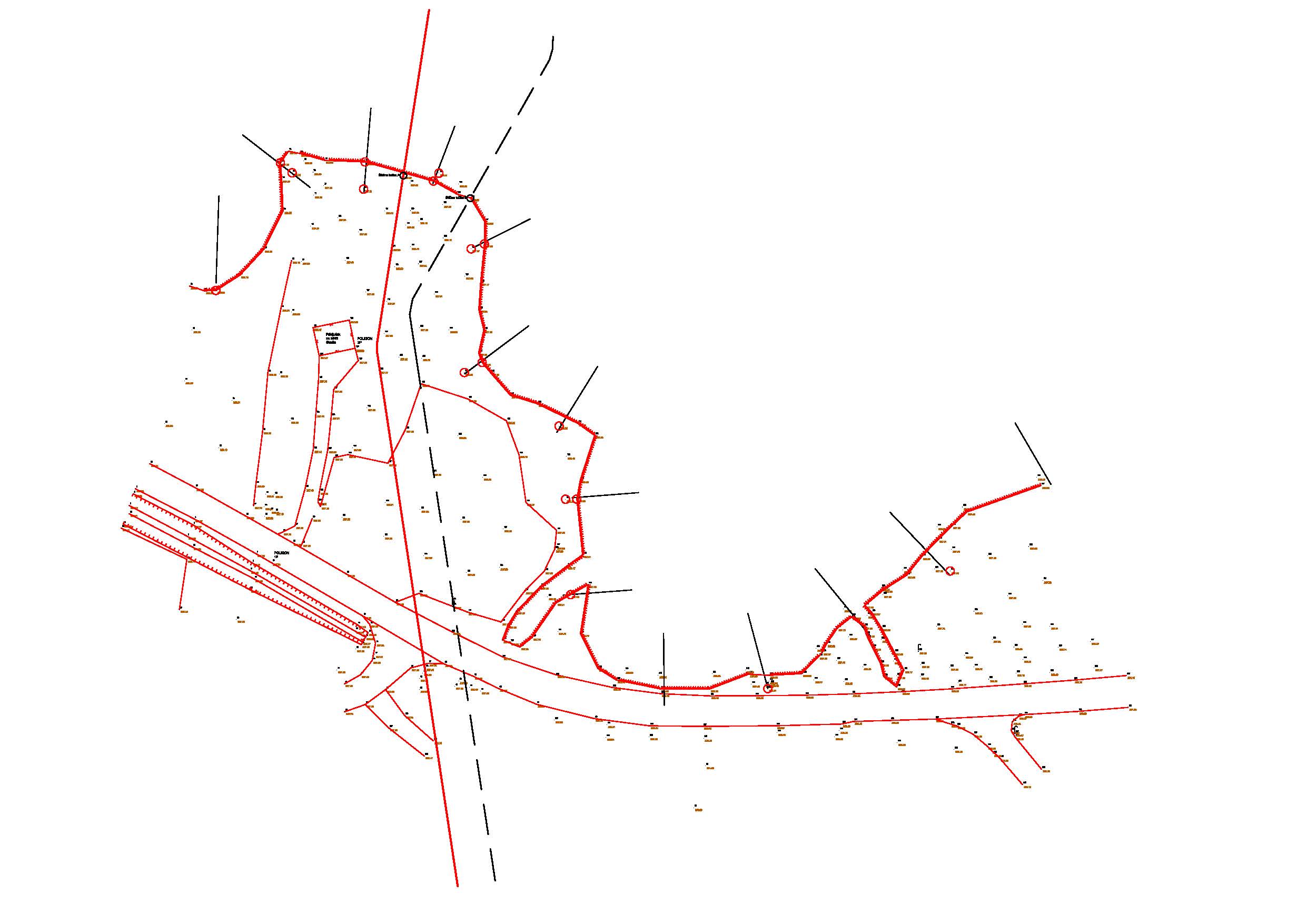
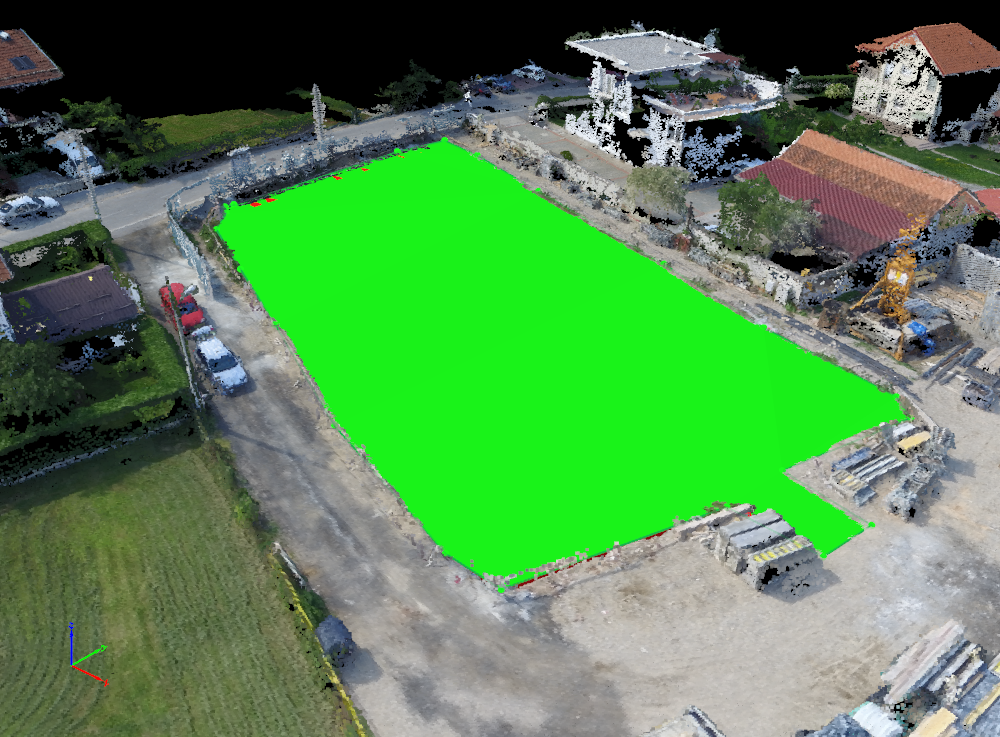
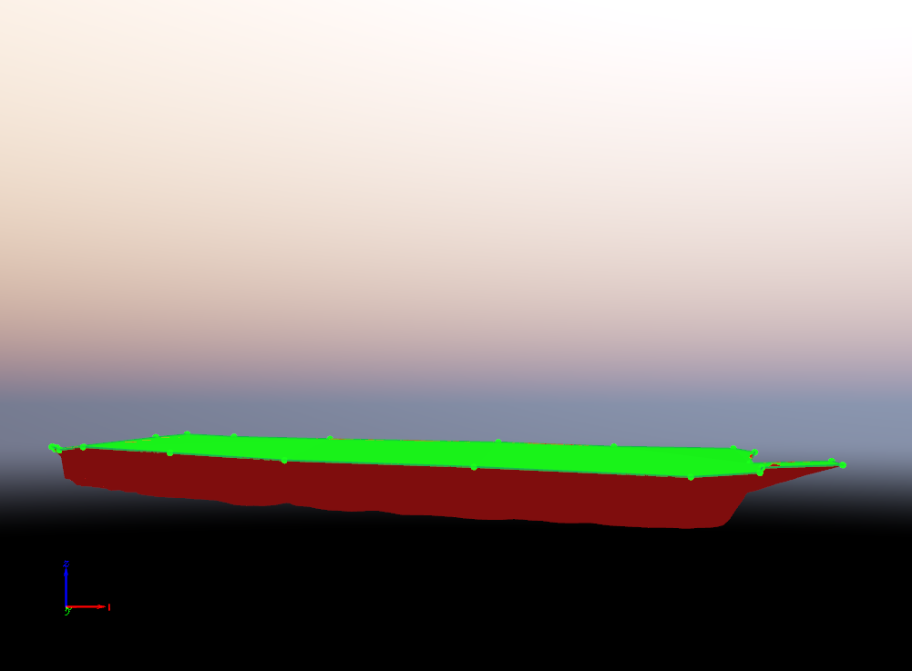
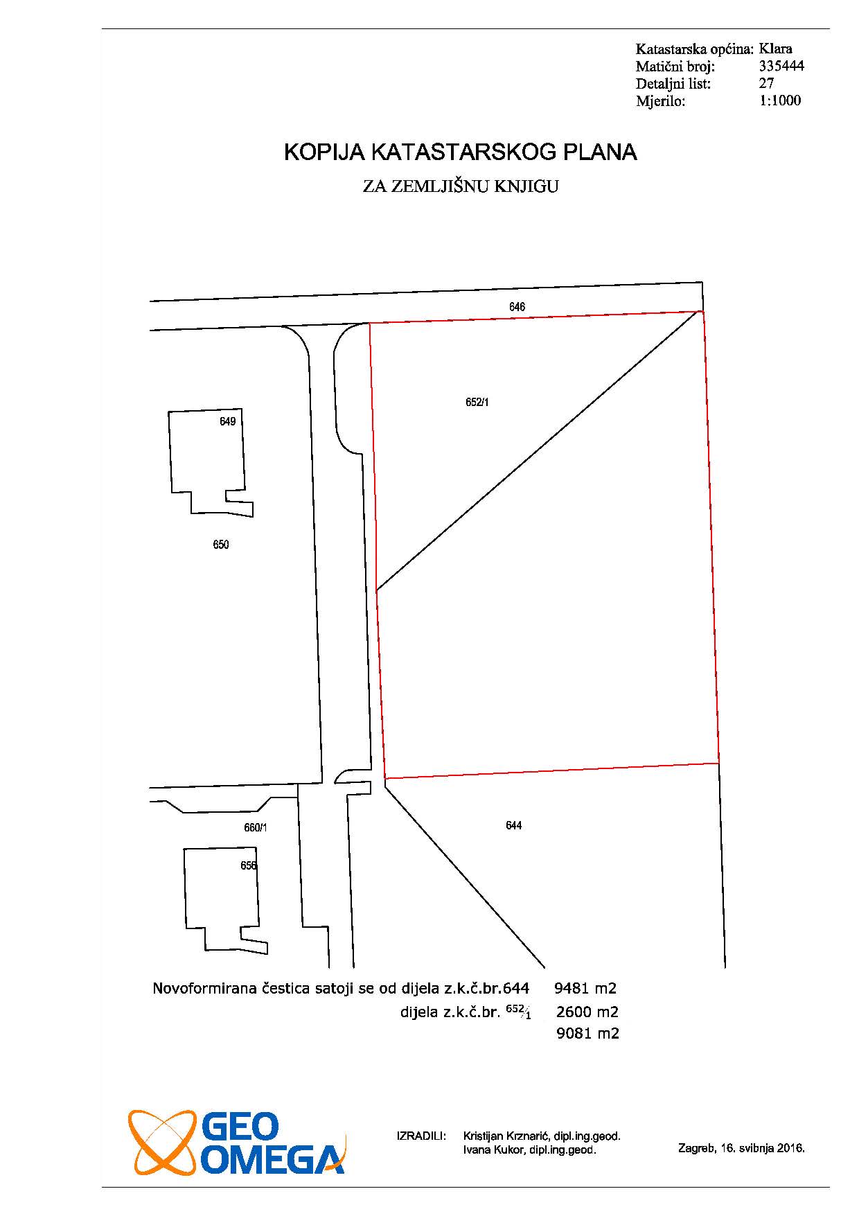
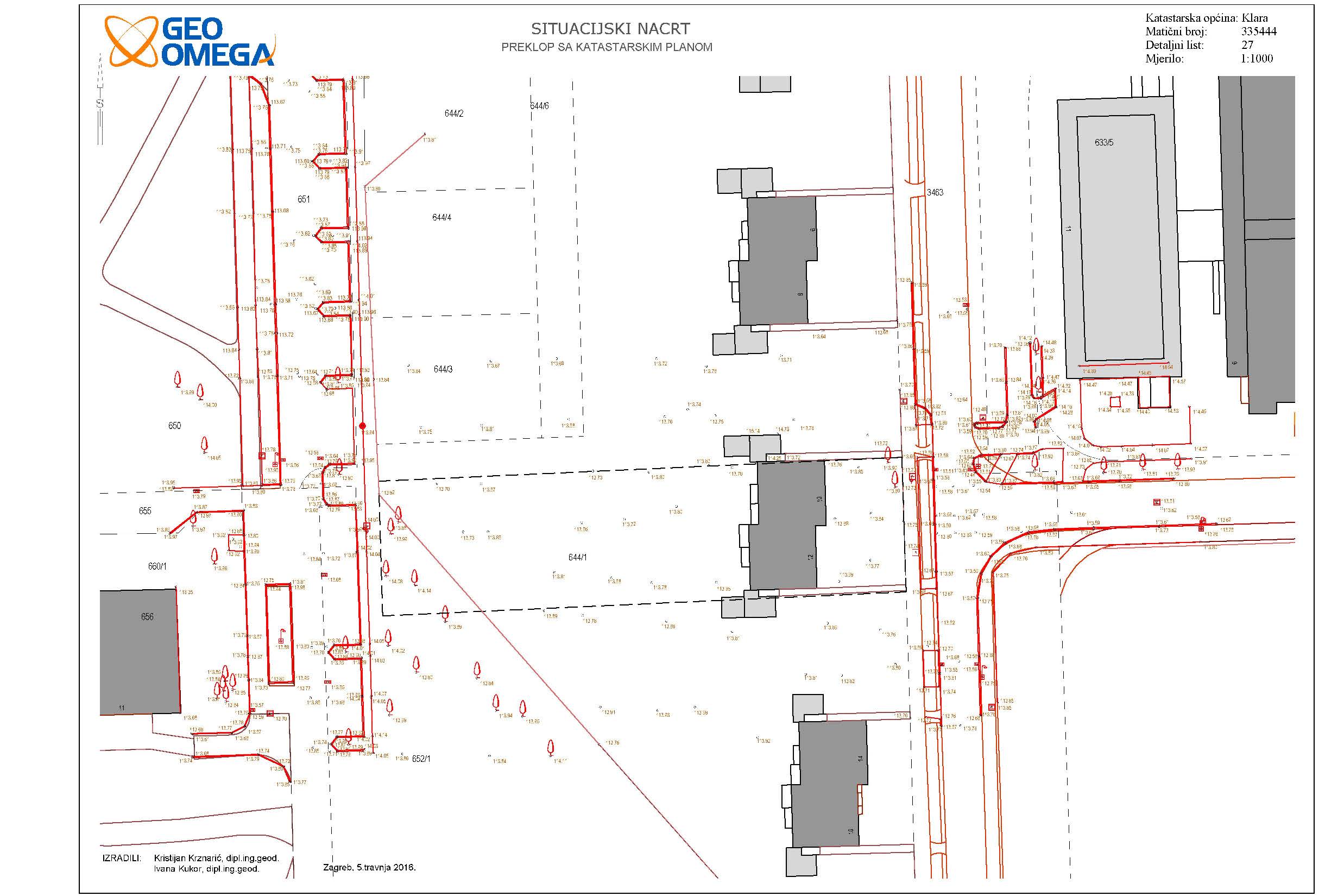
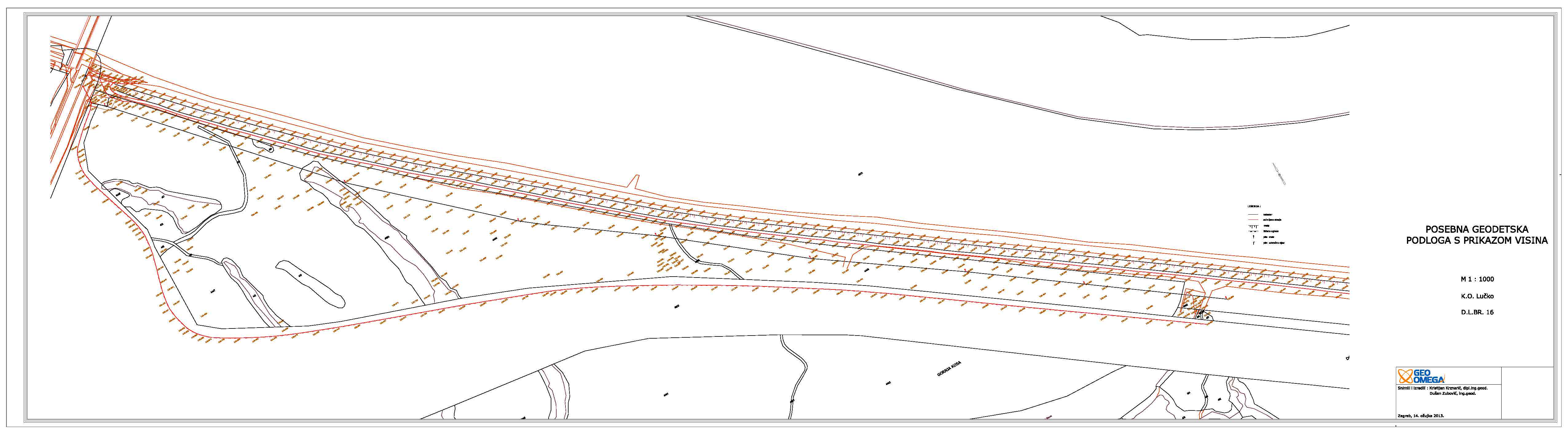
Geodetic survey for road design
Oporovec gradnja d.o.o.
cadastral municipality Klara
11000 m2
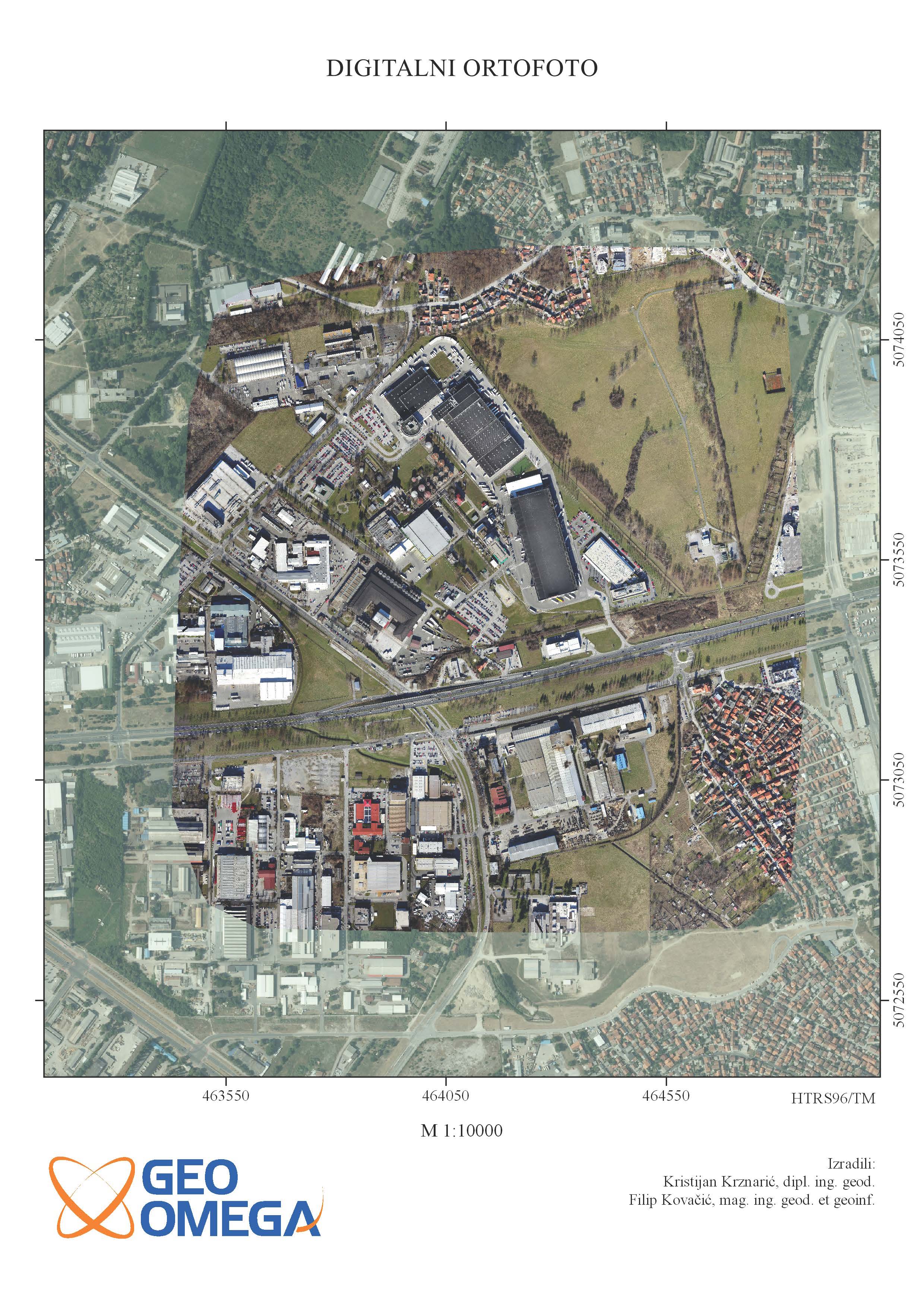
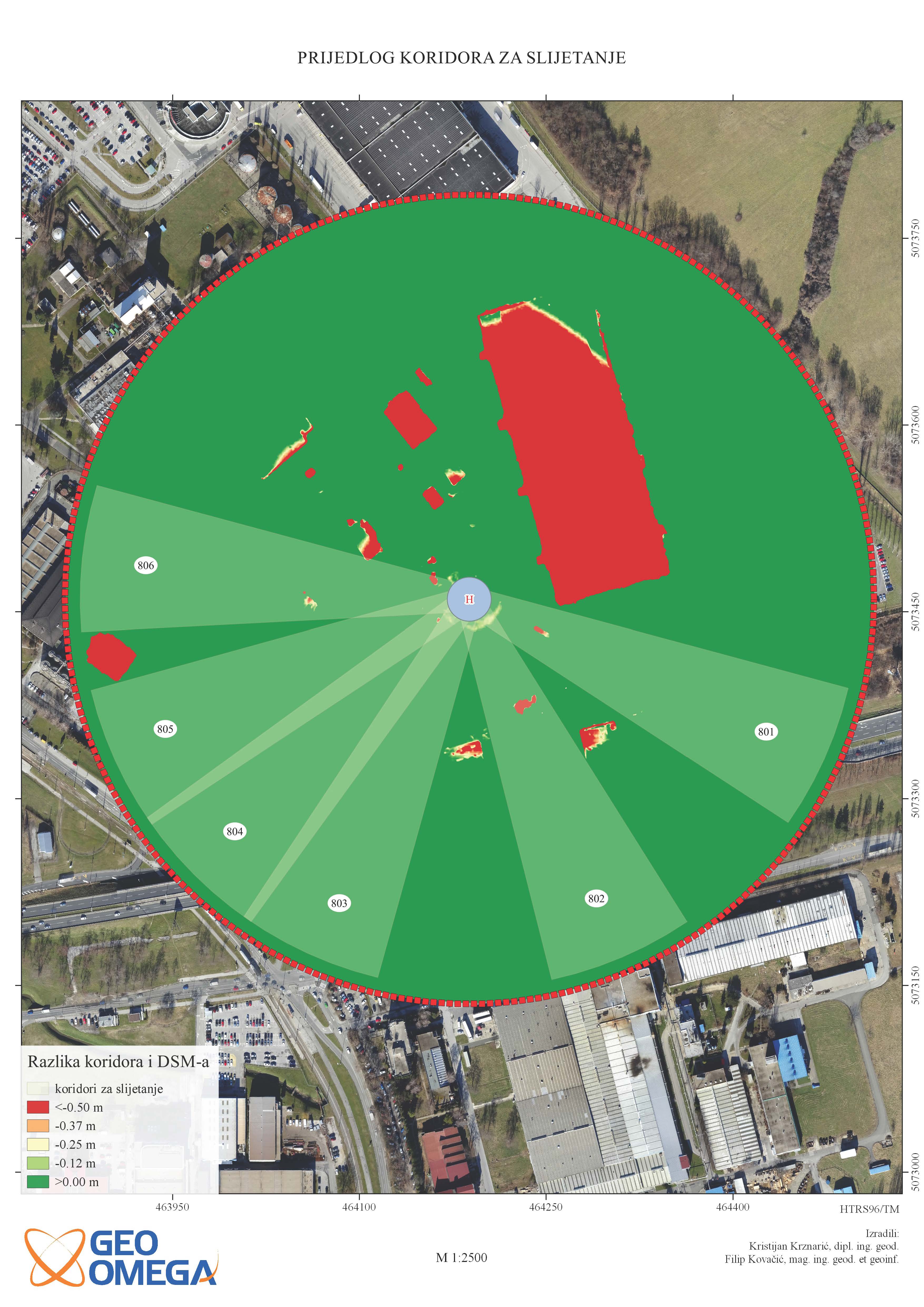
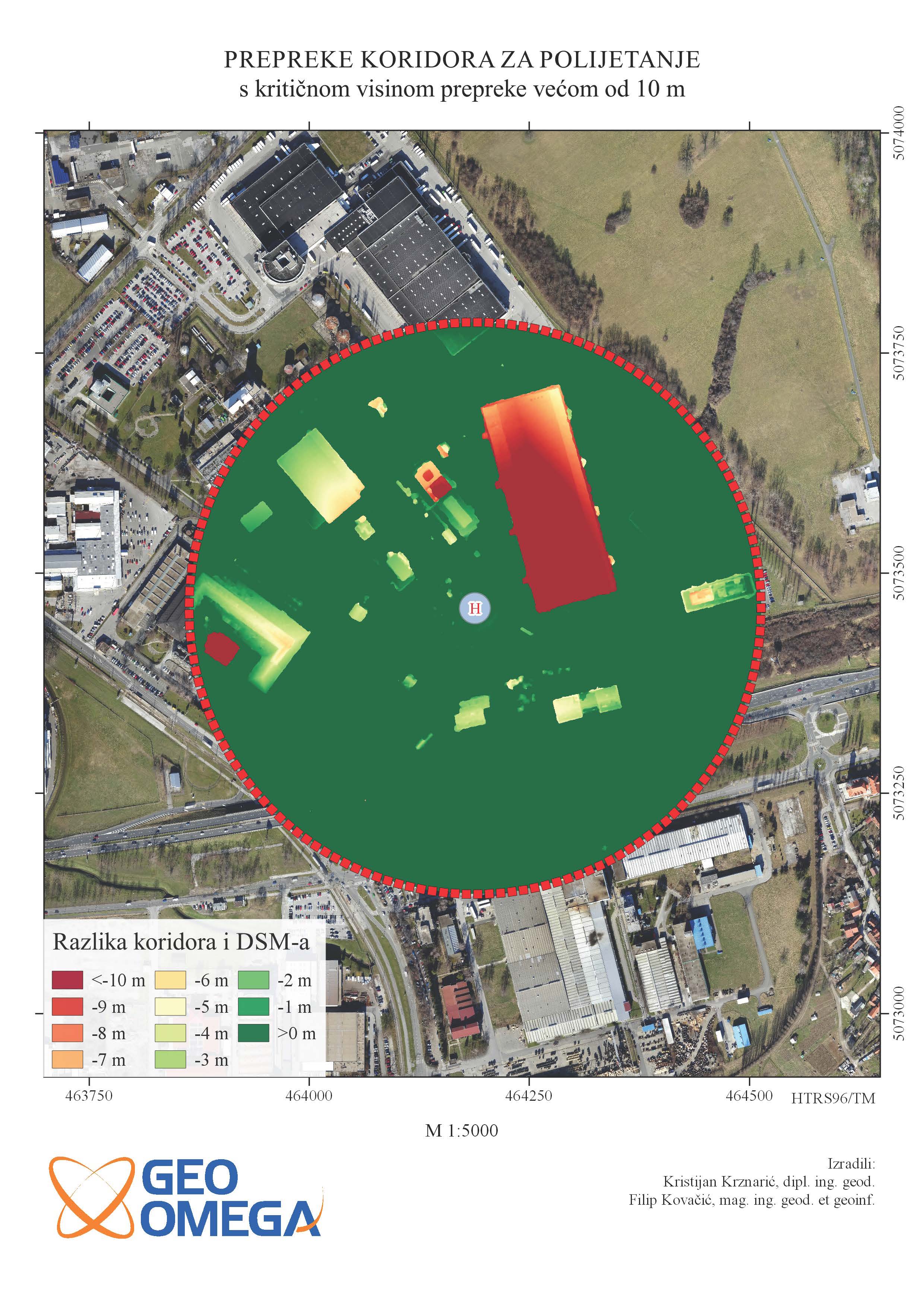
DSM analysis and heliport corridor proposal
Agrokor d.d.
cadastral municipality Pešćenica and Žitnjak
Developed DSM has been analyzed for the purpose of creating proposals for possible takeoff and landing heliport corridors. The analysis included calculating the difference between conical surfaces of different inclination and height differences relative to a heliport reference point and DSM. On obstacles layers made in relation to the specific criteria proposed corridors have been constructed in WGS84 system.
Geodetic survey - Karting center
KARTING CENTAR ZAGREB d.o.o.
cadastral municipality Lučko
Geodetic survey created for the area of karting track that sizes 16 ha.
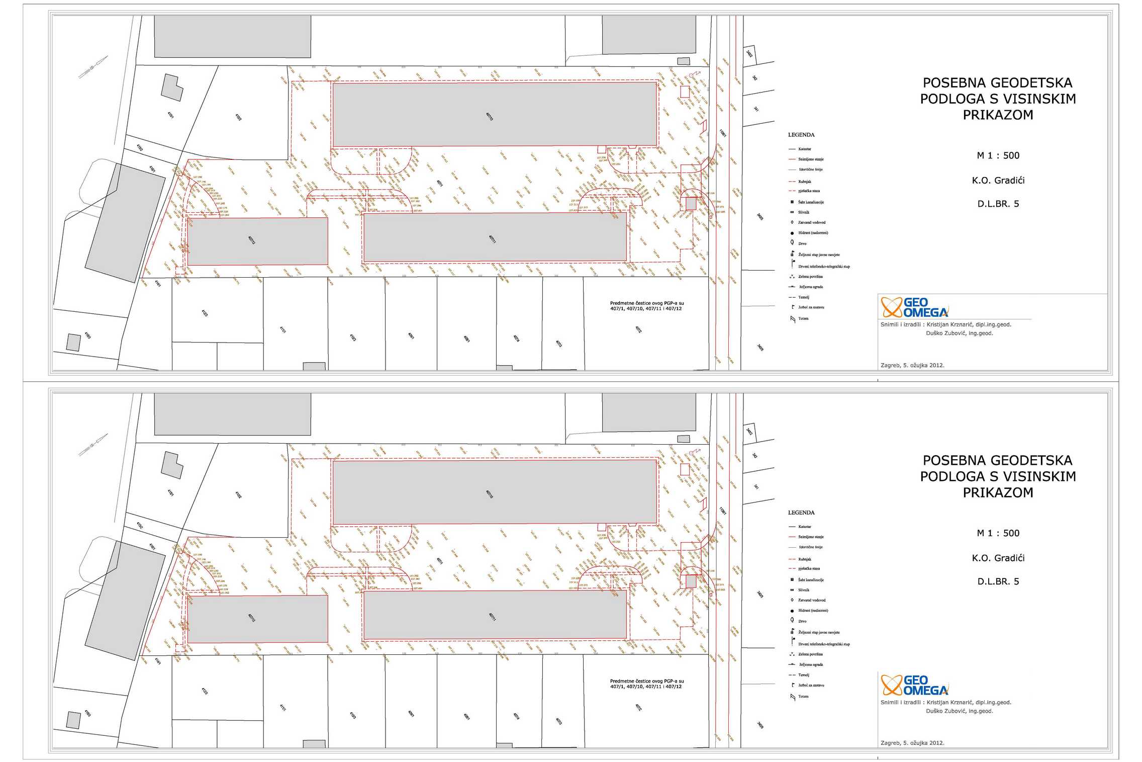
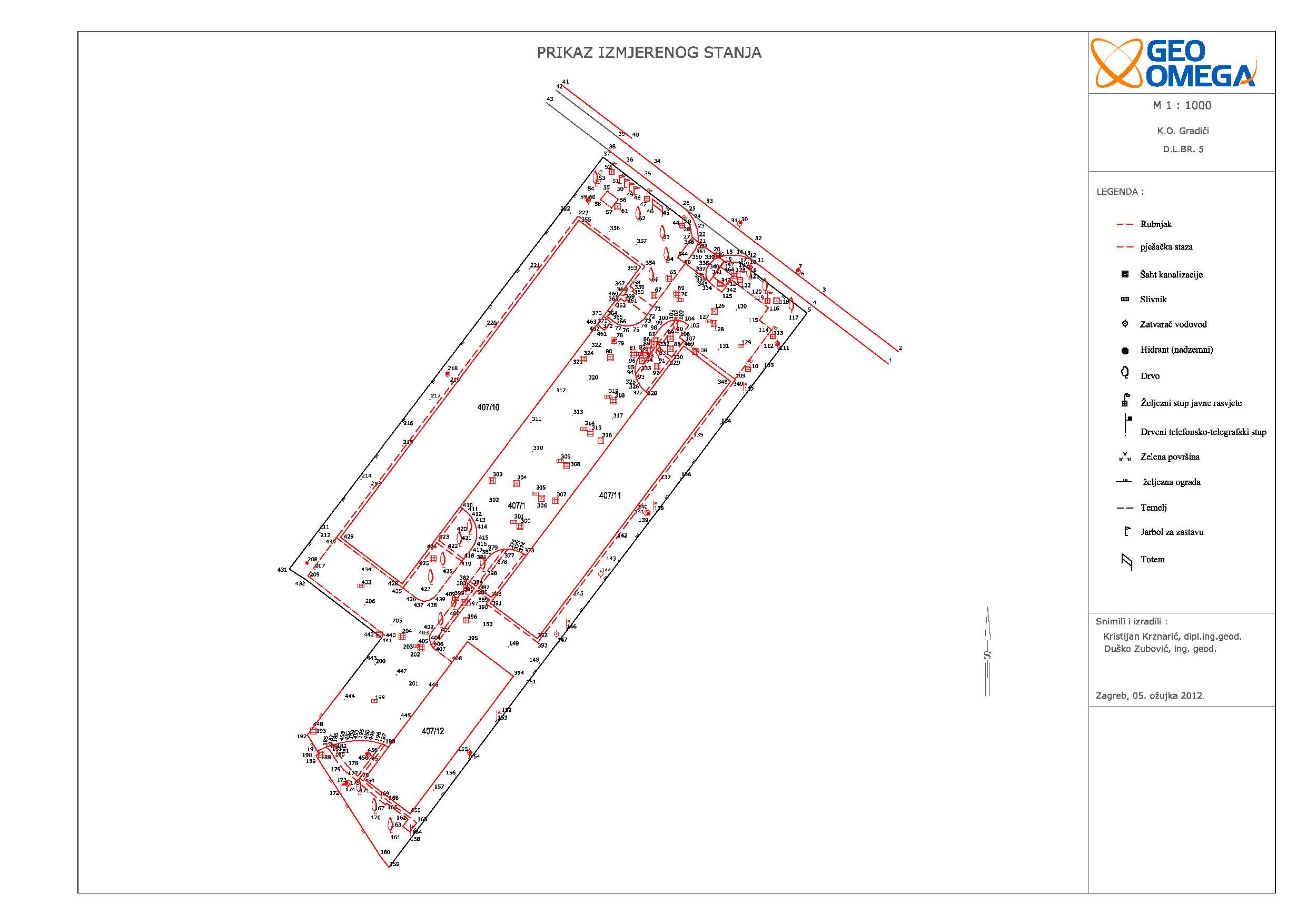
Geodetic survey - AGGEMO Gradići
AGGEMO d.o.o.
cadastral municipality Gradići
Geodetic survey created for the area of 2.5 ha.
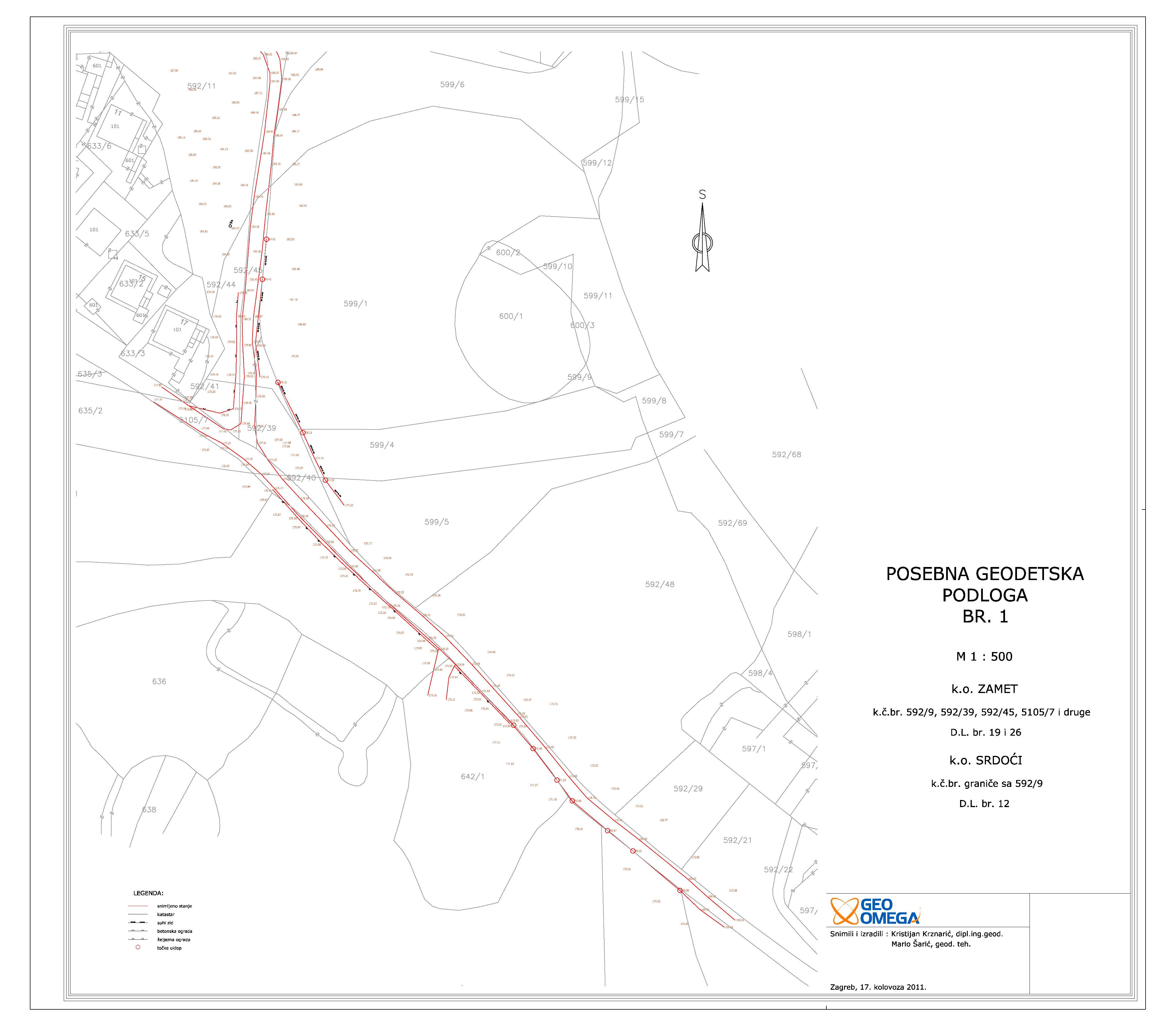
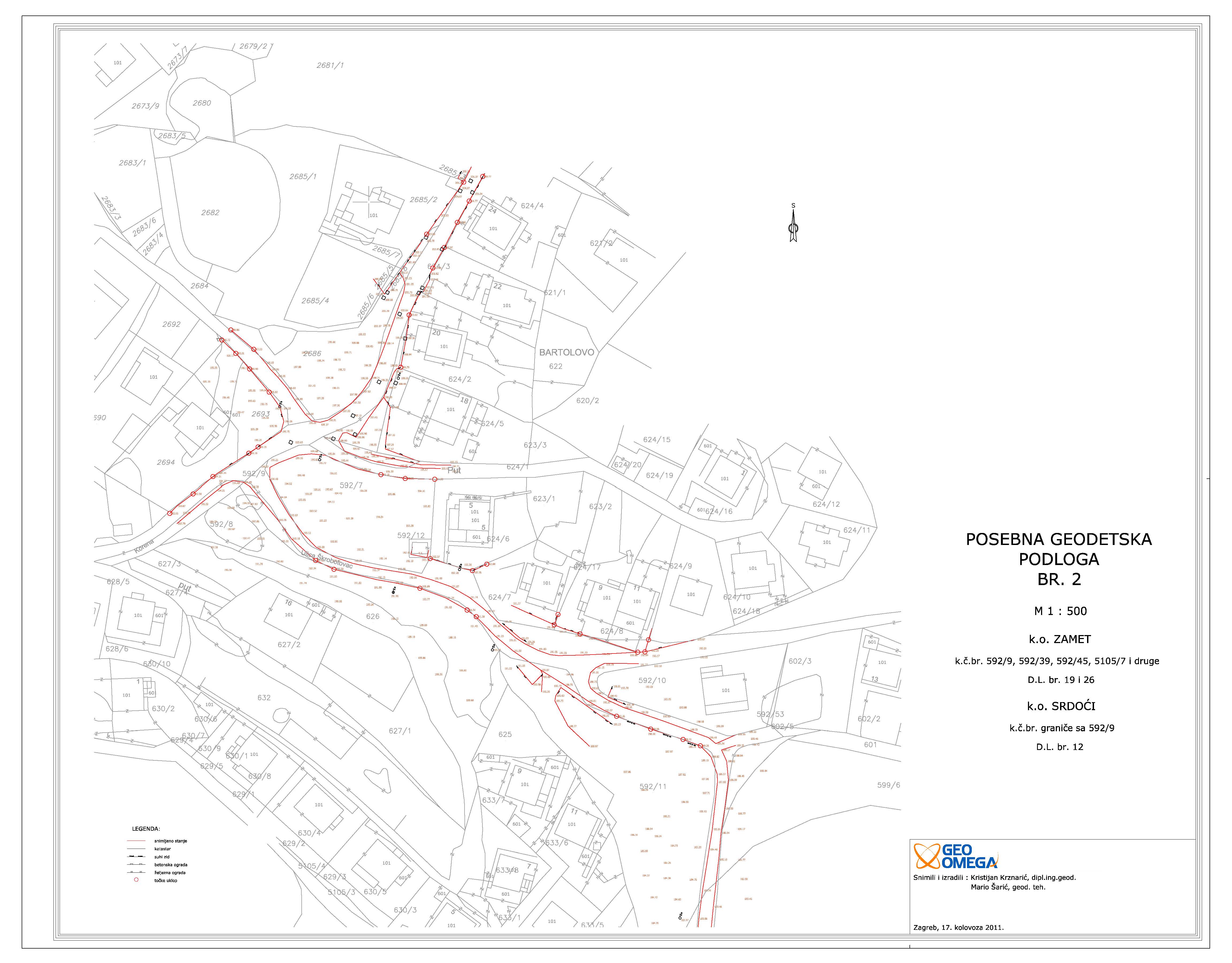
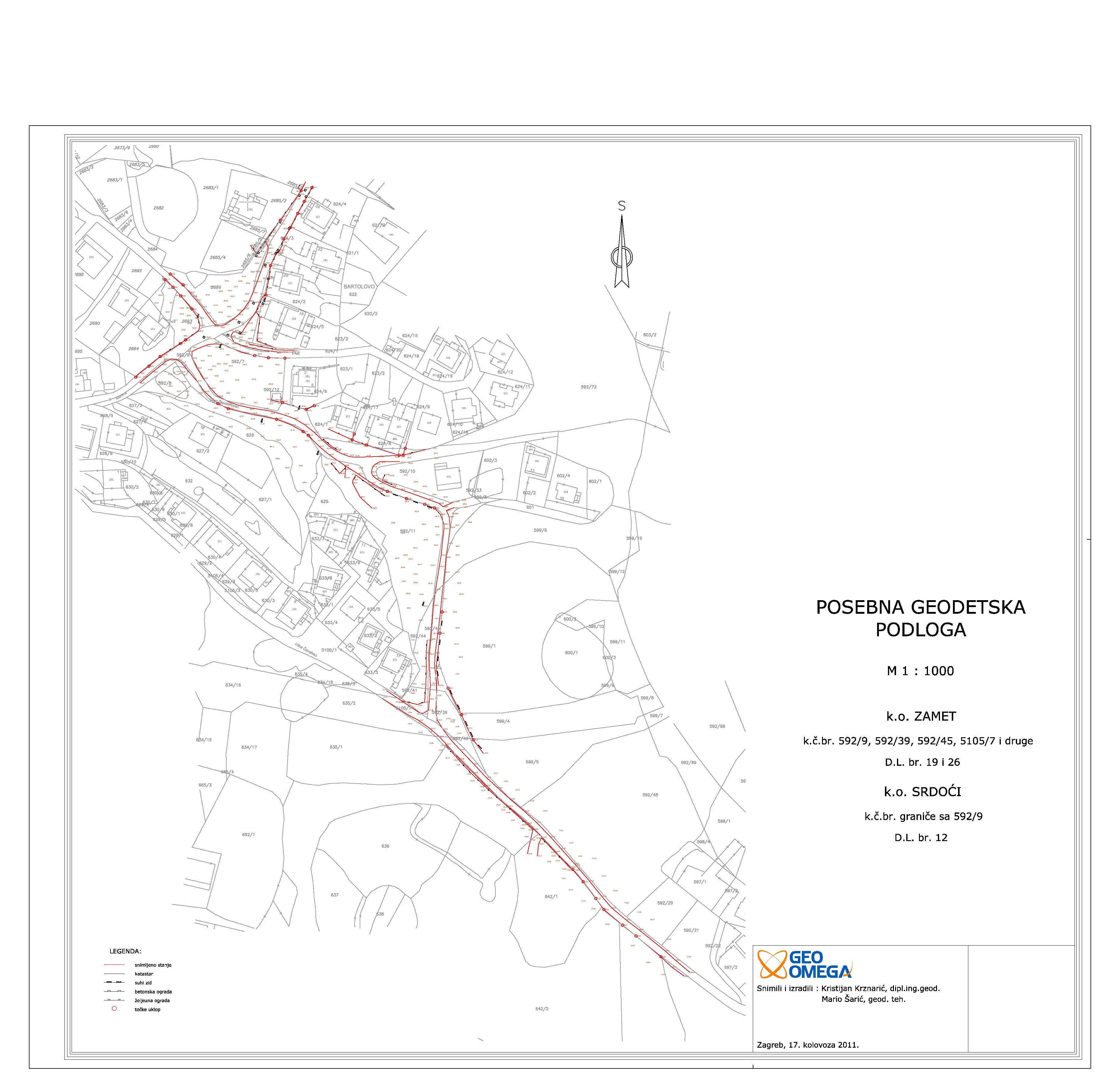
Geodetic survey - road Zamet, Srdoći
Rijeka promet d.d.
cadastral municipality Zamet and Srdoći
Geodetic survey created for the road design on the area of 1.5 ha.
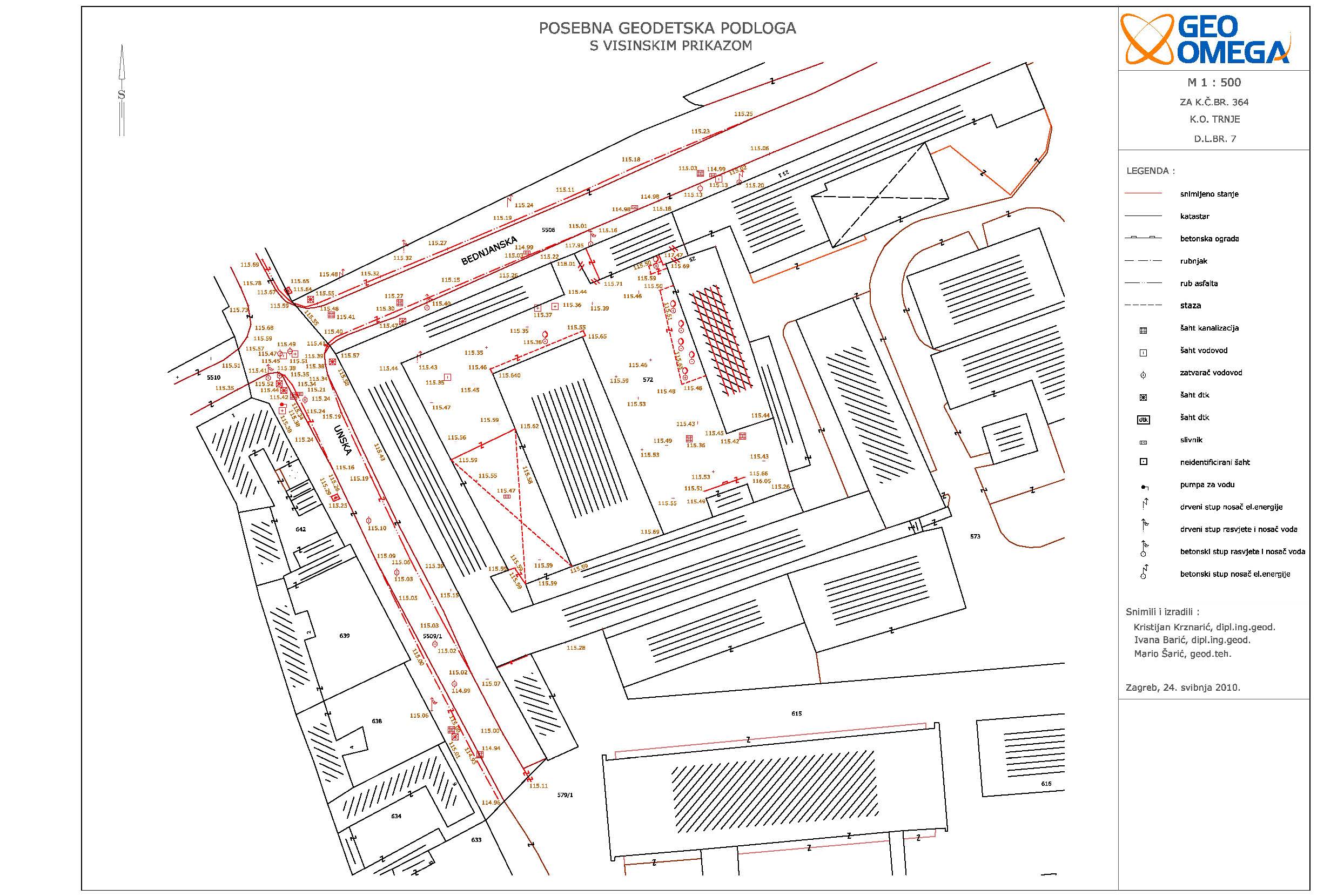
Geodetic survey - FER
Fakultet elektrotehnike i računarstva
cadastral municipality Trnje
Geodetic survey created fot the area of 1 ha.
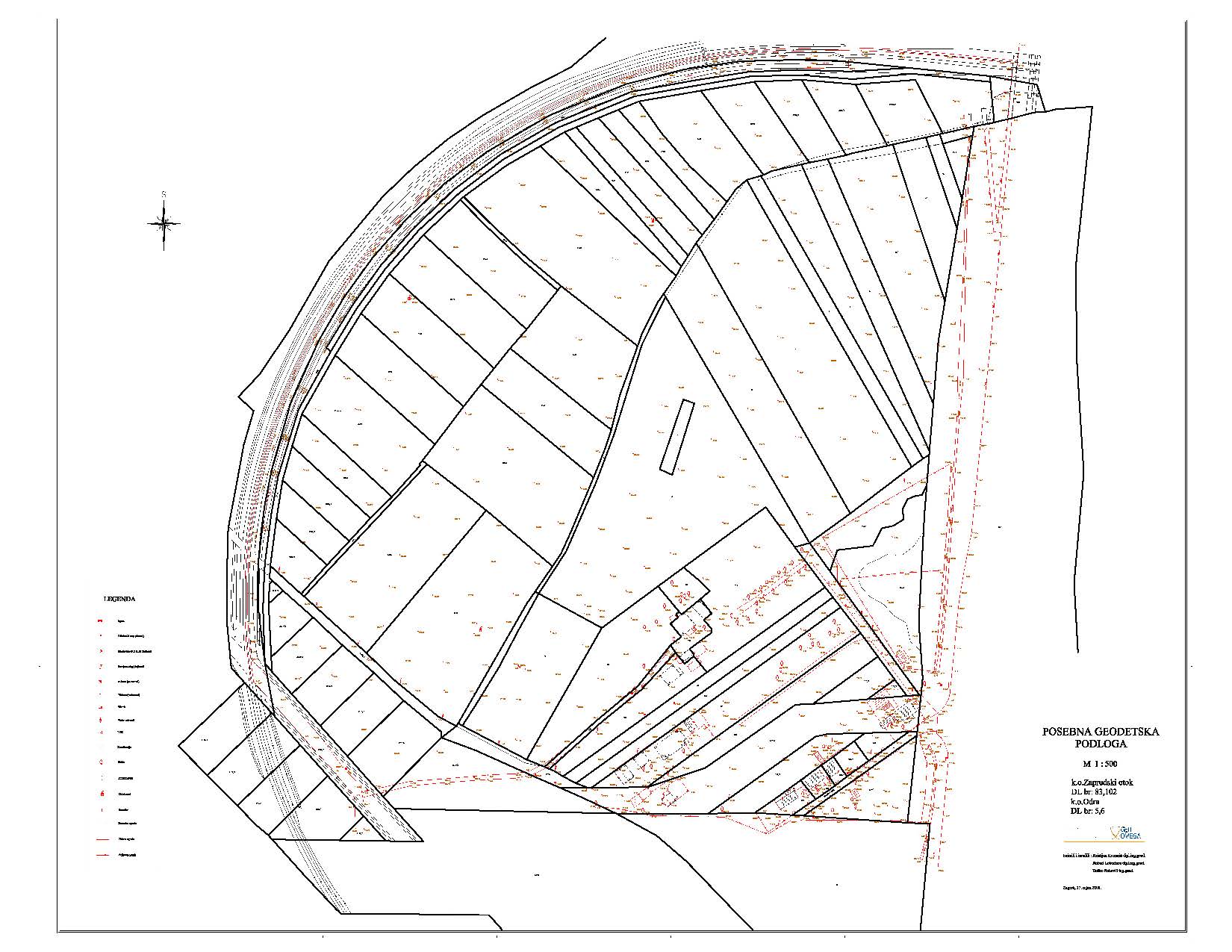
Geodetic survey - Zaprudski otok
Afirmacija nekretnine d.o.o.
cadastral municipality Zaprudski otok
Eight geodetic surveys created for the are larger than 20 ha.
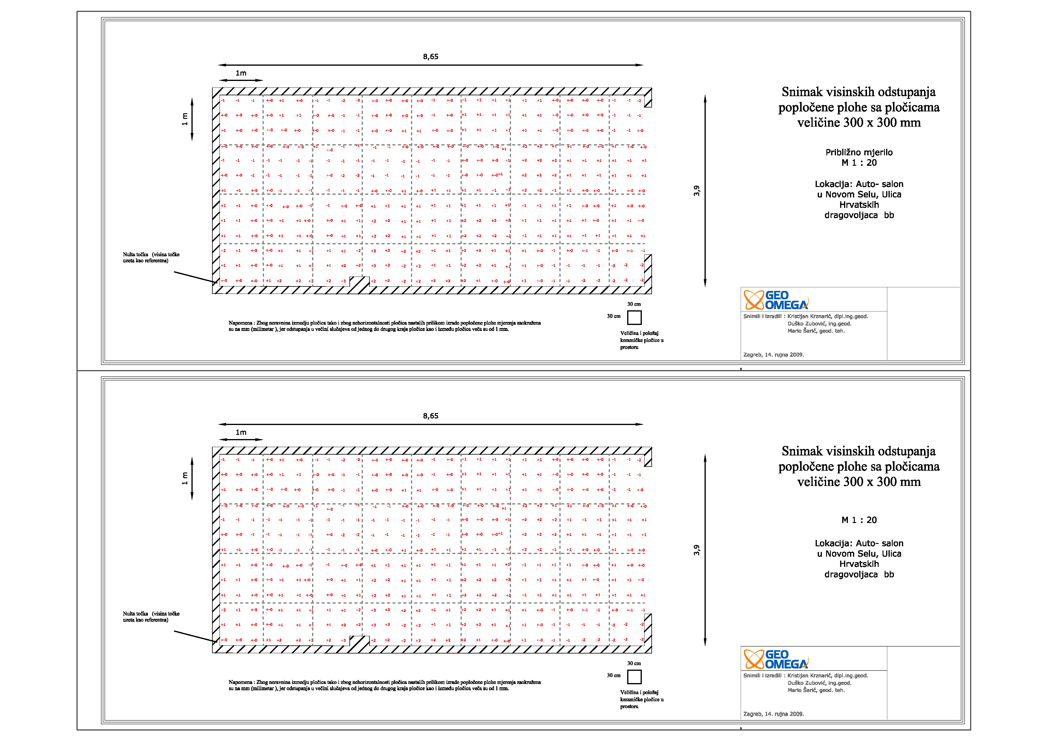
Surveying floor height deviations in Hall for Car Service
AUTOZUBAK d.o.o.
Novo selo, Požega
Surveying height deviations of surface paved with tiles measuring 300 x 300 mm.
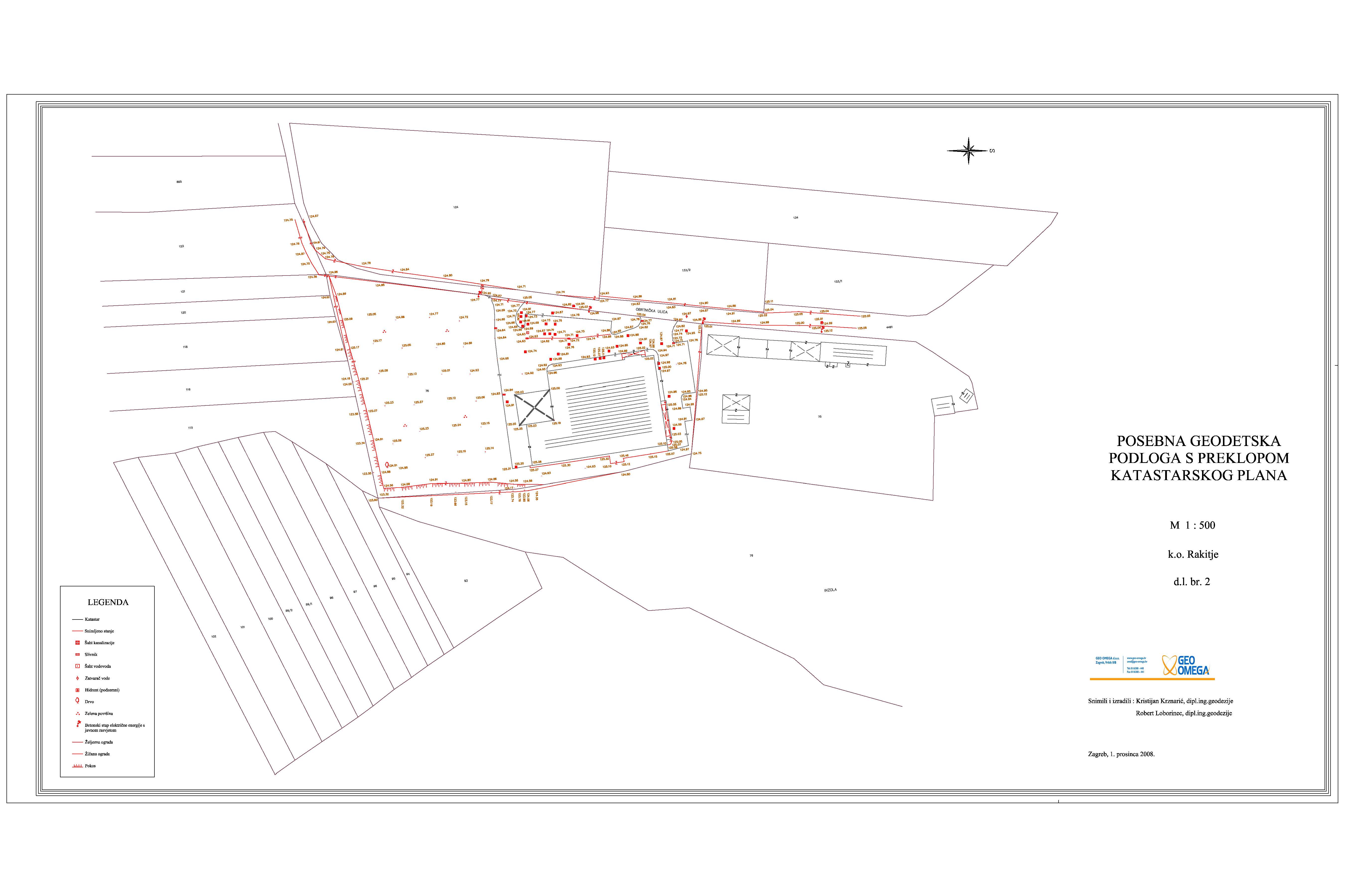
Geodetic survey - VMD Rakitje
VMD PROMET d.o.o.
cadastral municipality Rakitje
Geodetic survey created for the area of 38000 m2
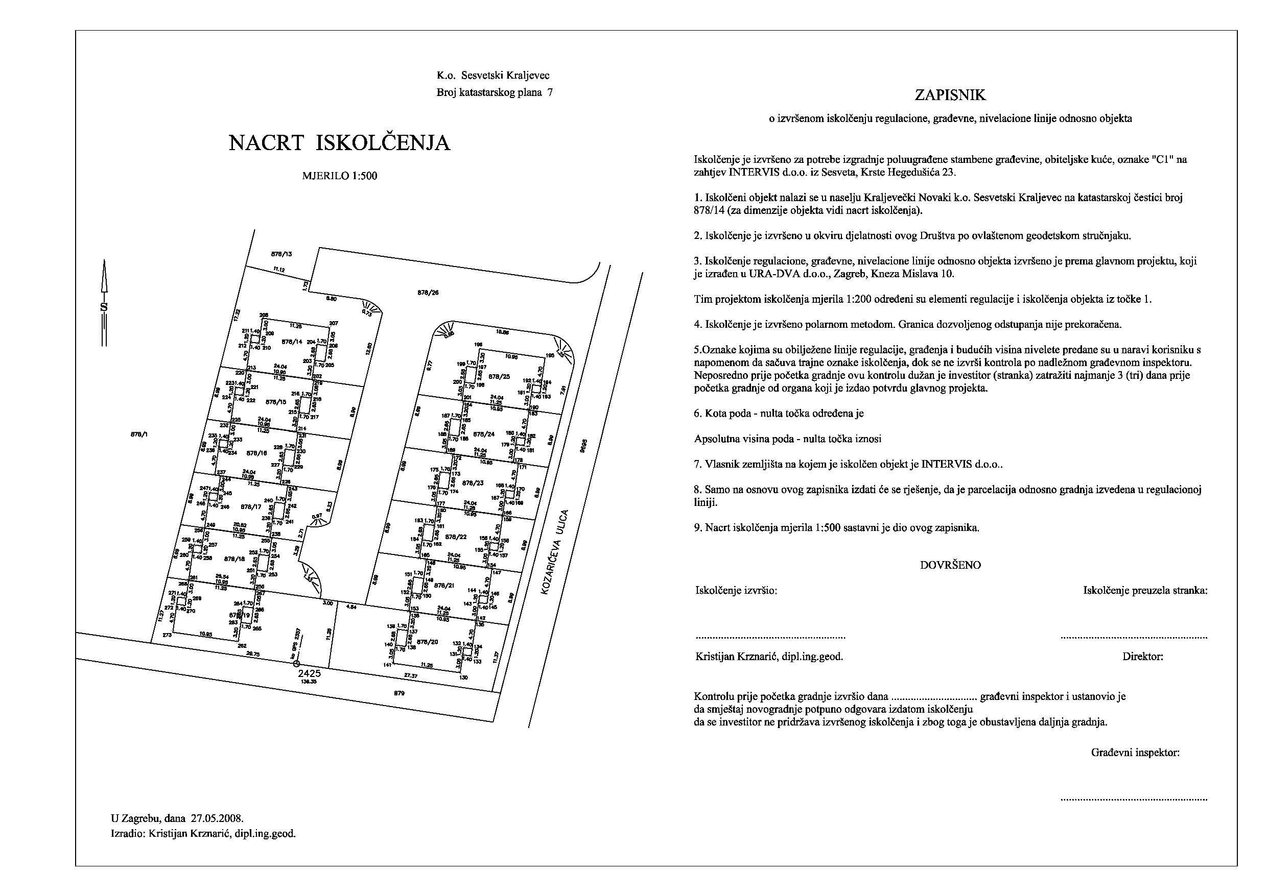
Residental buildings stake out
INTERVIS d.o.o.
cadastral municipality Sesvetski Kraljevec
Staking out and creating stake out report for 12 residential buildings.