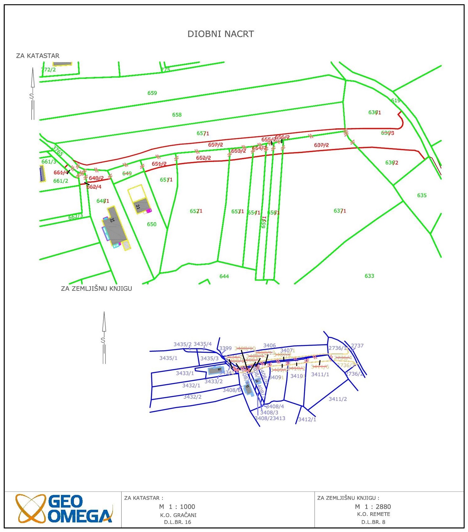
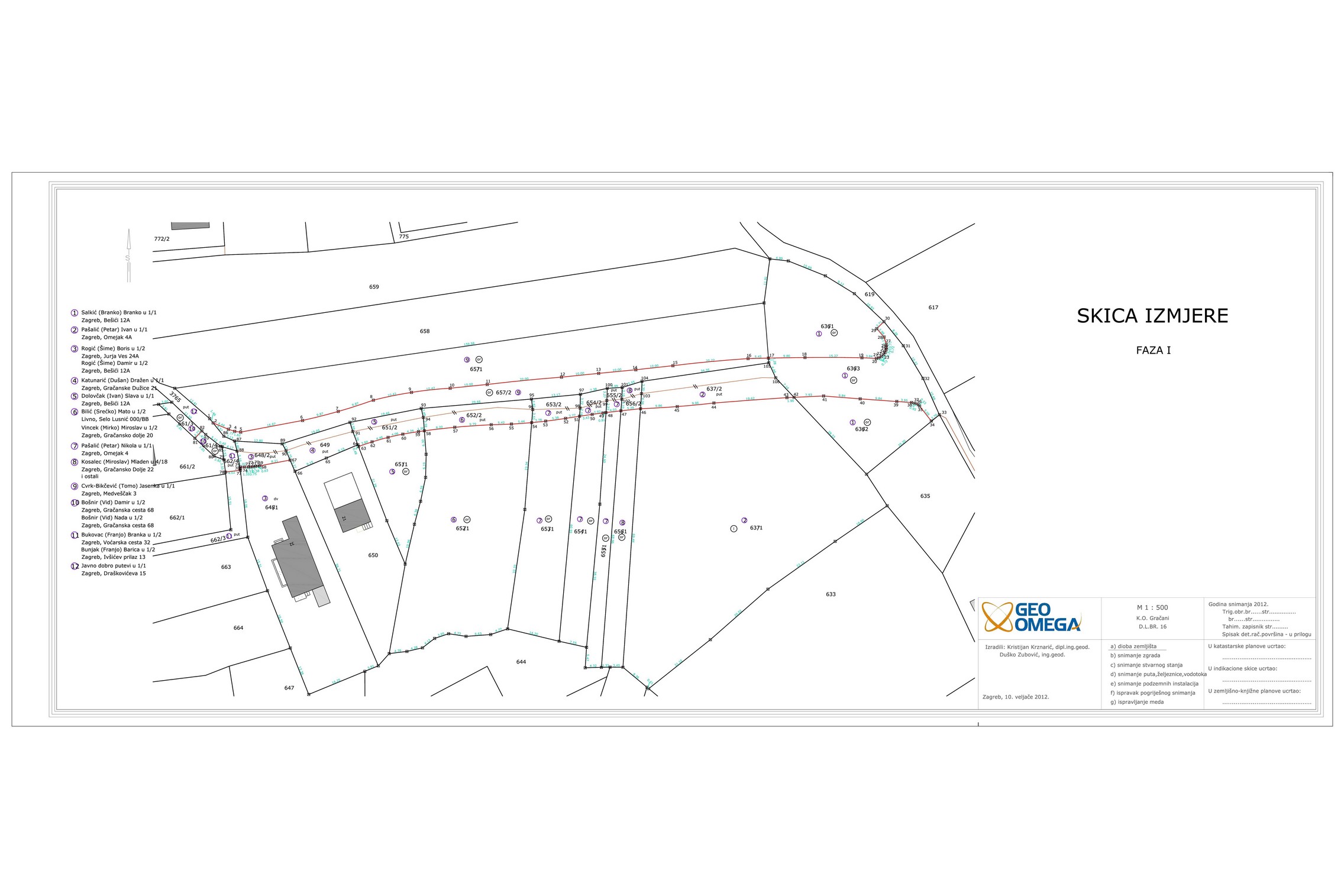
Parcelling
Parcelling is a procedure that divides cadastral parcel(s) into one or more of them, or combines parts of cadastral parcel(s)s into one. Parcelation study is made for this kind of change on the property, based on the documents or acts of Spatial Planning (a location permit, a building permit, decision on determining building parcels, urban land consolidation).

Registrating buildings
Any change of construction in the the space must be recorded in the cadastral operate. For this purpose is made geodetic study for registrating, deleting or changing data on buildings or other construction. This type of geodetic study can be produced for the purpose of maintaining the cadastre of real estate and for the purposes of making changes in Land Cadastre.

Survey study
Survey study is an integral part of the preliminary / main project for location / construction permit. Survey study is a set of public documents and other geodetic-technical documentation, appropriate geodetic surveys and technical reports on executed geodetic works, made in order to design interventions in the area, monitoring of construction and registration of newly constructed buildings in the cadastral operate and land registry.

Condominium
We provide condominium services for all types of buildings. Condominium is the technical and administrative legal proceedings establishing ownership per floor. Condominium ownership is ownership of an apartment or other independent room (office space, garage, etc.), associated with the corresponding co-owned part (ideal part) of property consisted of land with a building or of the construction rights to the building.

Utility projects
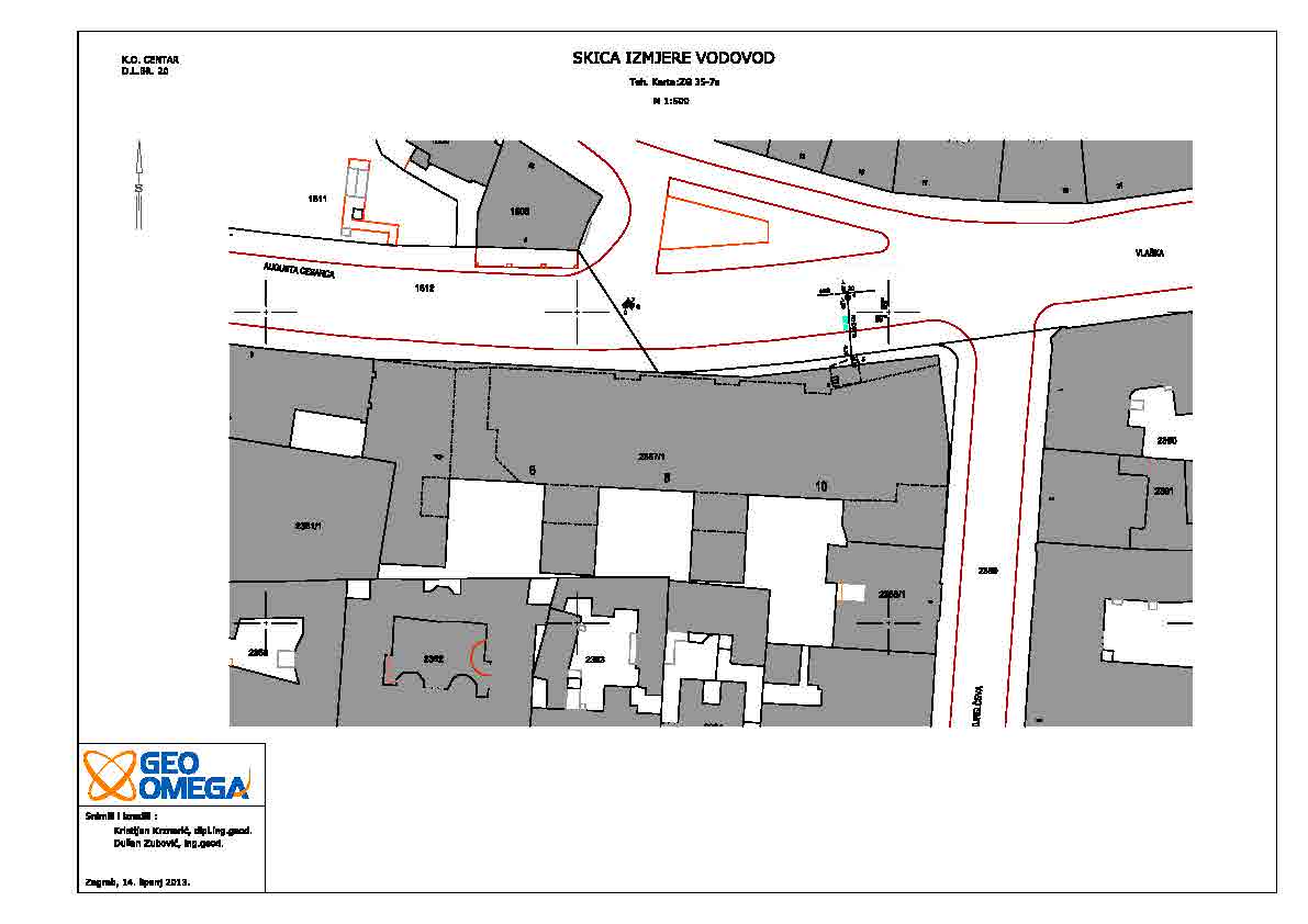
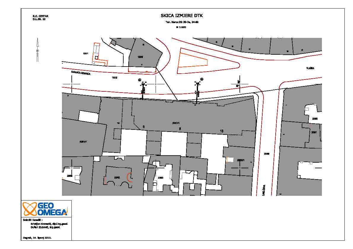
With the each new facility construction, connection to the existing infrastructure is fundamental. All necessary data for connection of the project is held in the cadastre of utility projects, and actual (current) state is determined by survey in the field. When building new infrastructure facility - utility projects and their associated facilities, it is essential to determine the current situation, to place the project facilities on terrain and at the end developing study for the registry of utility projects. We produce studies and monitor the construction of all utilities, energy, telecommunications and other facilities. In addition, on the basis of the data collected we develope GIS for various purposes.
PROJECTS
Geodetic and infrastructure project
MAXIMA d.o.o.
k.o. Podsused
16 k.č.
Geodetic studies for Reconciliation
ZAGREBAČKI HOLDING d.o.o.
k.o. Podsused i Trešnjevka
5 km
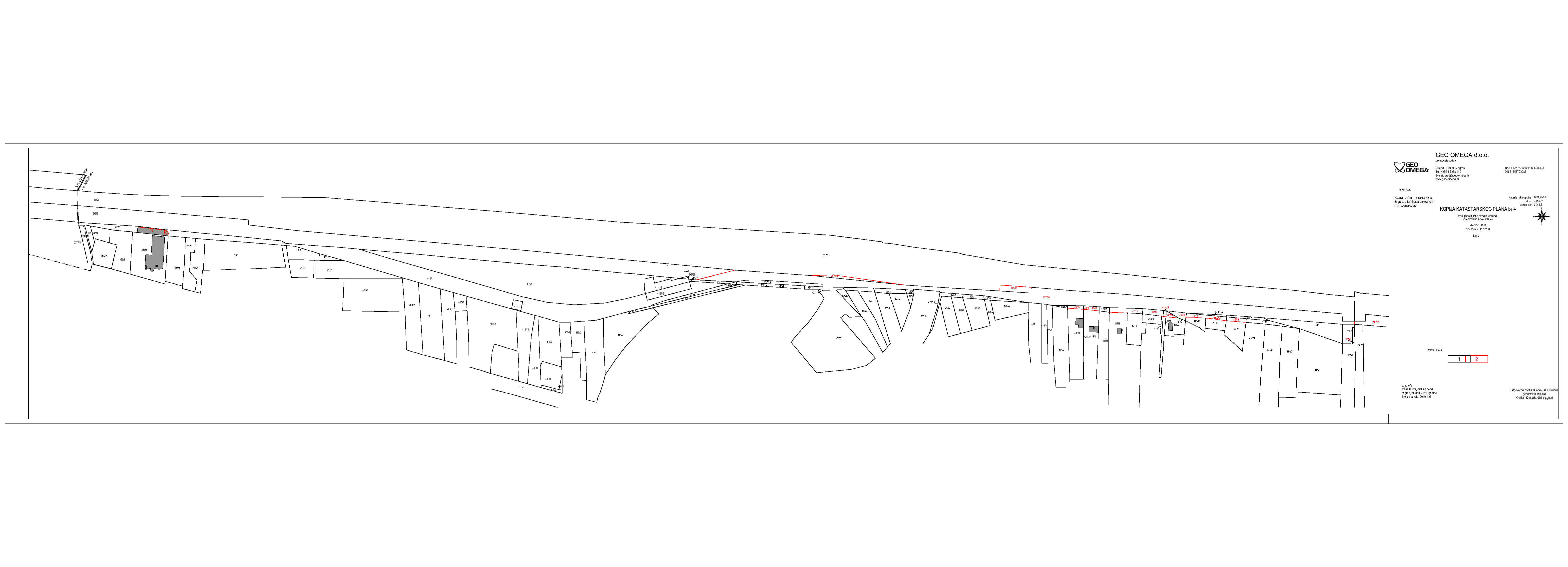
Geodetic project i parcelations for roads
PROJEKT ŠTRIGINA d.o.o.
k.o. Peščenica
1 building plot 4 roads
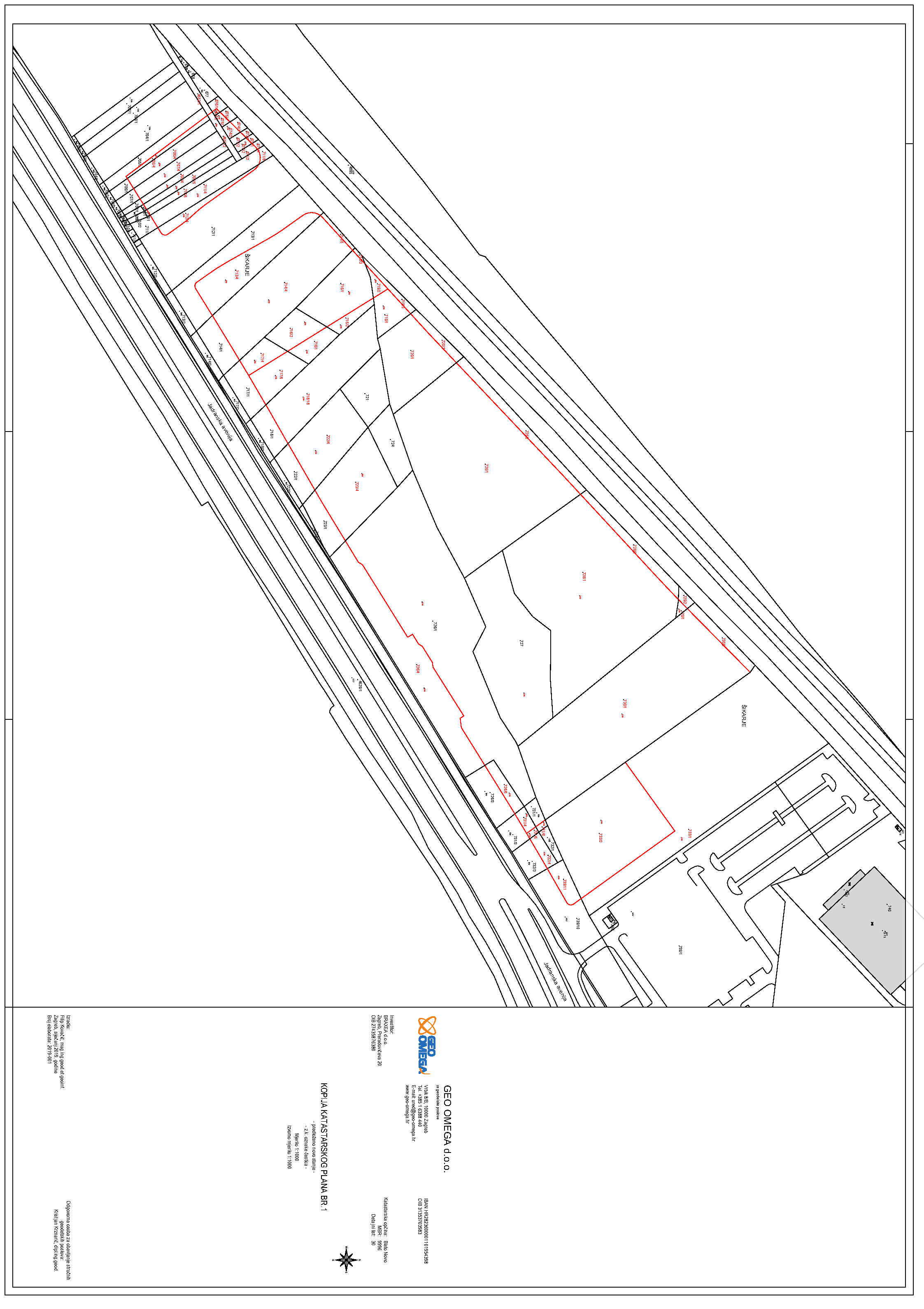
Parcelling according to the urban development plan
BRAXEA d.o.o.
k.o. Blato
40 k.č.
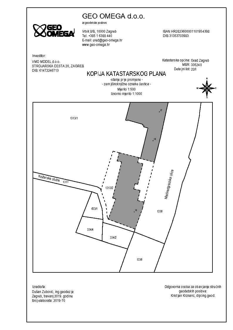
Geodetic surveys and studies
VMD MODEL d.o.o.
k.o. Centar
Geodetic studies for registration of easement rights
PLINACRO d.o.o.
61 k.o.
170 km +
Geodetic study of recording the constructed condition of the road
HEP-Proizvodnja d.o.o.
k.o. Popovo selo
2 km
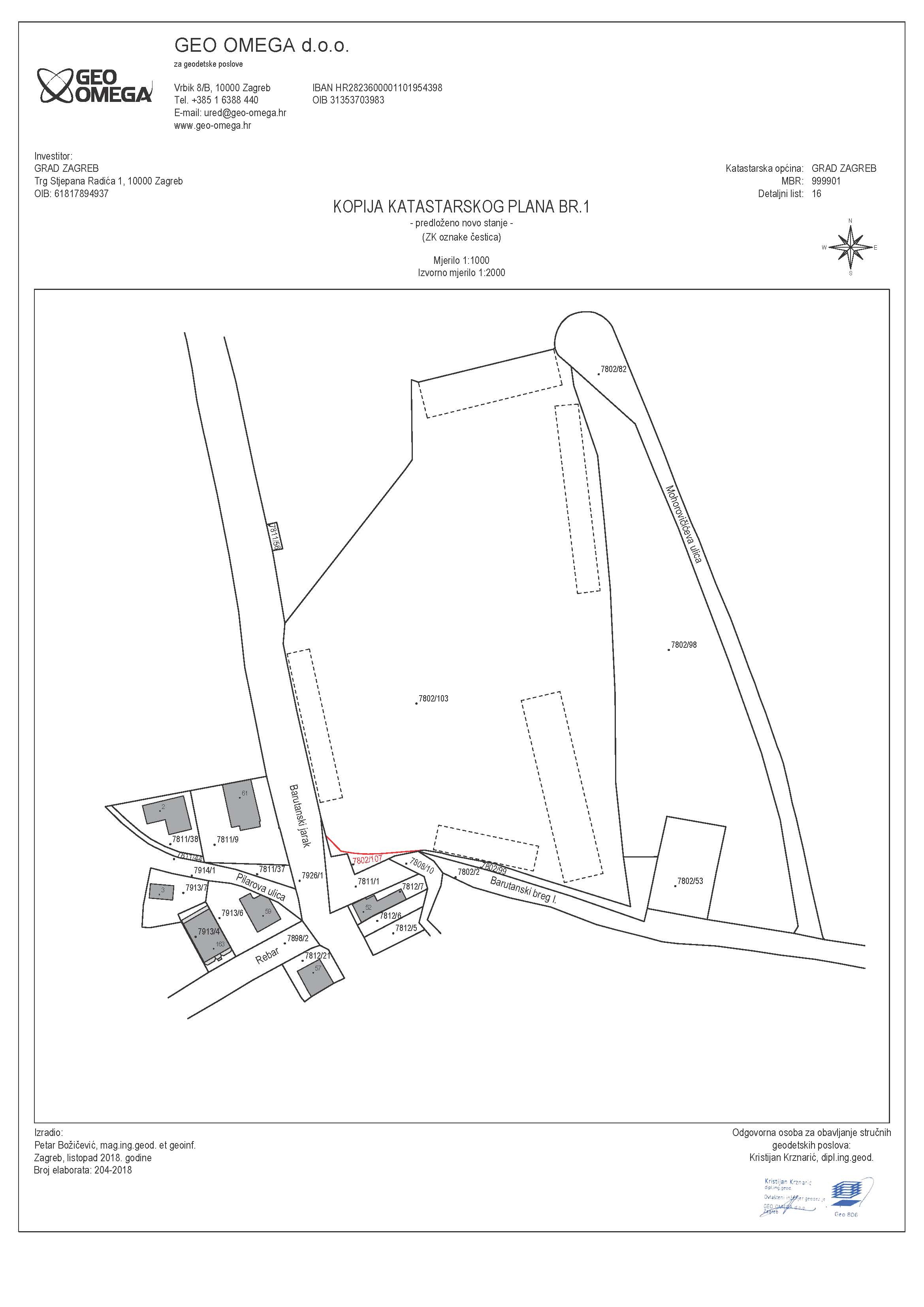
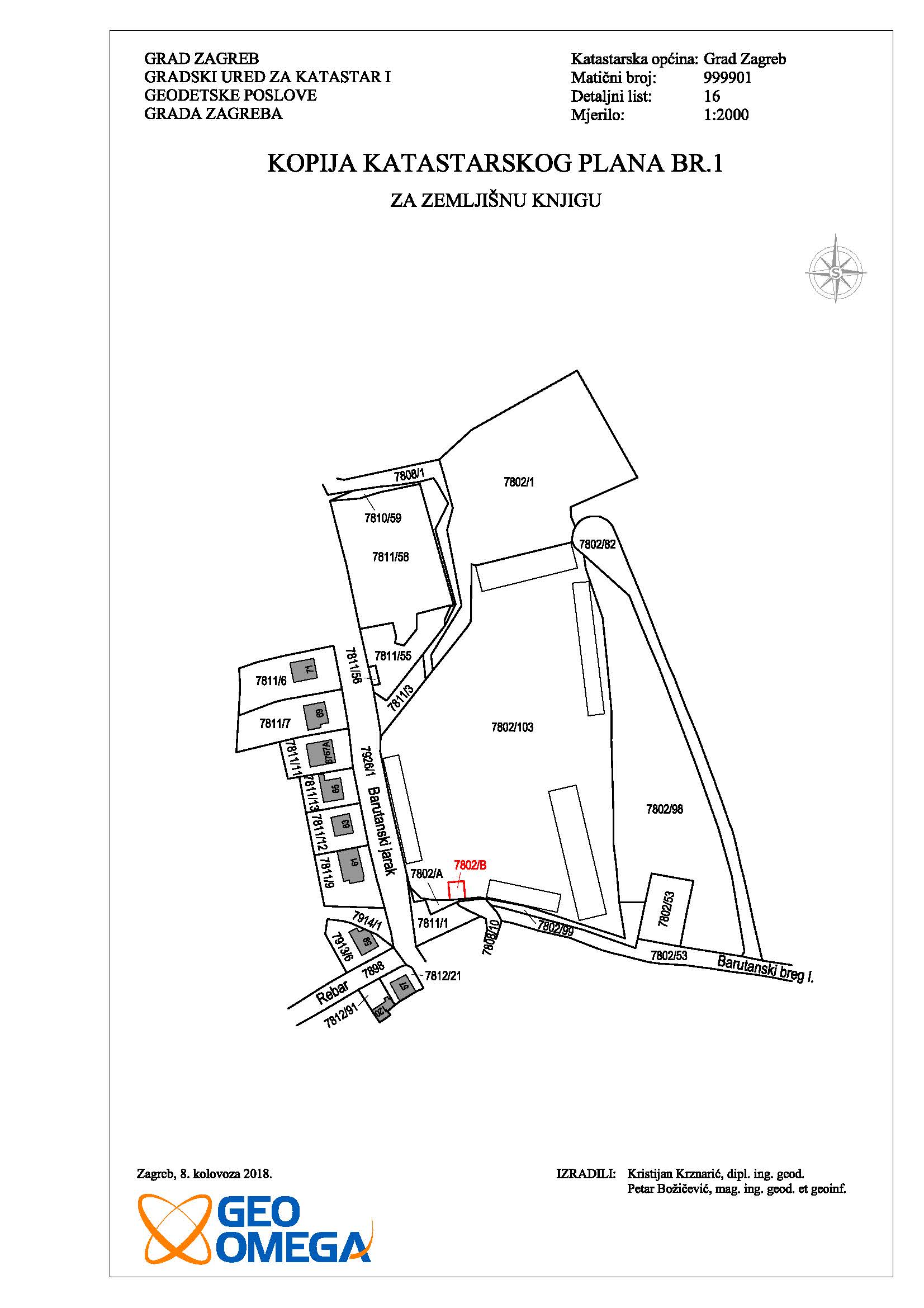
Parcelling of the street and Survey study for shopping mall
GD JARAK MALL d.o.o.
k.o. Maksimir
2 ha +
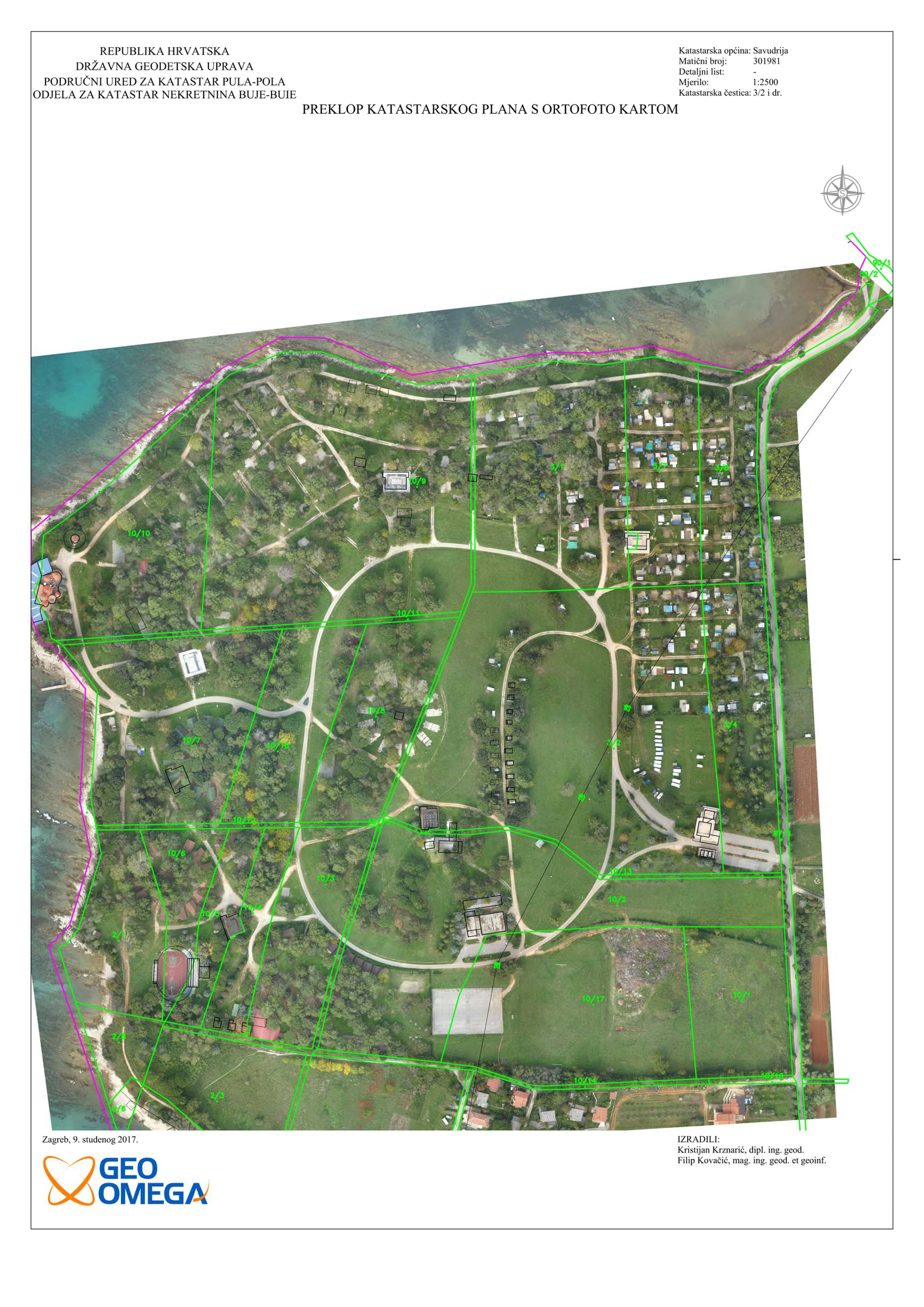
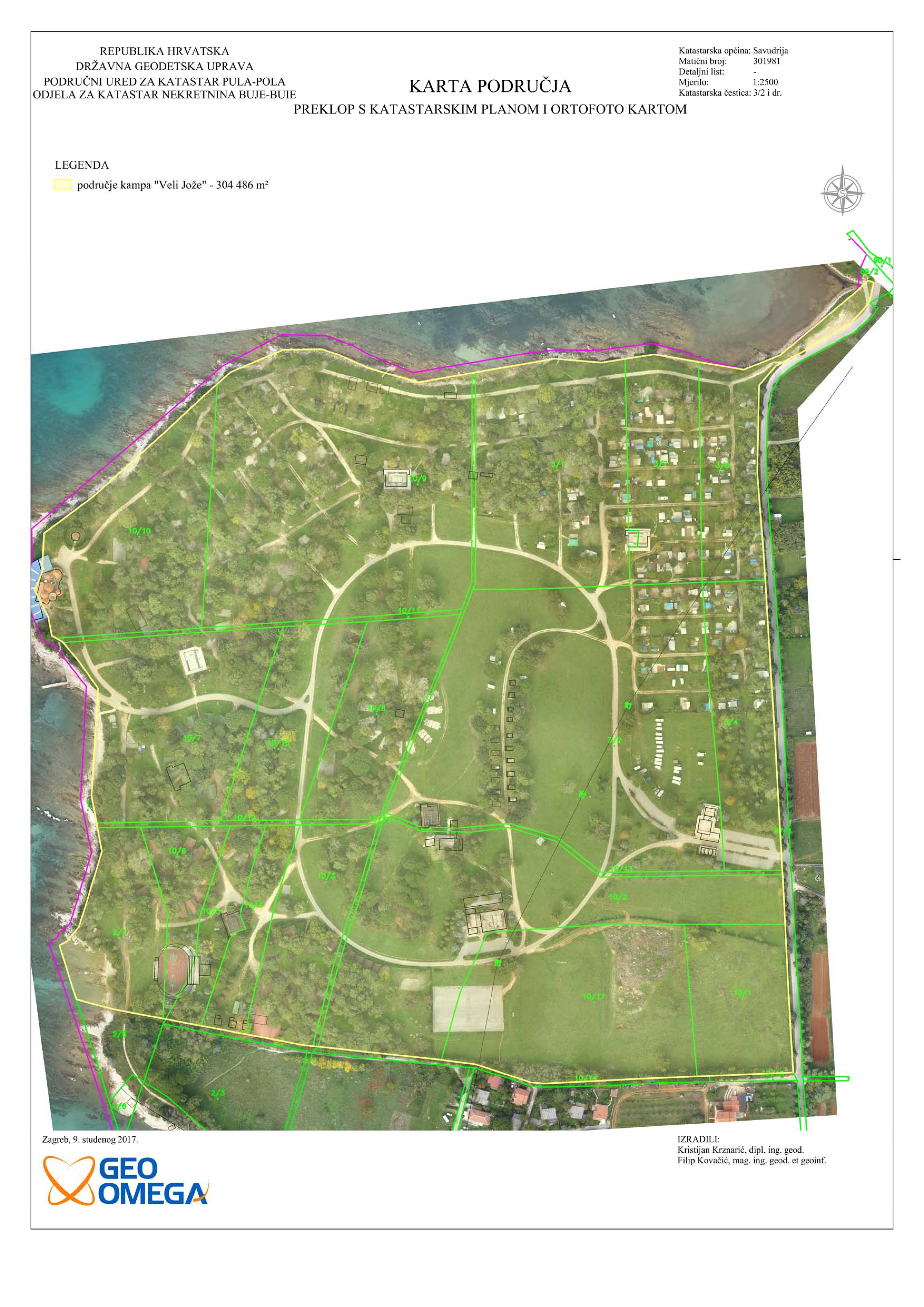
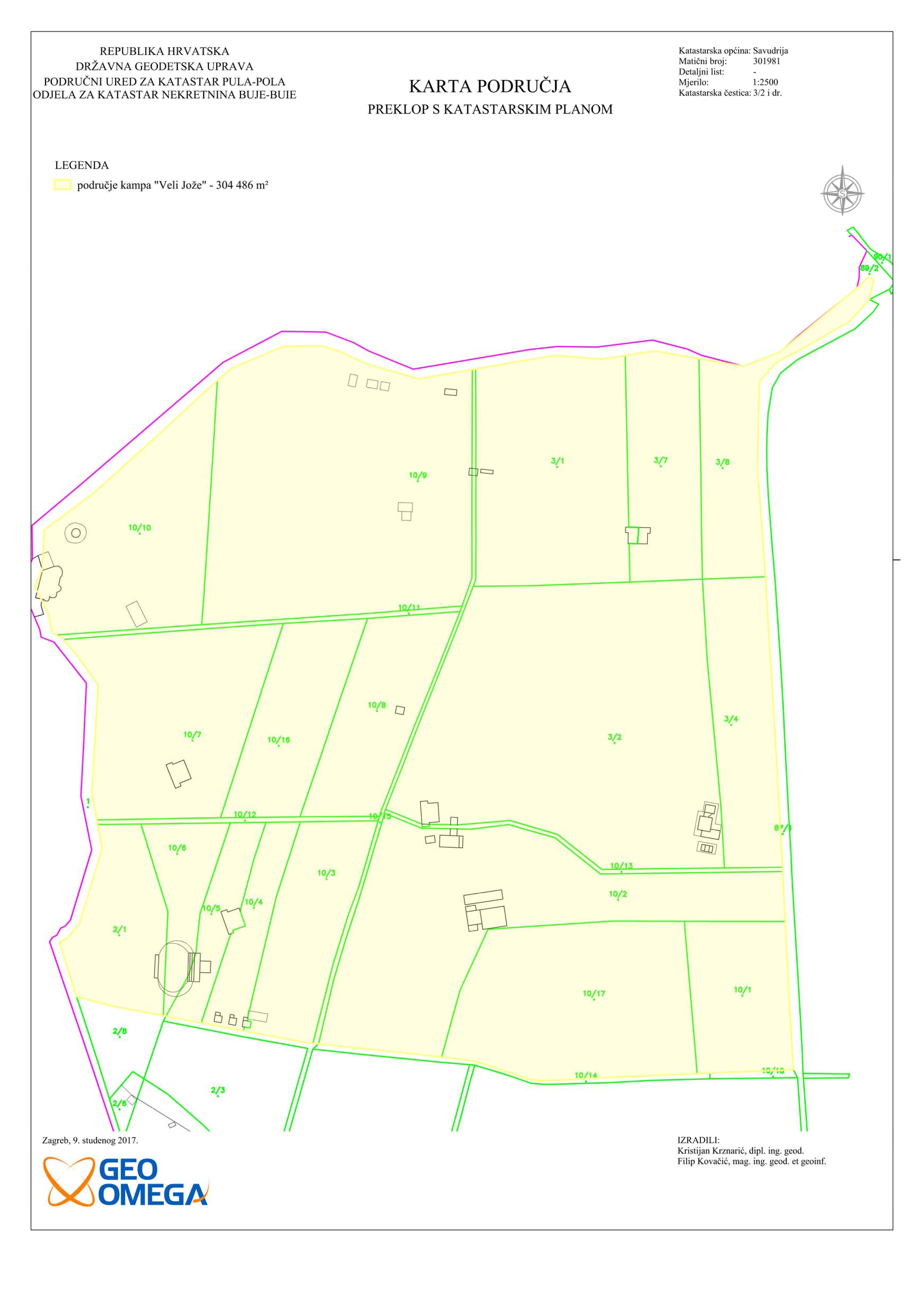
Orthomosaic creation and homogenization of the cadastral plan
ZAGREBAČKI HOLDING
cadastral municipality Savudrija
68 ha
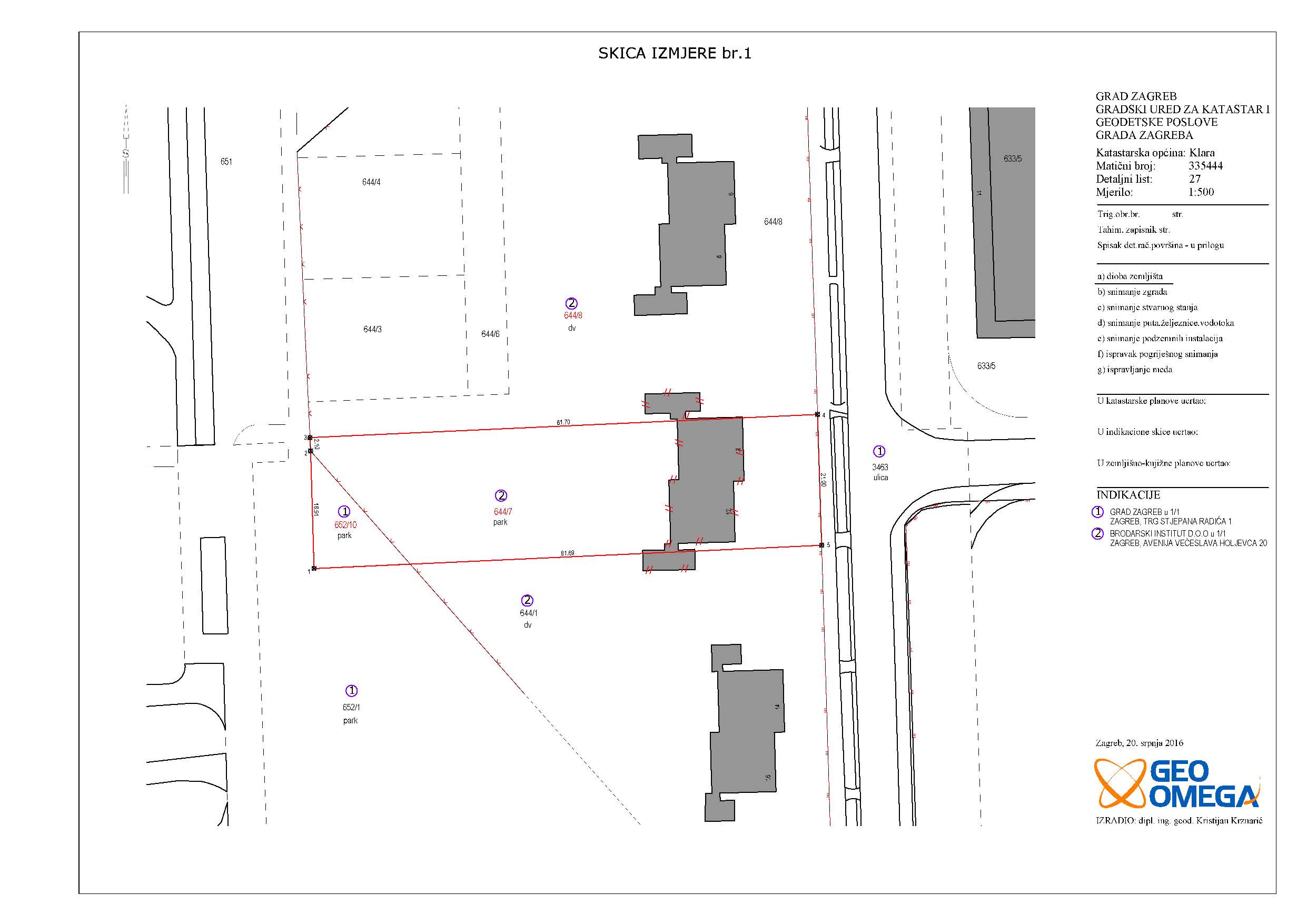
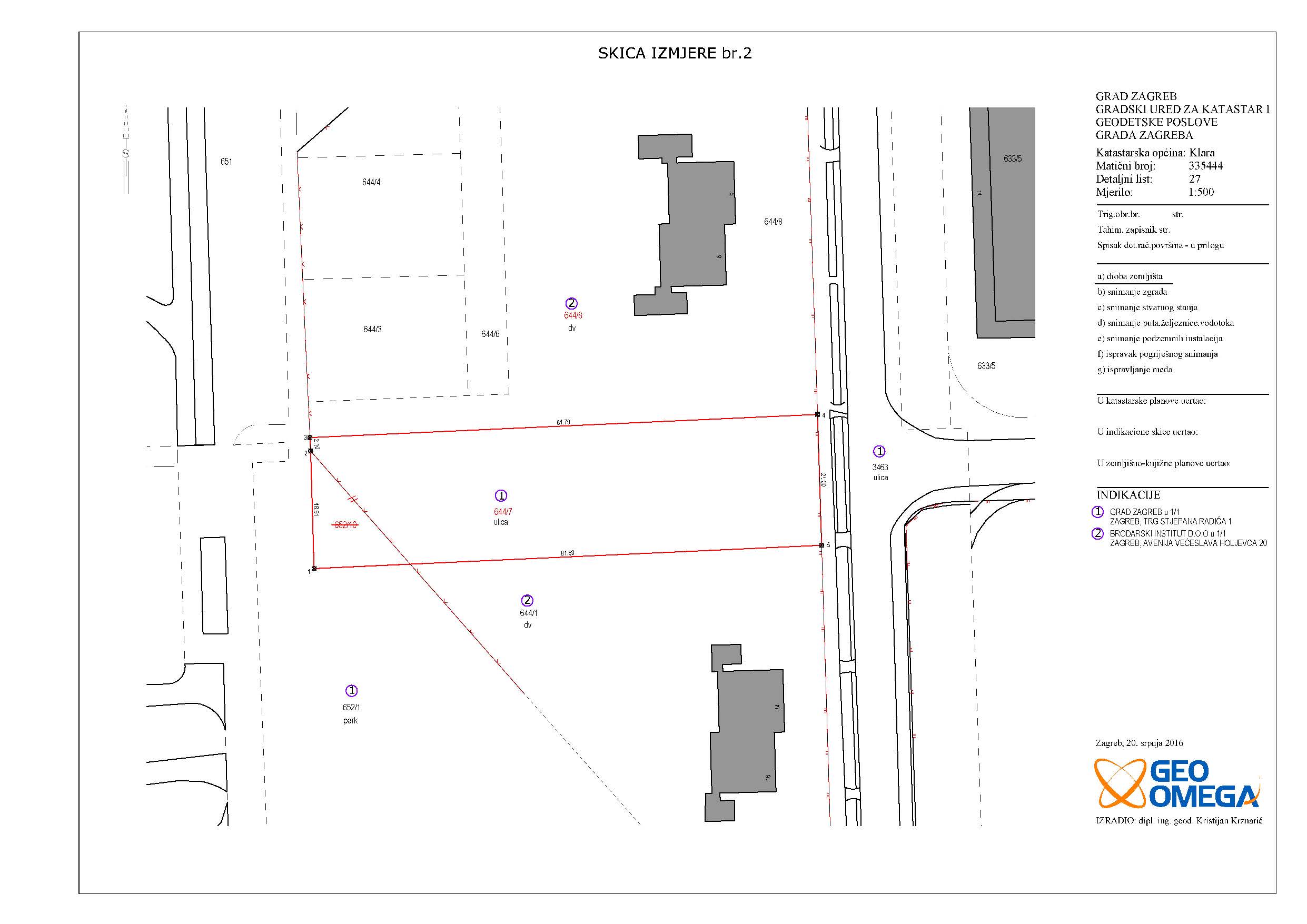
Parcelling of the Siget street
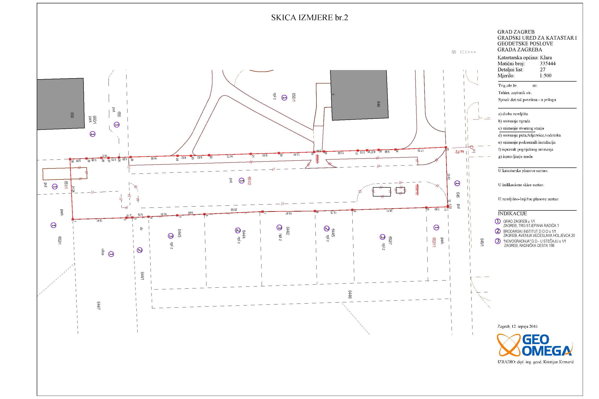
Grad Zagreb
cadastral municipality Klara
12000 m2
5 cadastral parcel(s) 5 land registry parcel(s)
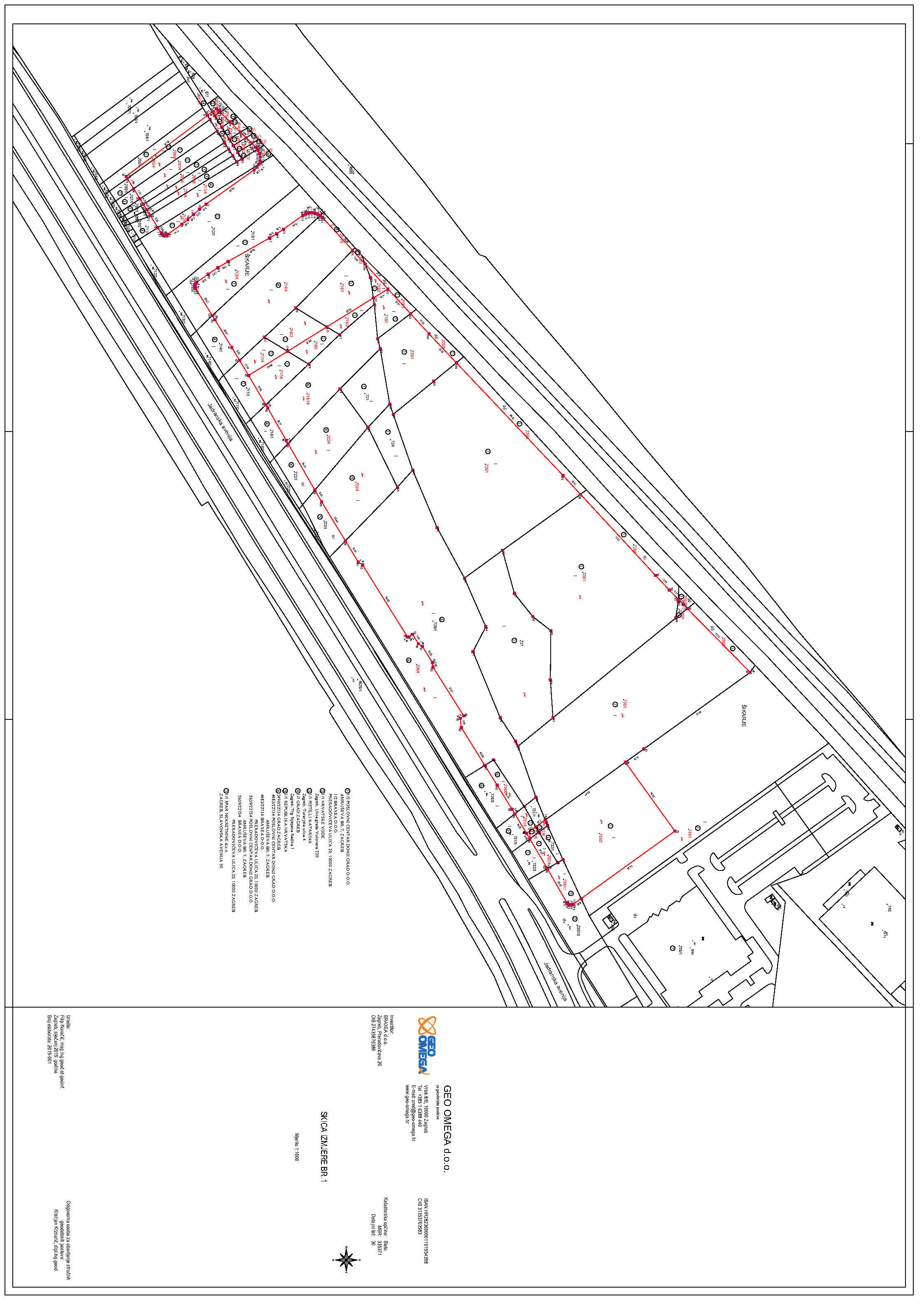
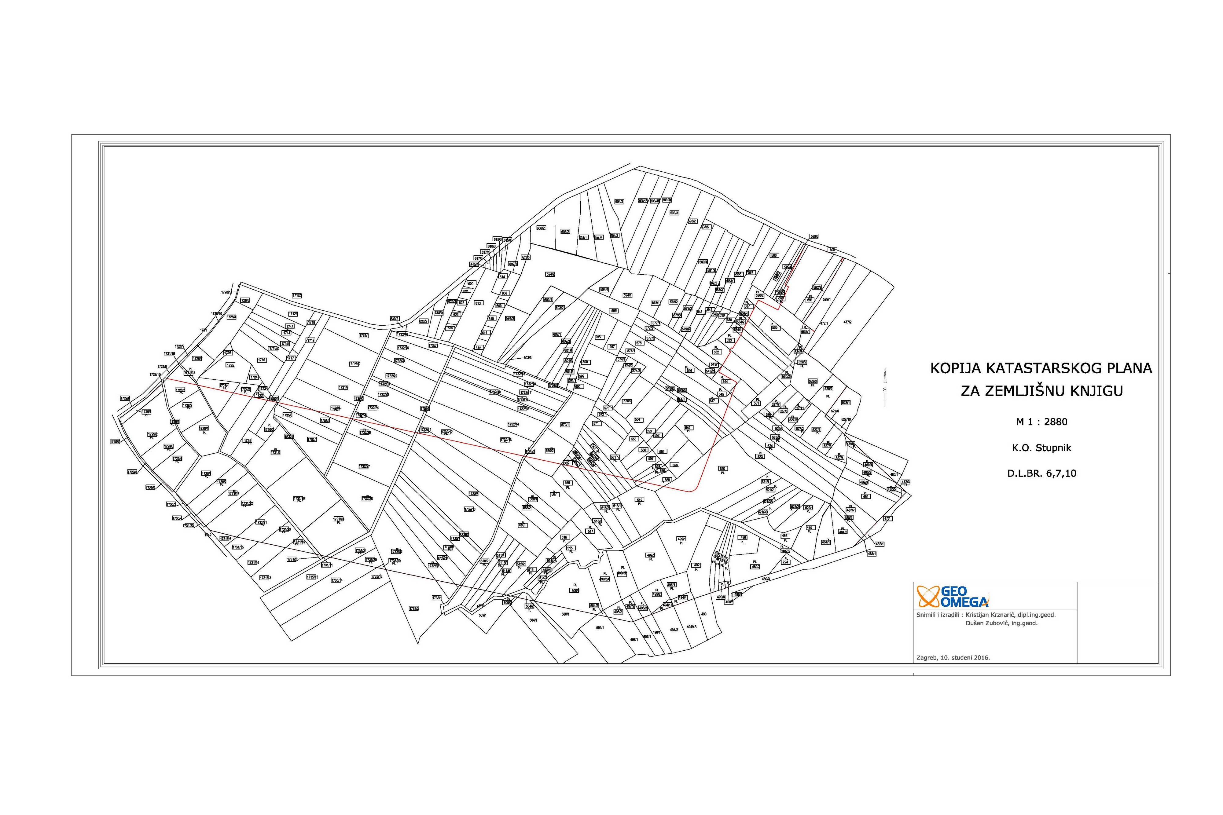
Parcelling of the airport Lučko
Fakultet Prometnih Znanosti
cadastral municipality Stupnik
118 ha
4 cadastral parcel(s) 168 land registry parcel(s)
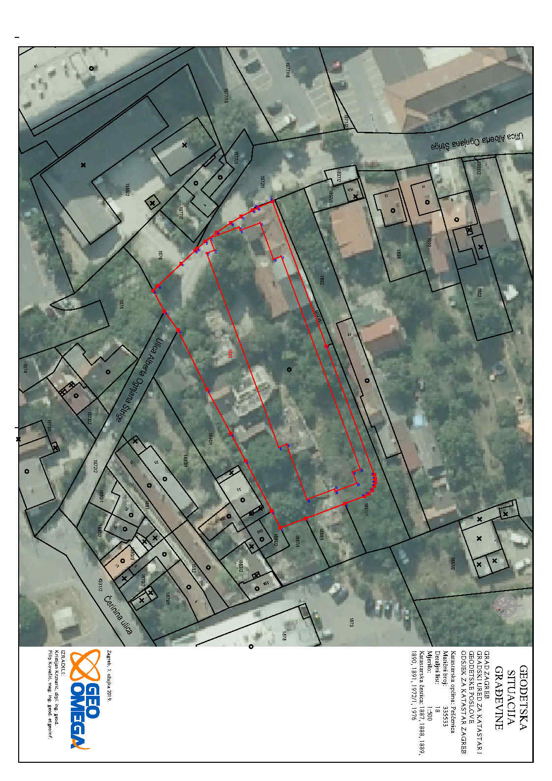
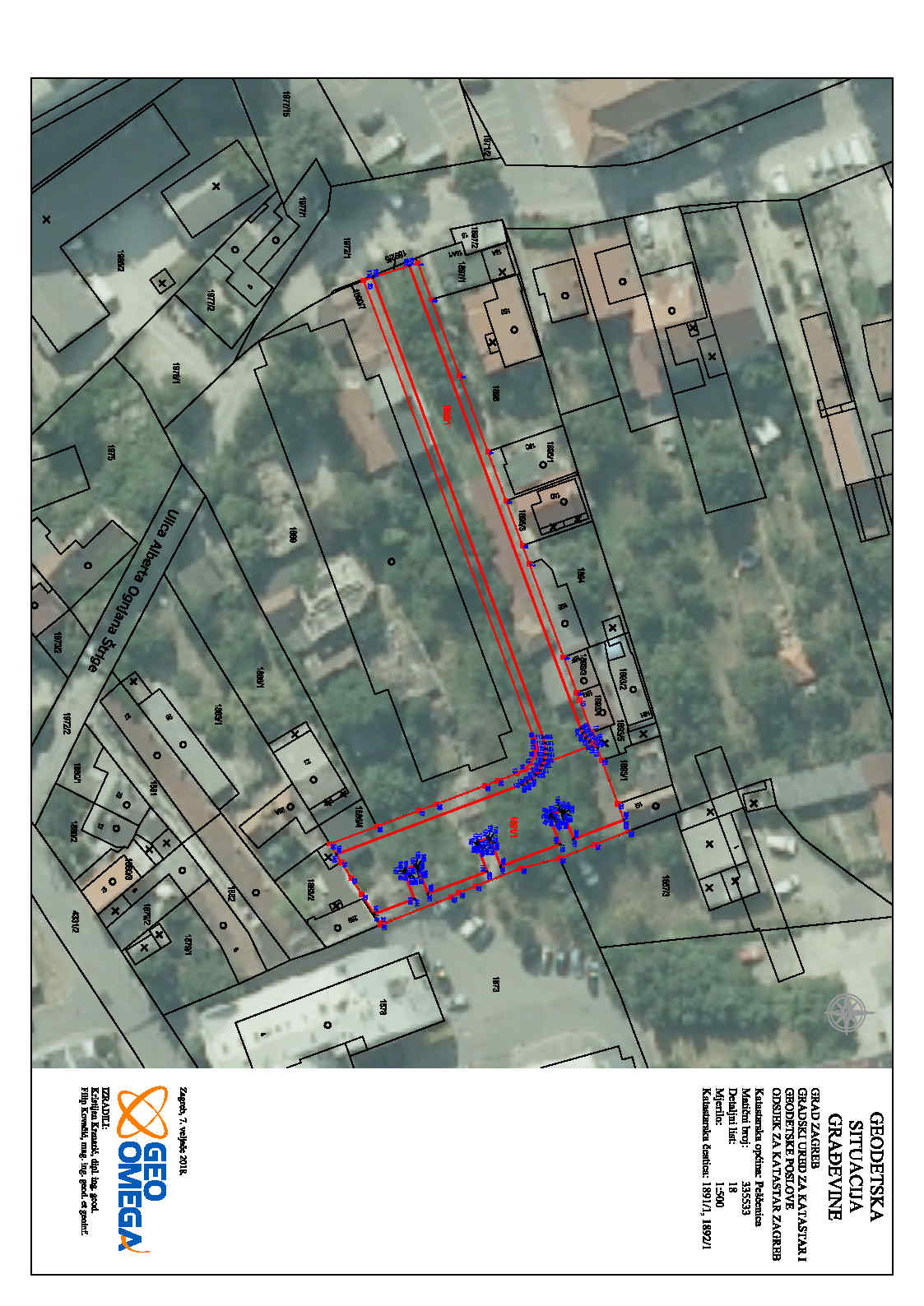
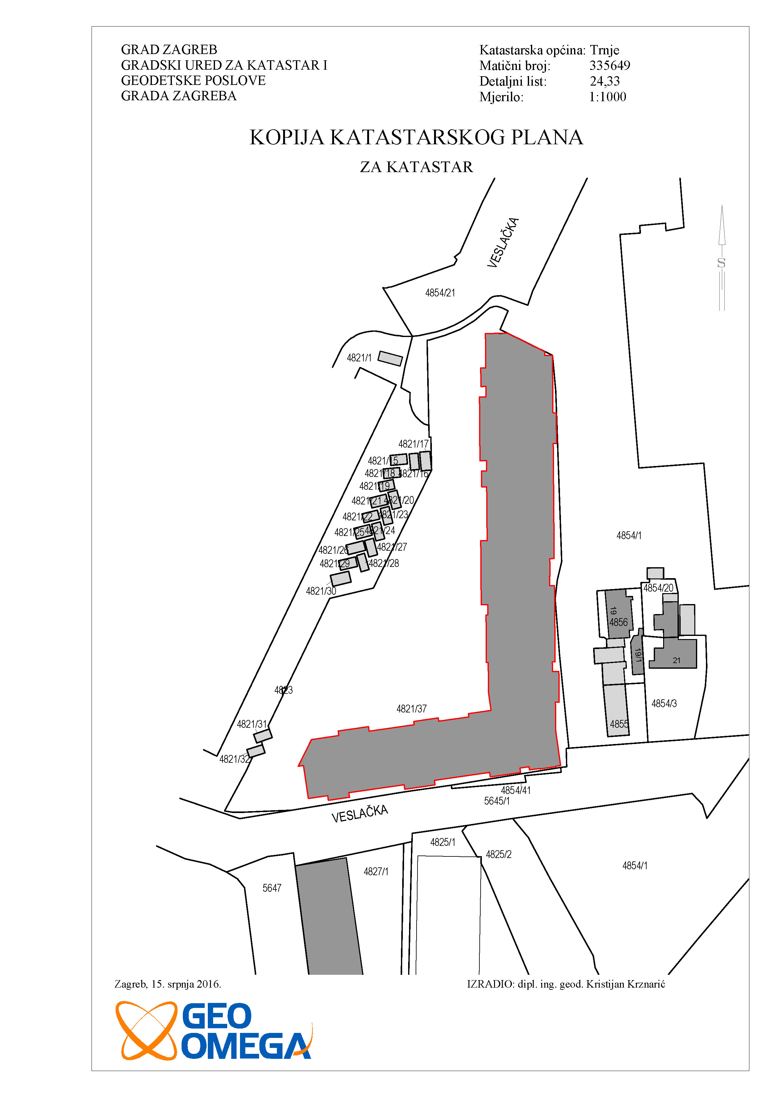
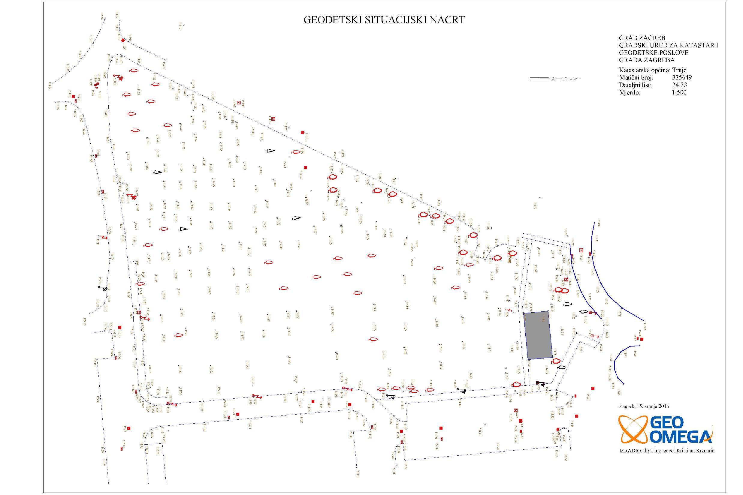
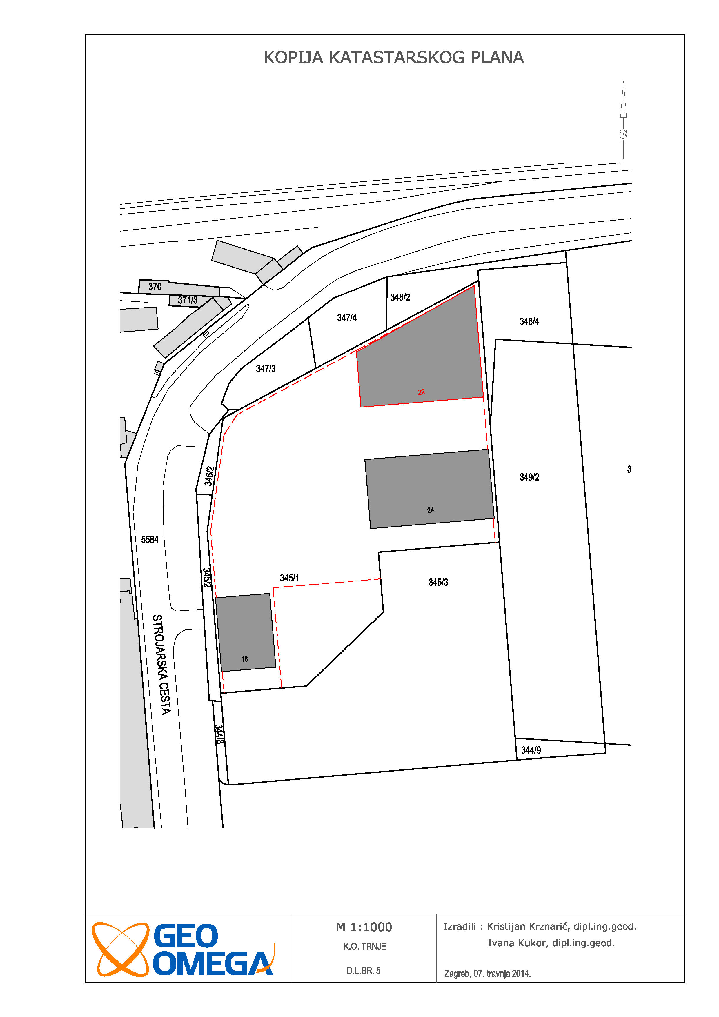
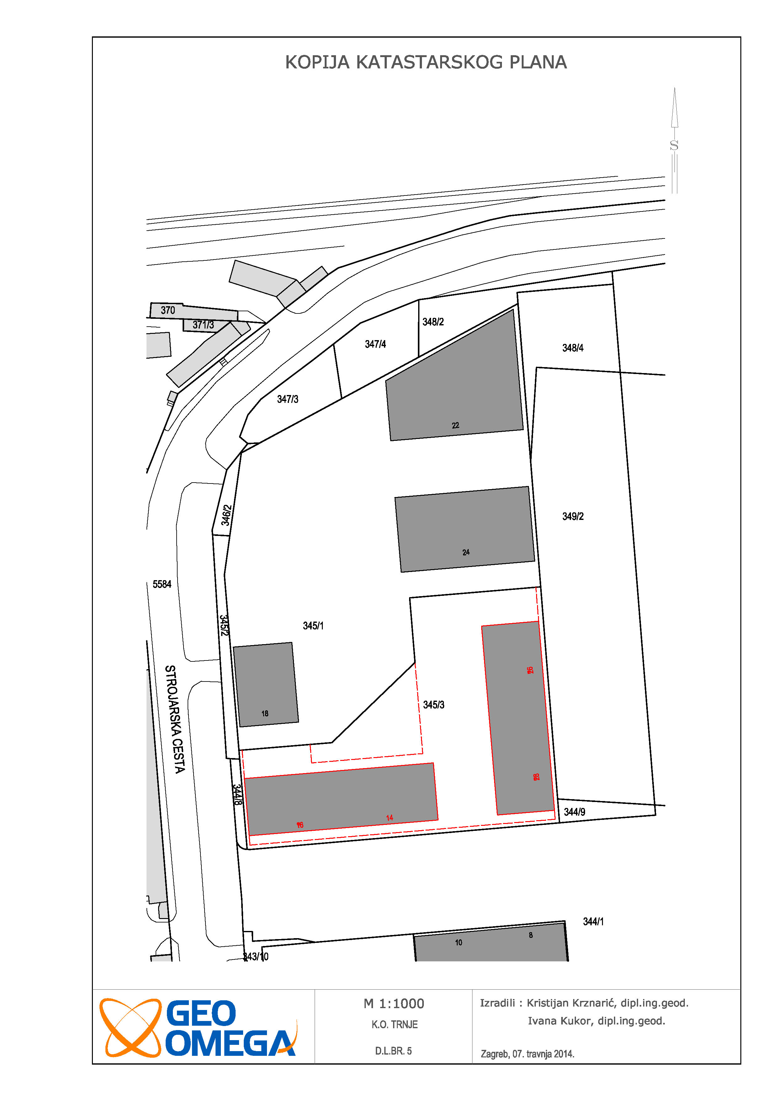
Survey study for residential-commercial building in Veslačka street
ALFA STAN GRUPA d.o.o.
cadastral municipality Trnje
7000 m2
3 cadastral parcel(s) 4 land registry parcel(s)
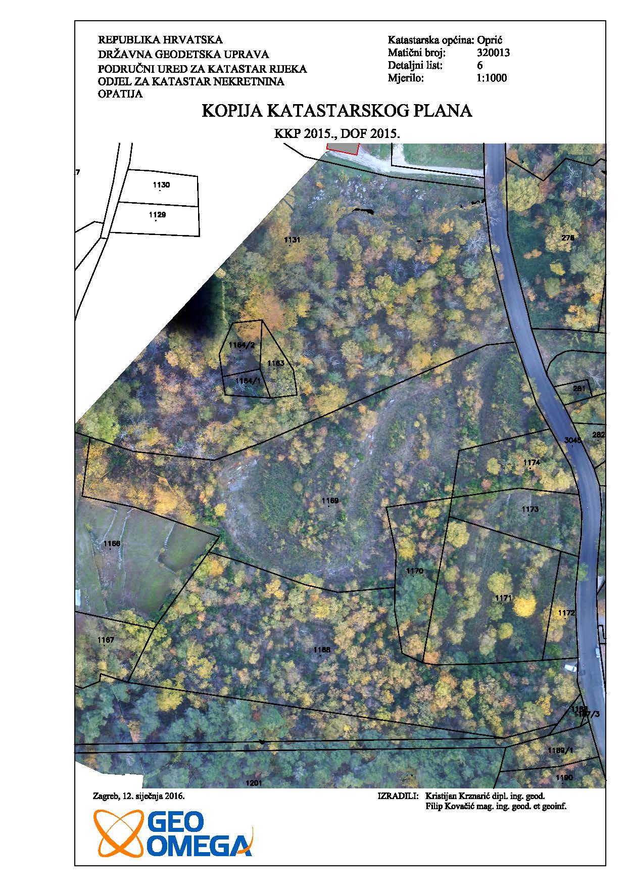
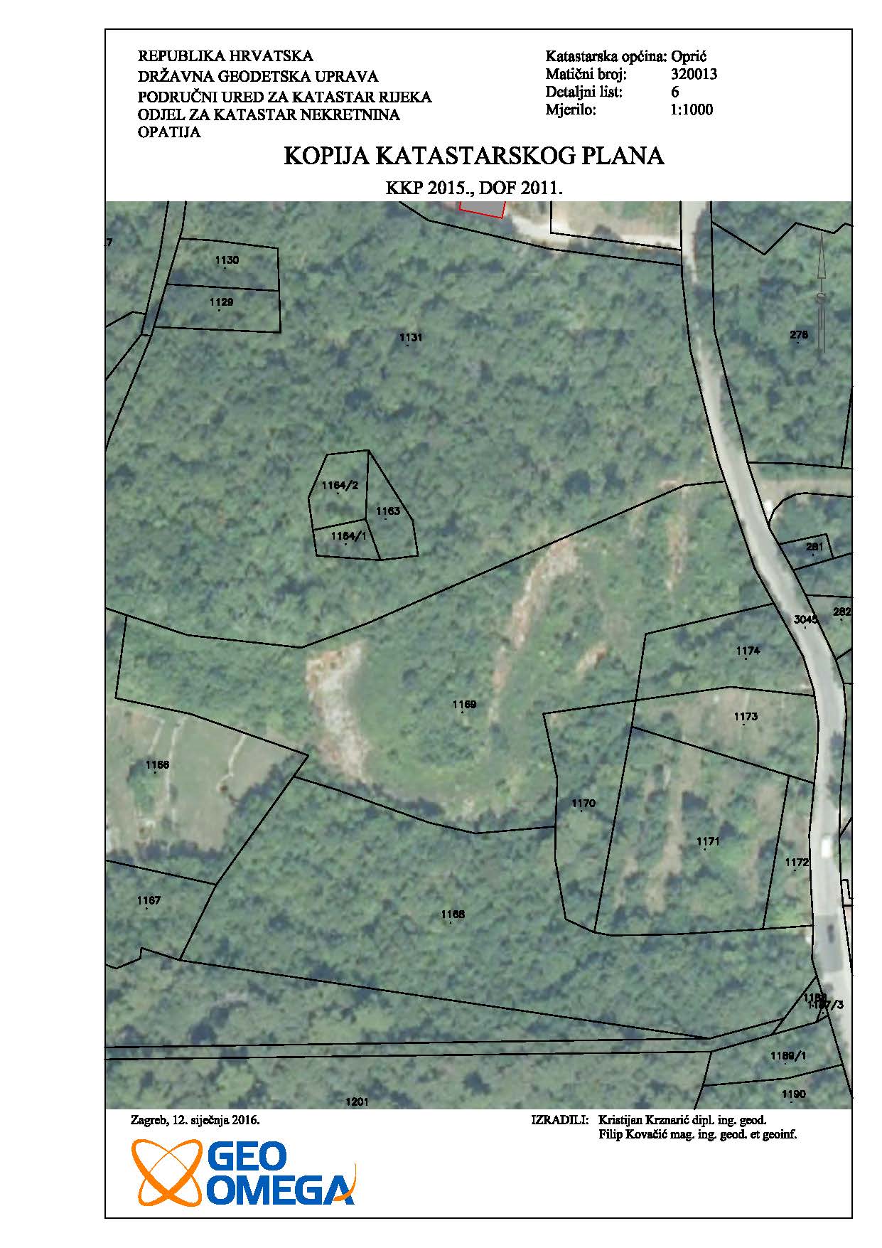
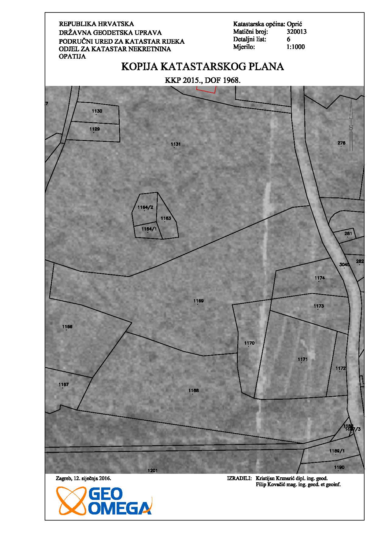
Analysis of the actual situation, the cadastre and land register - Oprič
Amir Madani
cadastral municipality Oprič
11000 m2
2 cadastral parcel(s) 2 land registry parcel(s)
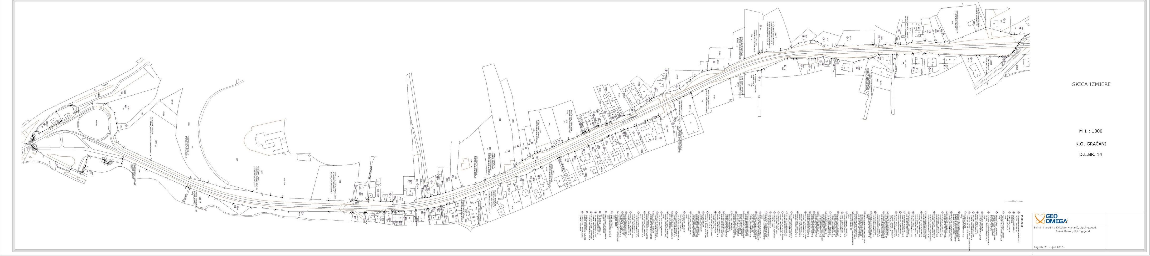
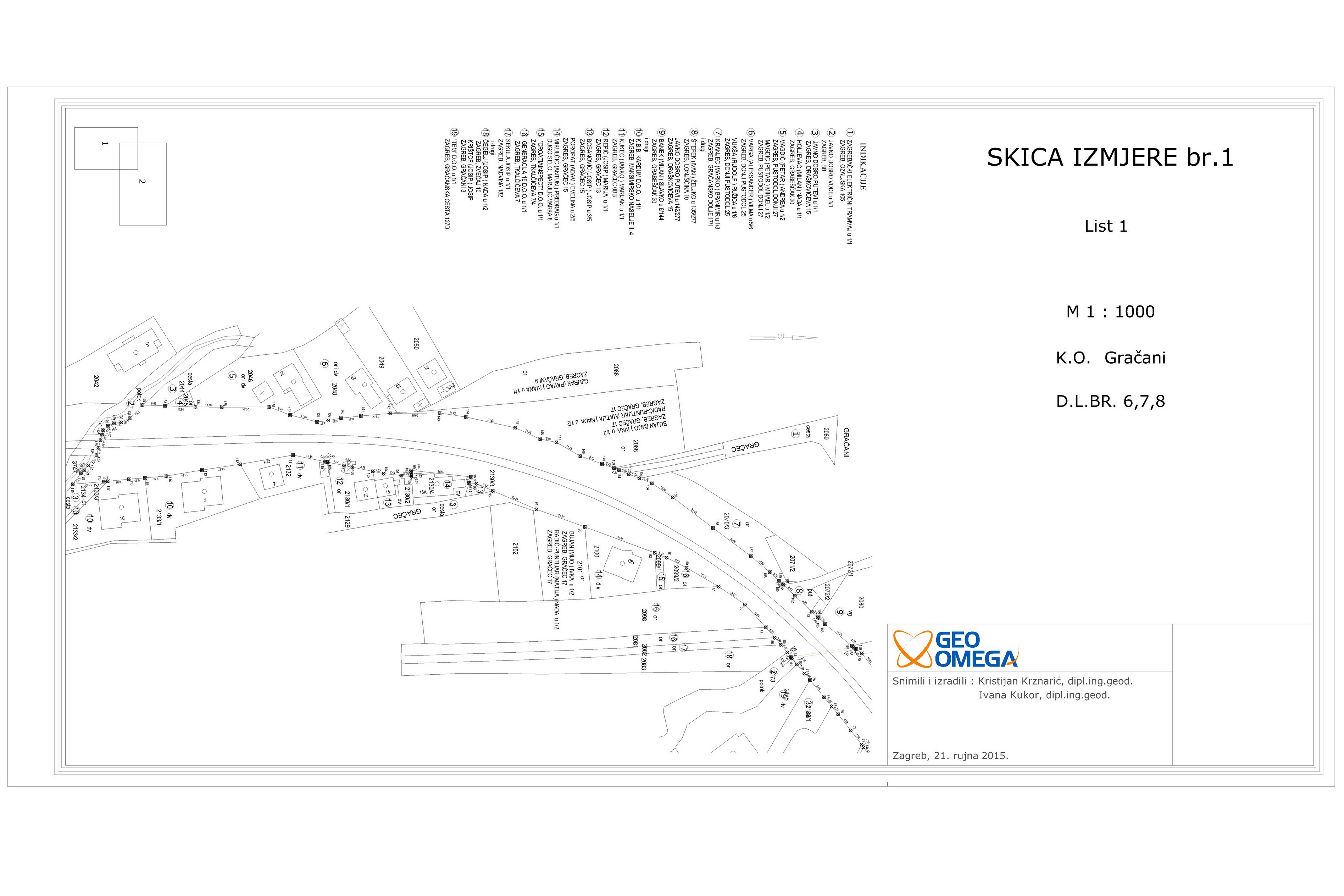
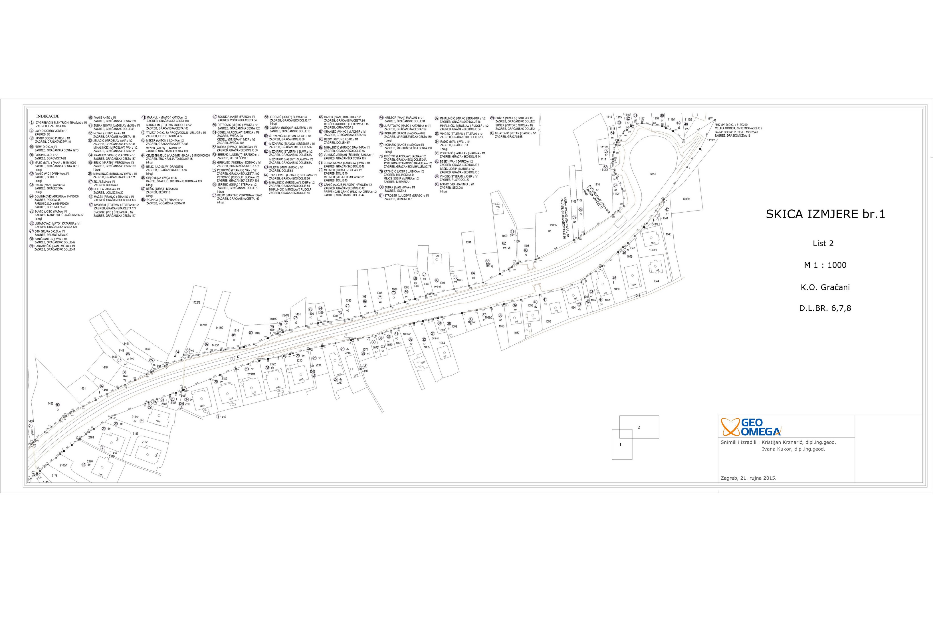
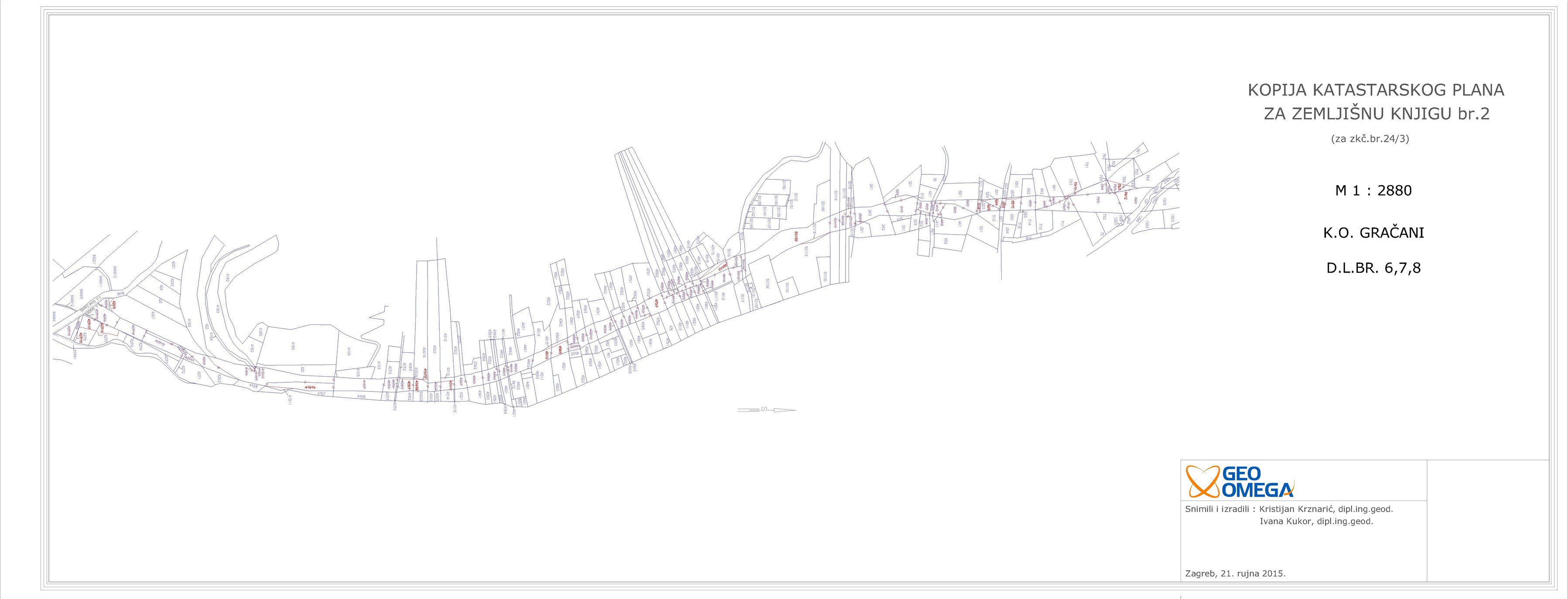
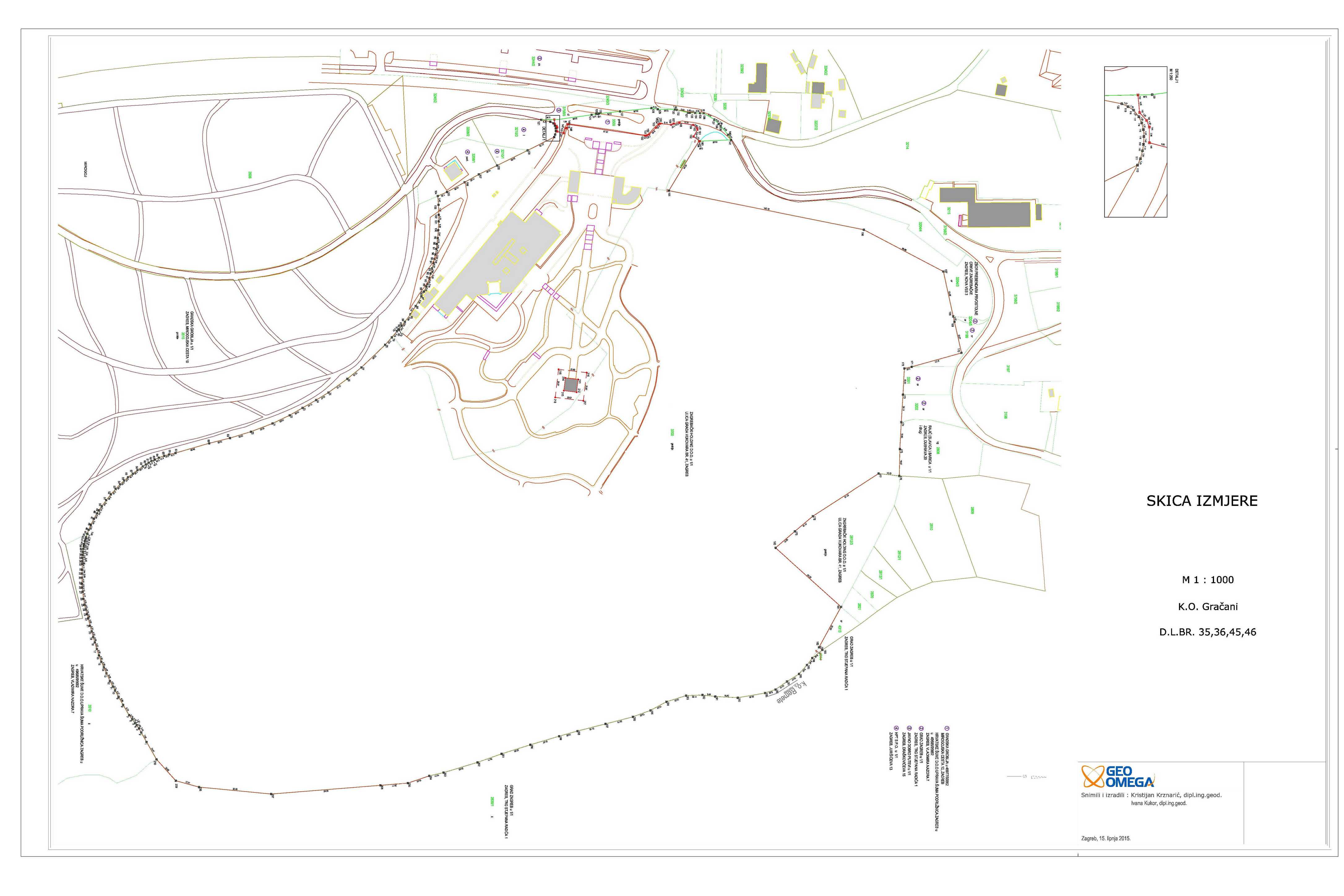
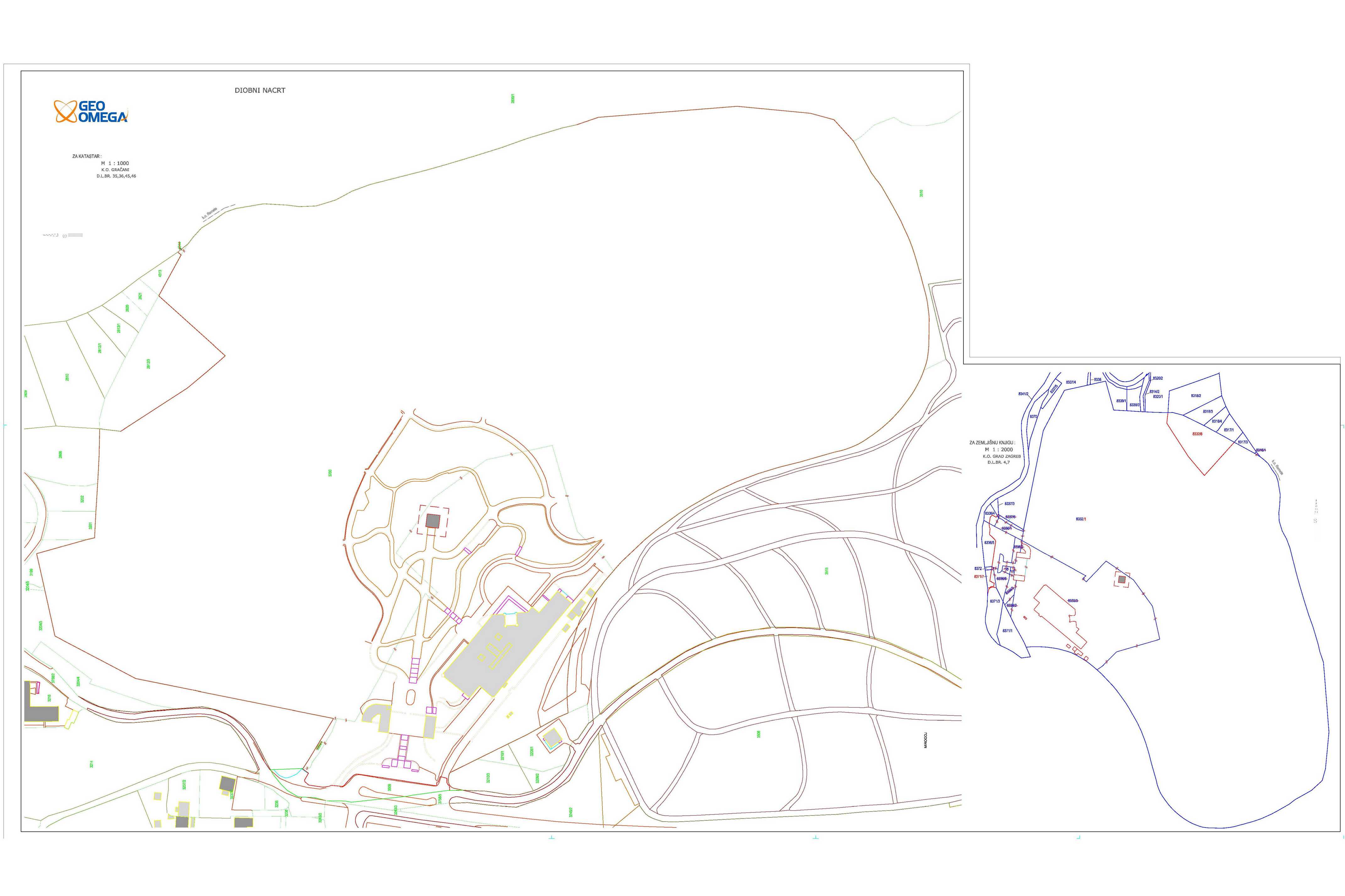
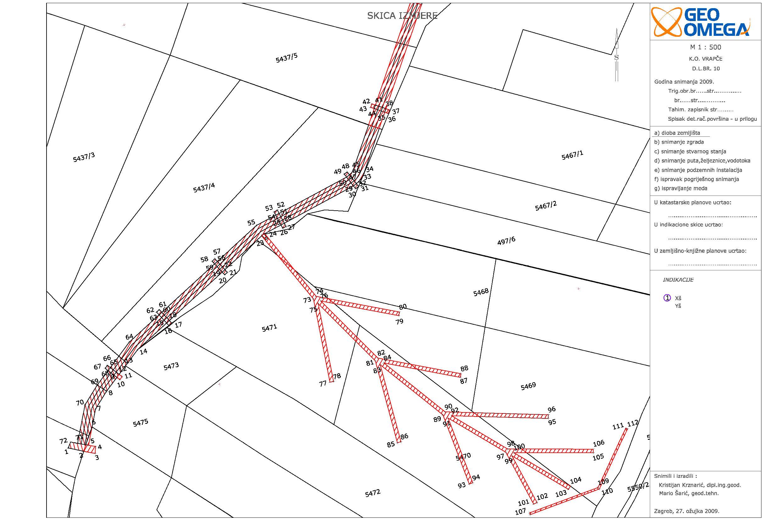
Reconciliation of land registry according to the cadastre - Cableway
Zagrebački holding d.o.o.
cadastral municipality Gračani
15700 m2
2 cadastral parcel(s) 31 land registry parcel(s)
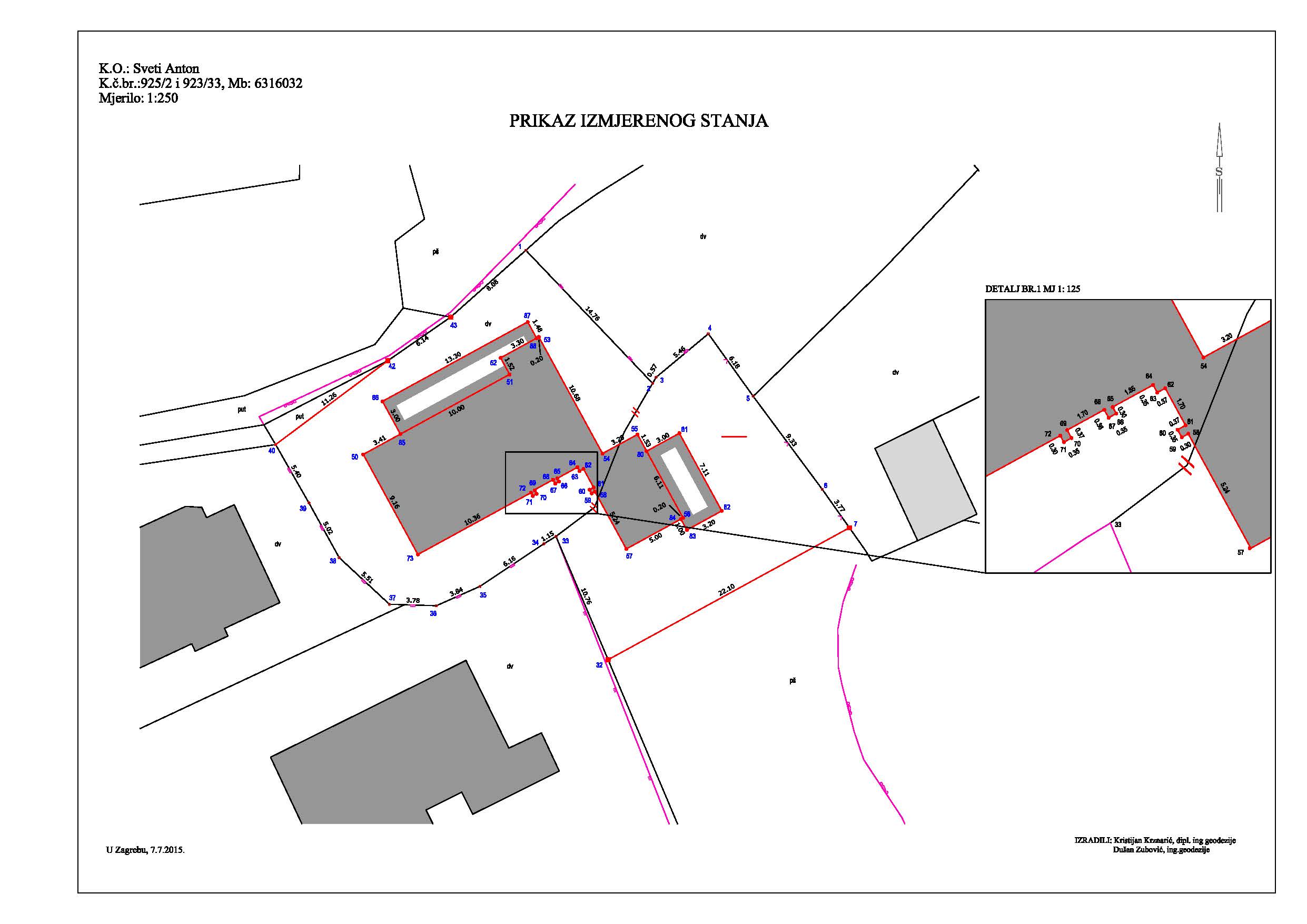
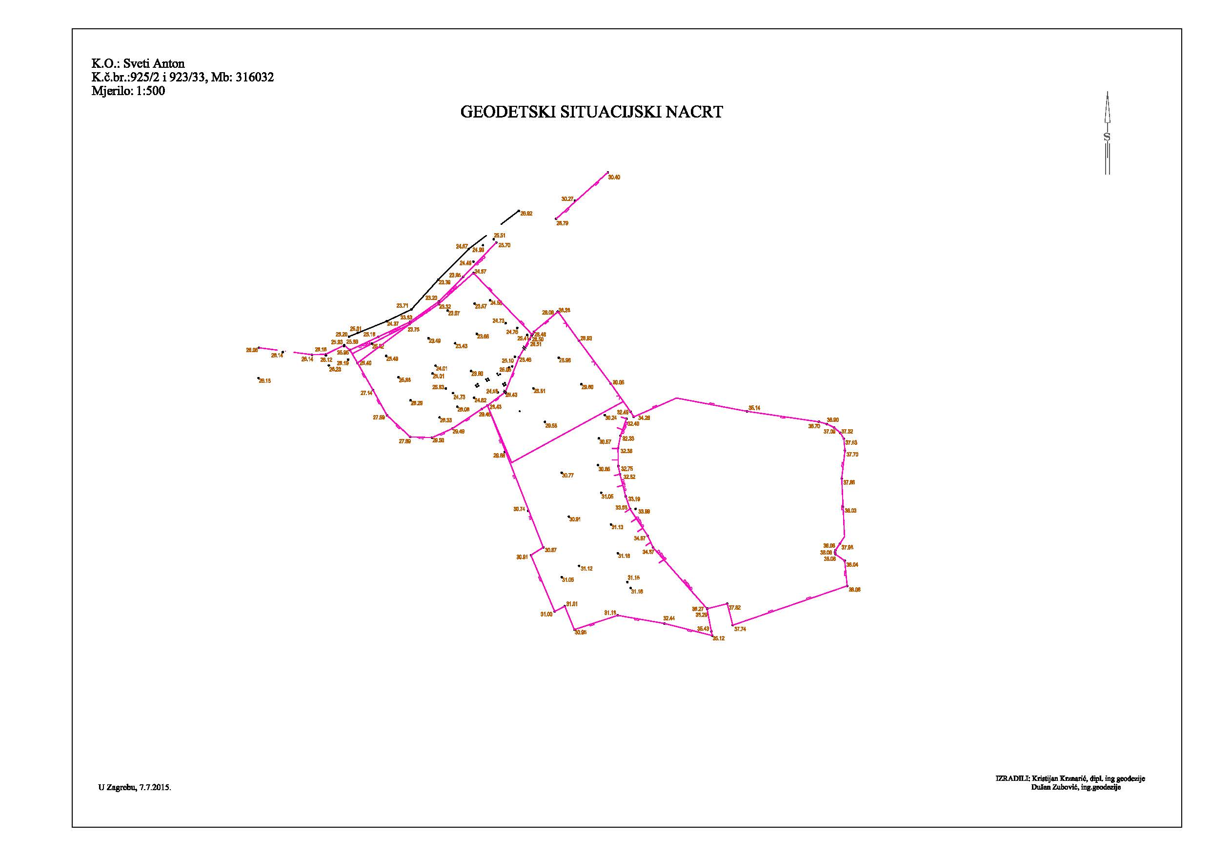
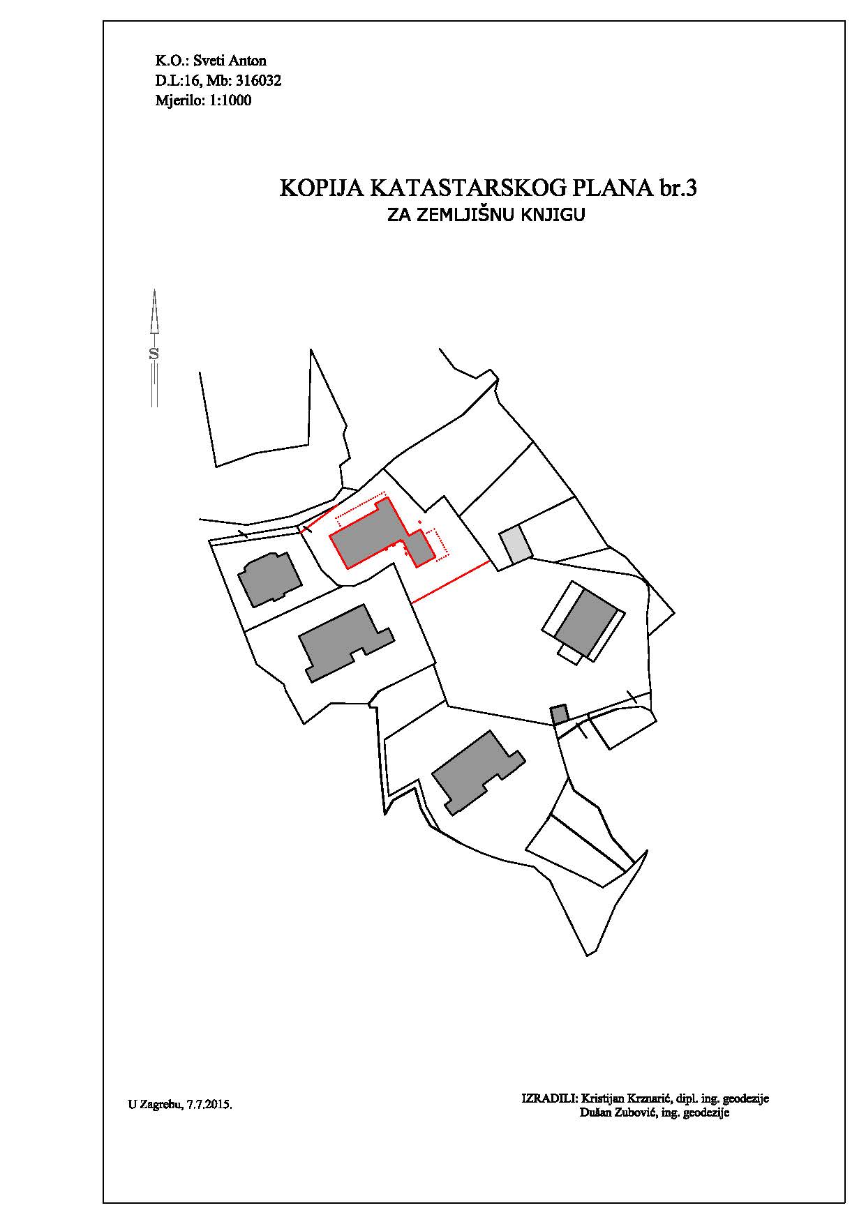
Survey study - Projekt MT - Sv. Anton
PROJEKT MT d.o.o.
cadastral municipality Sv. Anton
11500 m2
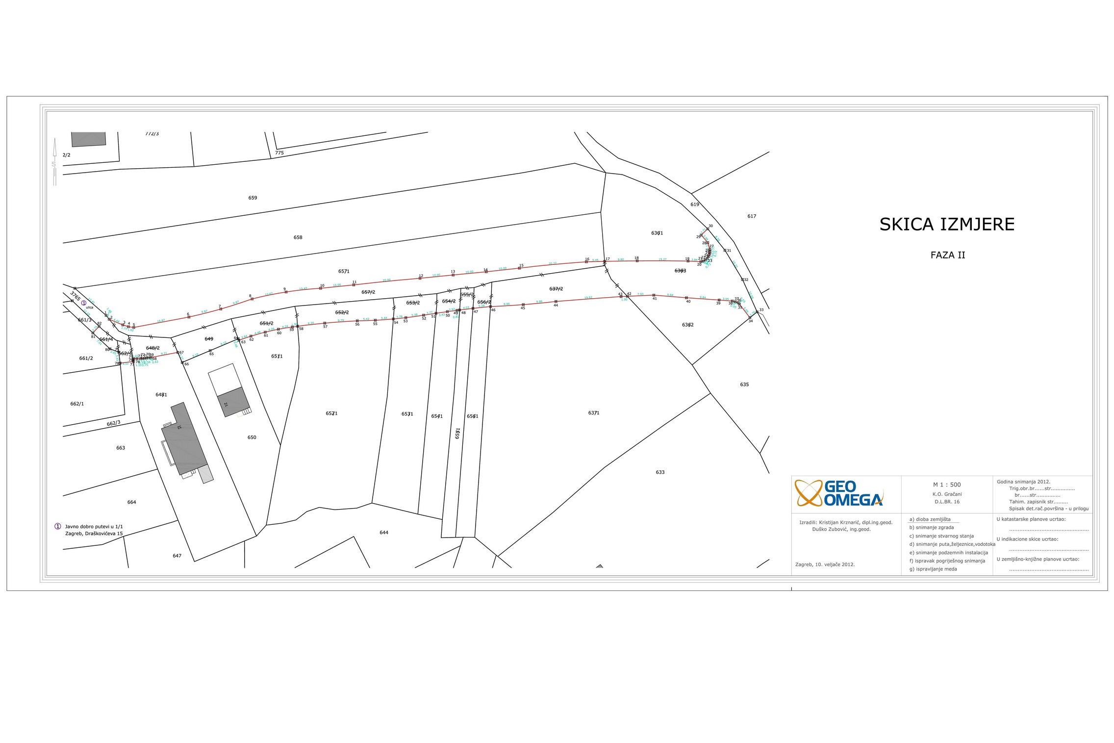
Parcelling and registrating cenotaph
Grad Zagreb
cadastral municipality Gračani
191700 m2
4 cadastral parcel(s) 16 land registry parcel(s)
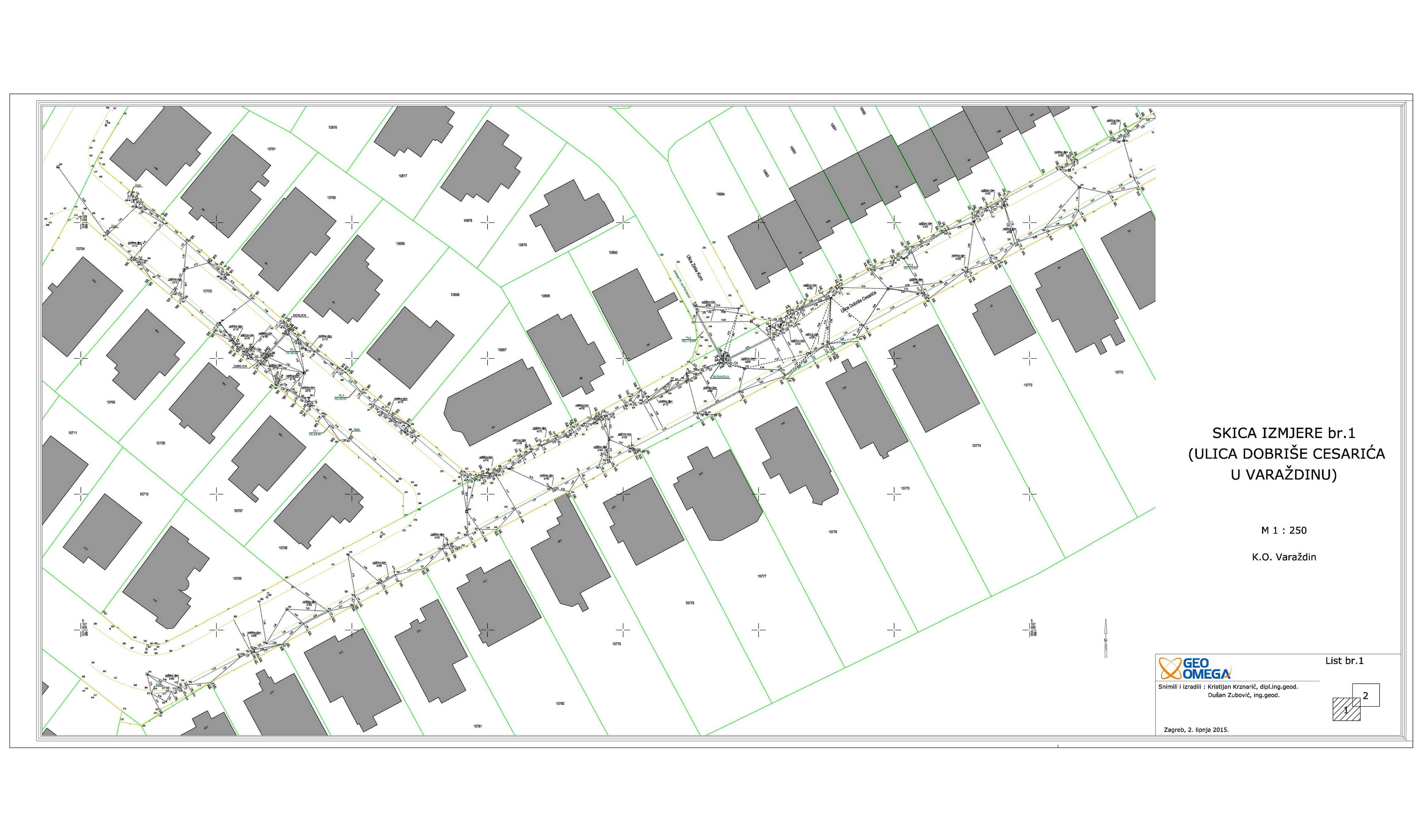
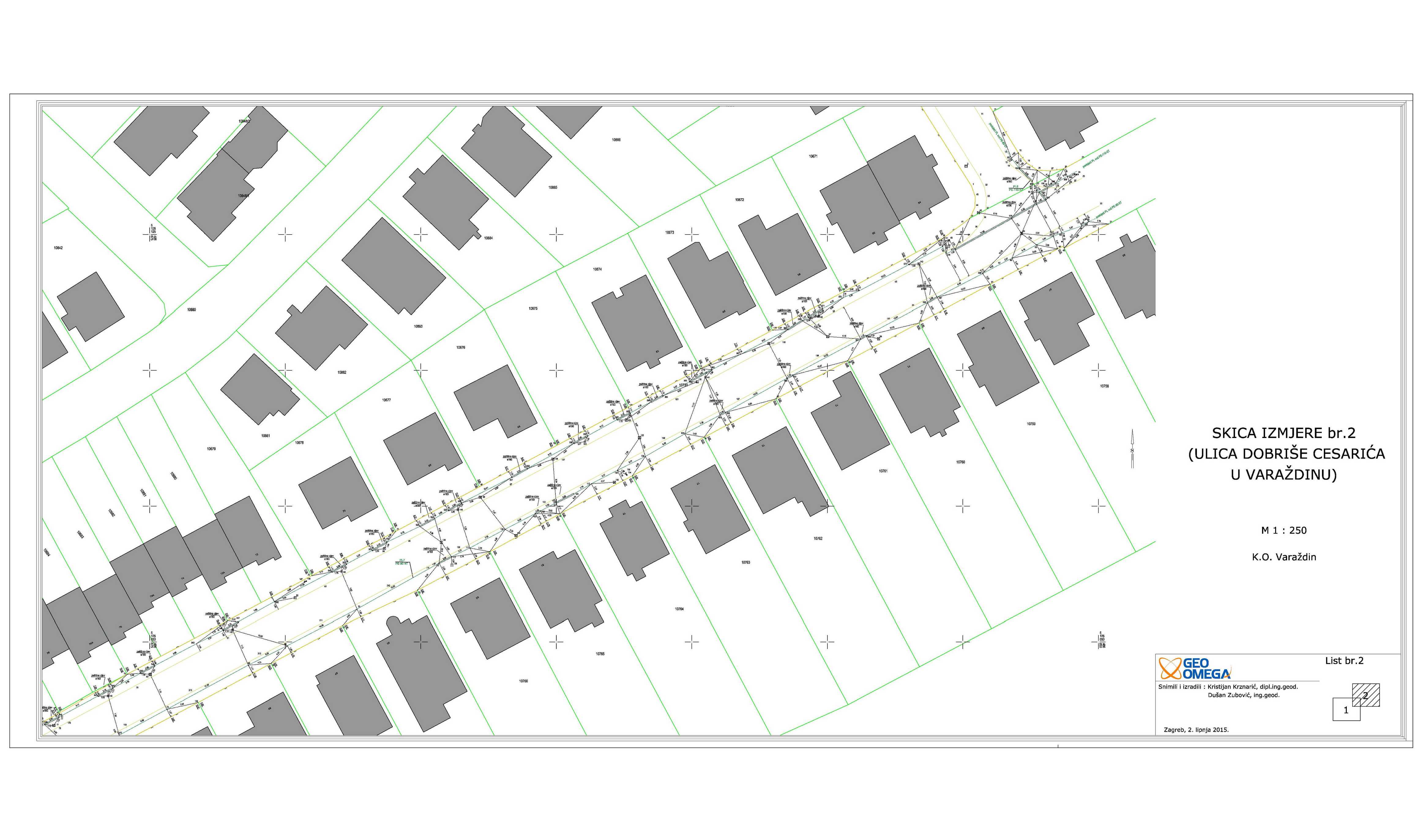
Utility projects study - gas pipeline
TERMOPLIN d.d.
cadastral municipality Varaždin, Dobriša Cesarić street
1000 m
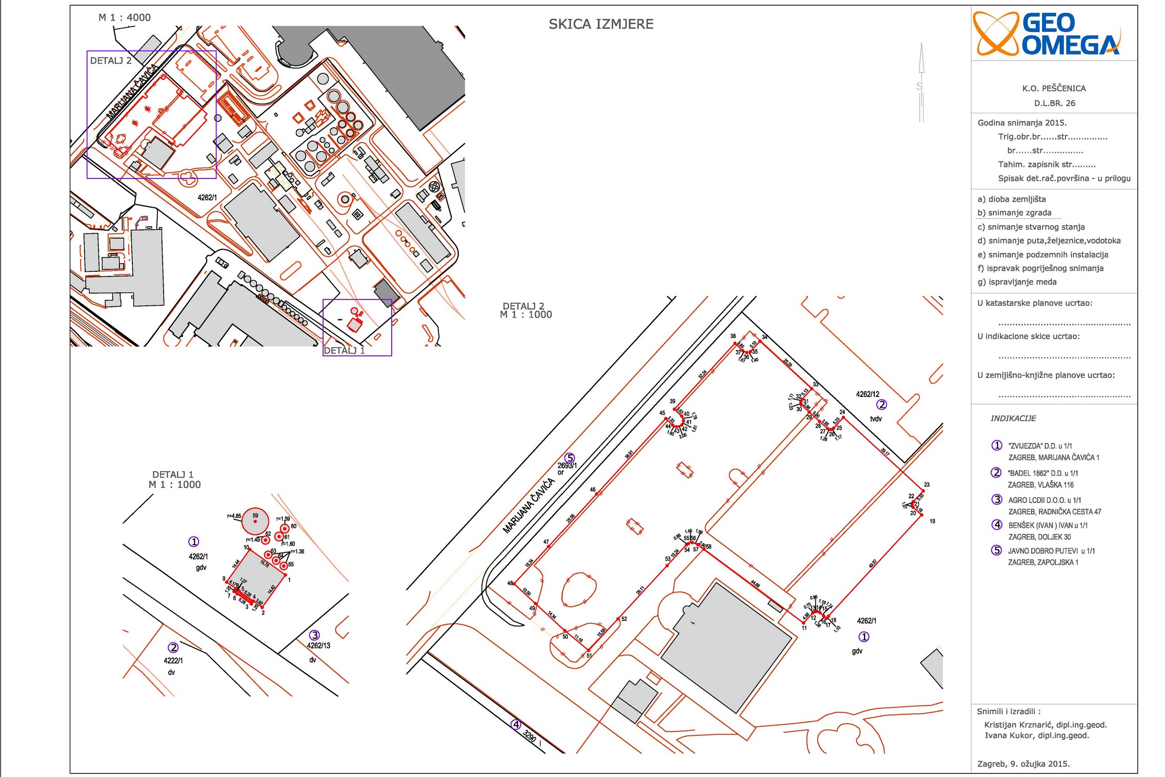
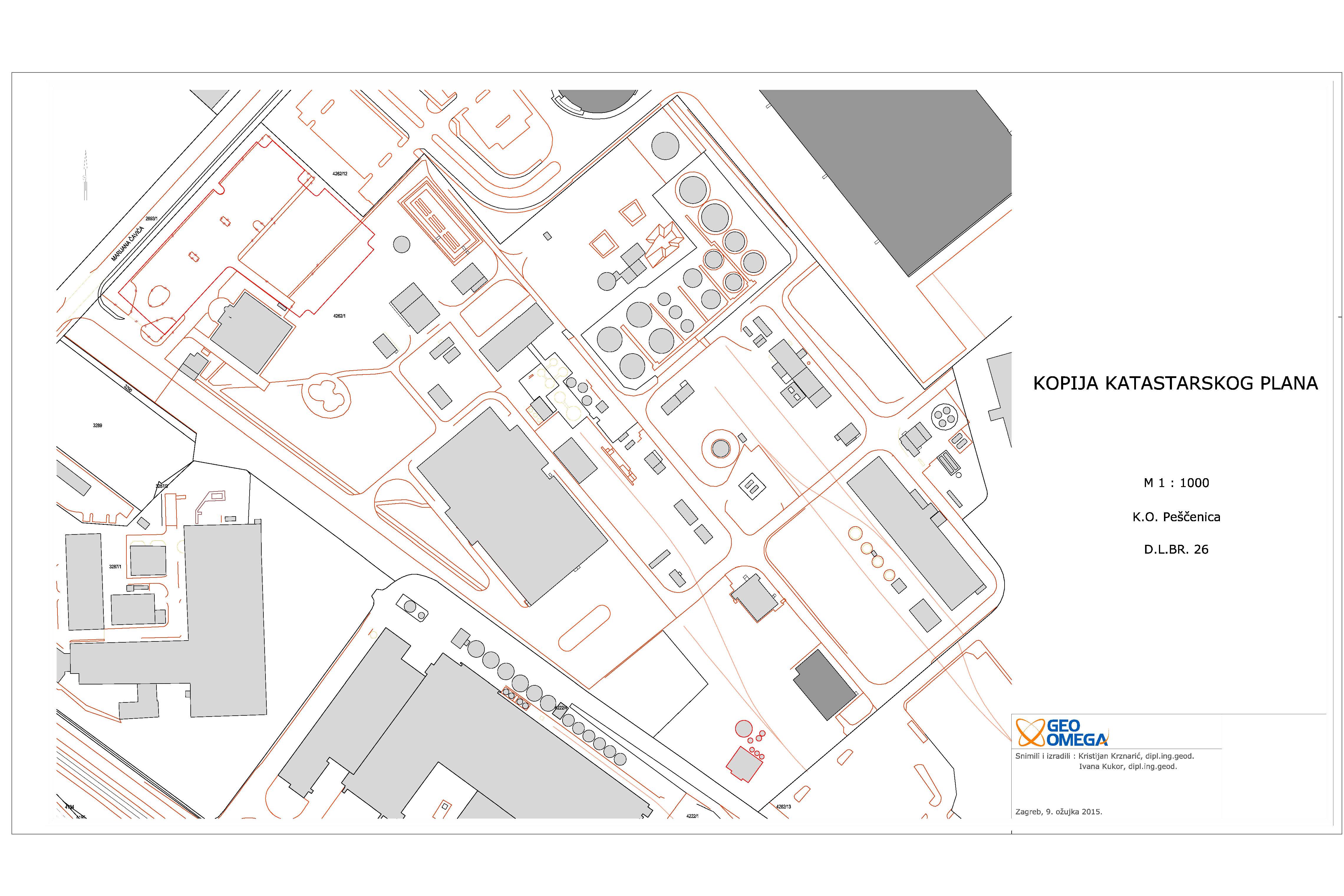
Registrating commercial building, 7 tanks and parking lot
Zvijezda d.d.
cadastral municipality Pešćenica
118000 m2
1 cadastral parcel(s) 1 land registry parcel(s)
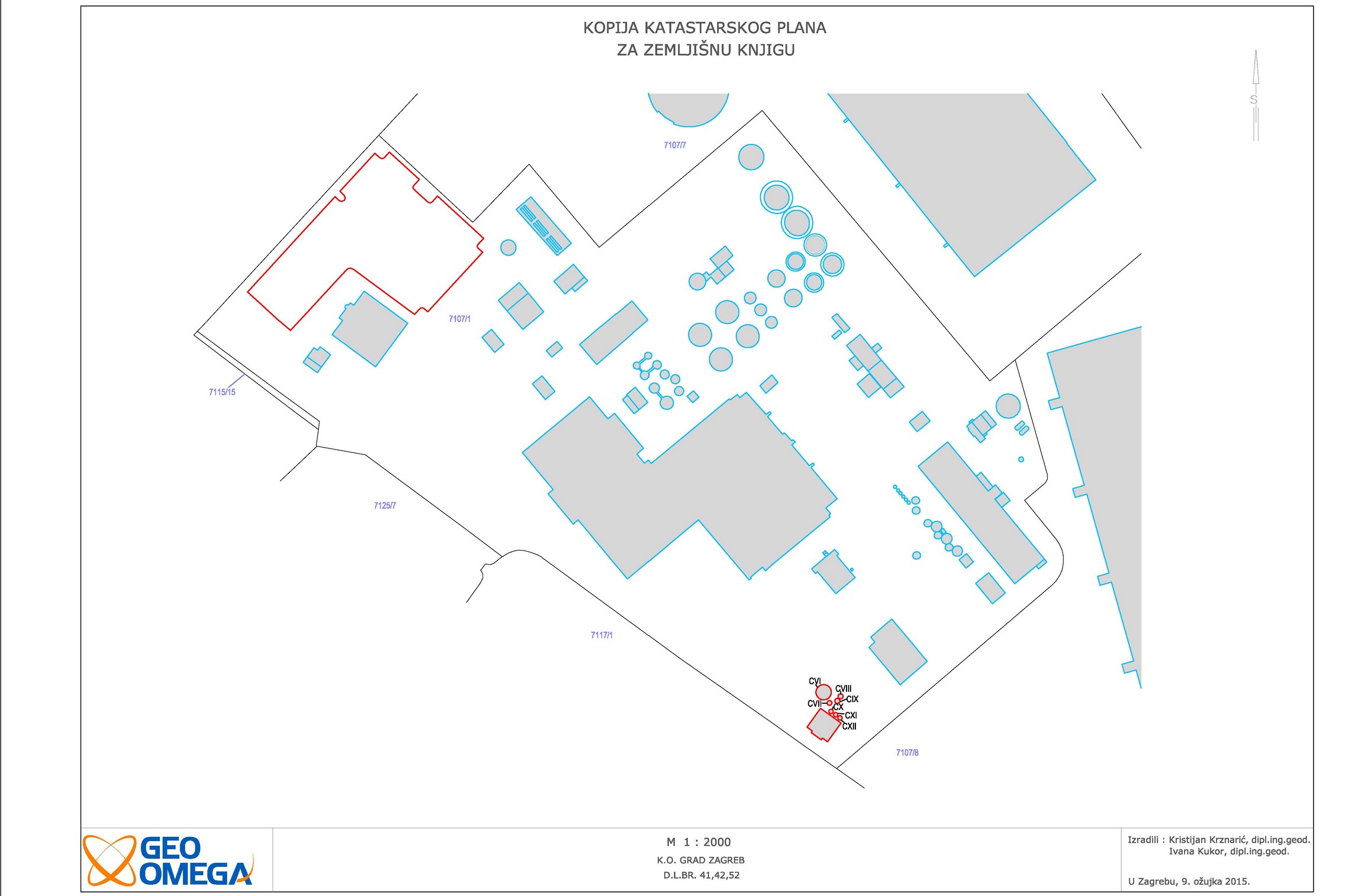
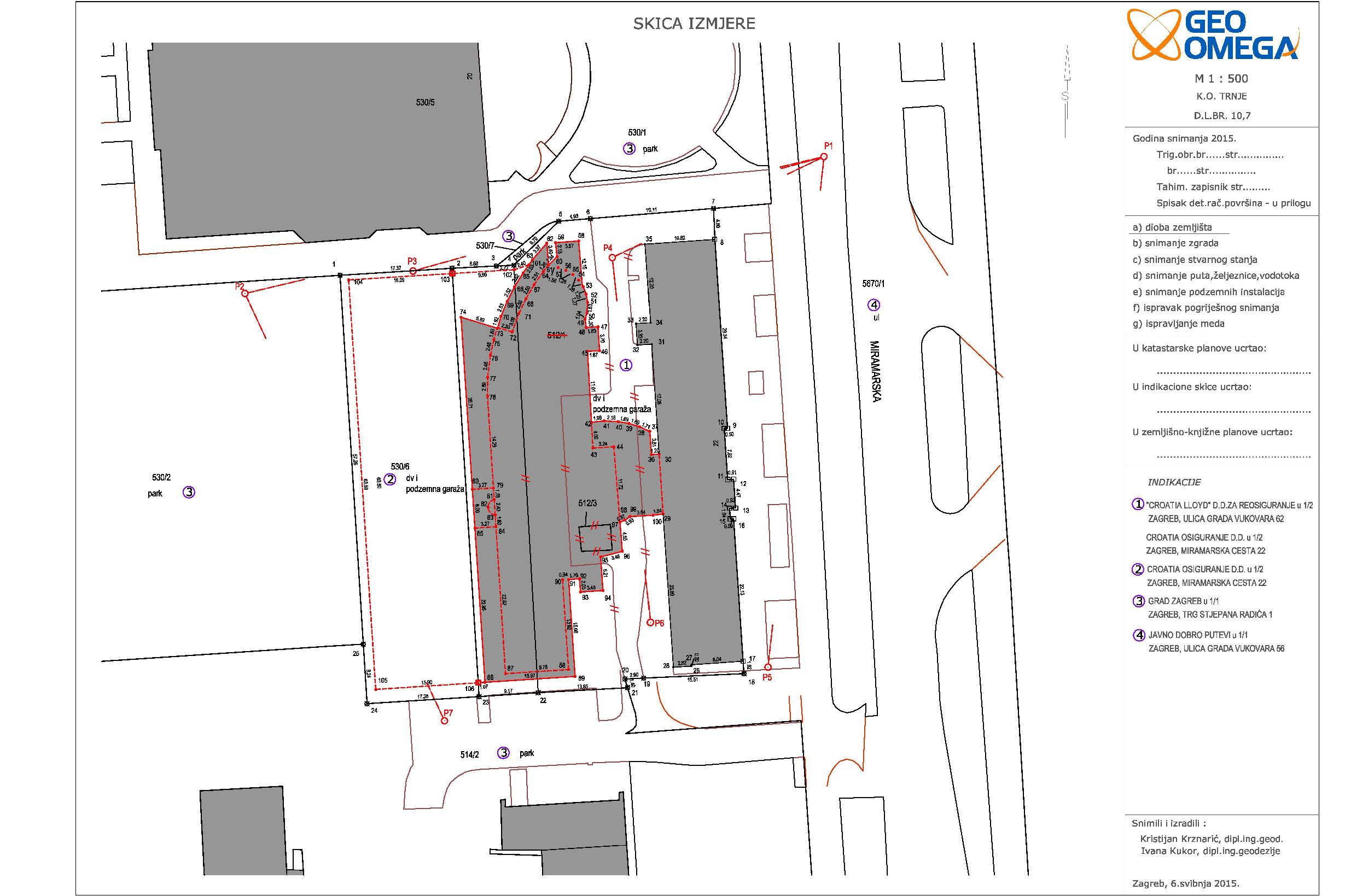
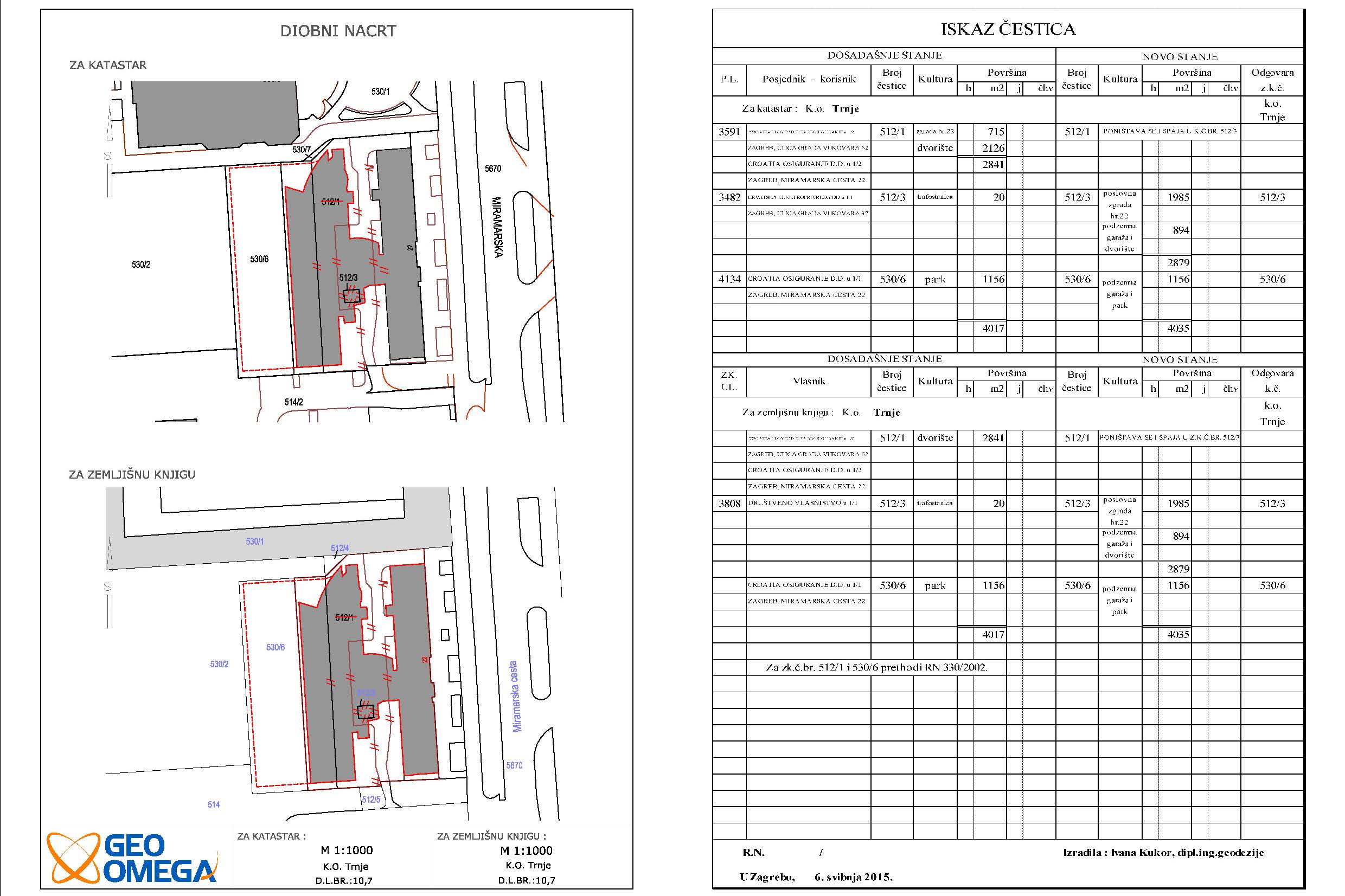
Parcelling and registrating commertial building and underground garage
Croatia osiguranje d.d.
cadastral municipality Trnje
4000 m2
3 cadastral parcel(s) 3 land registry parcel(s)
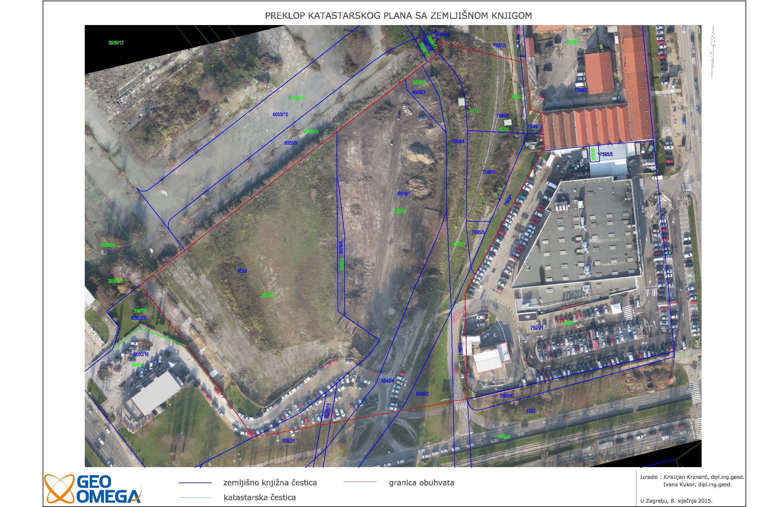
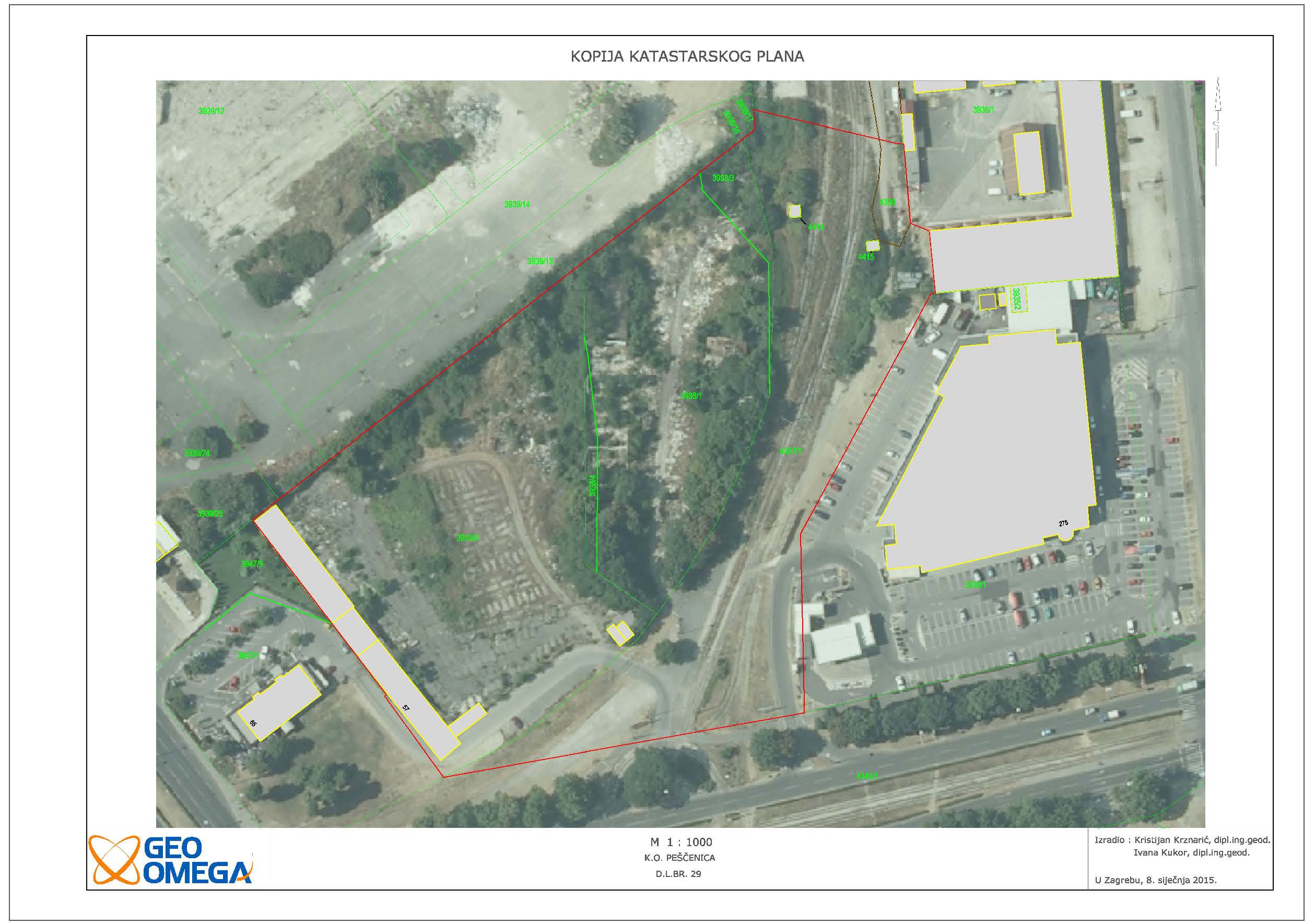
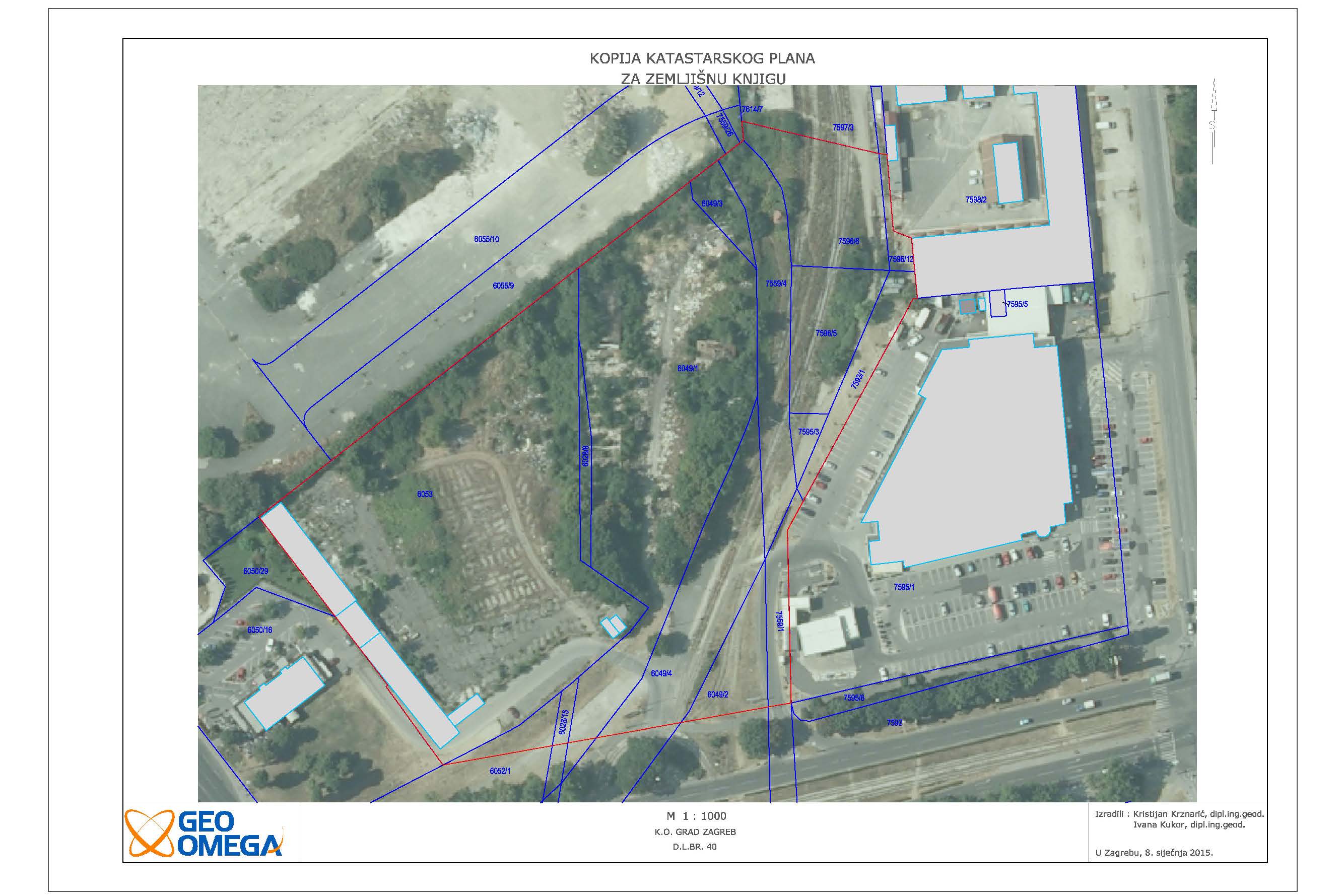
Analysis of Cadastre and Land registry - Pešćenica
MAMIĆ PERIĆ REBERSKI RIMAC odvjetničko društvo d.o.o.
cadastral municipality Pešćenica
28000 m2
13 cadastral parcel(s) 15 land registry parcel(s)
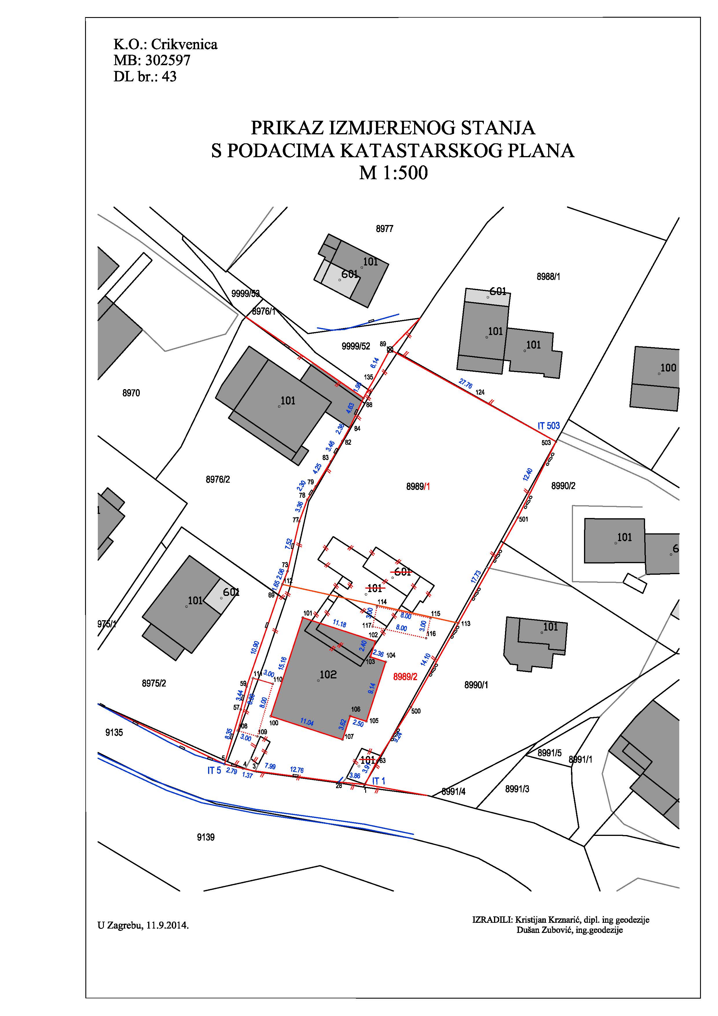
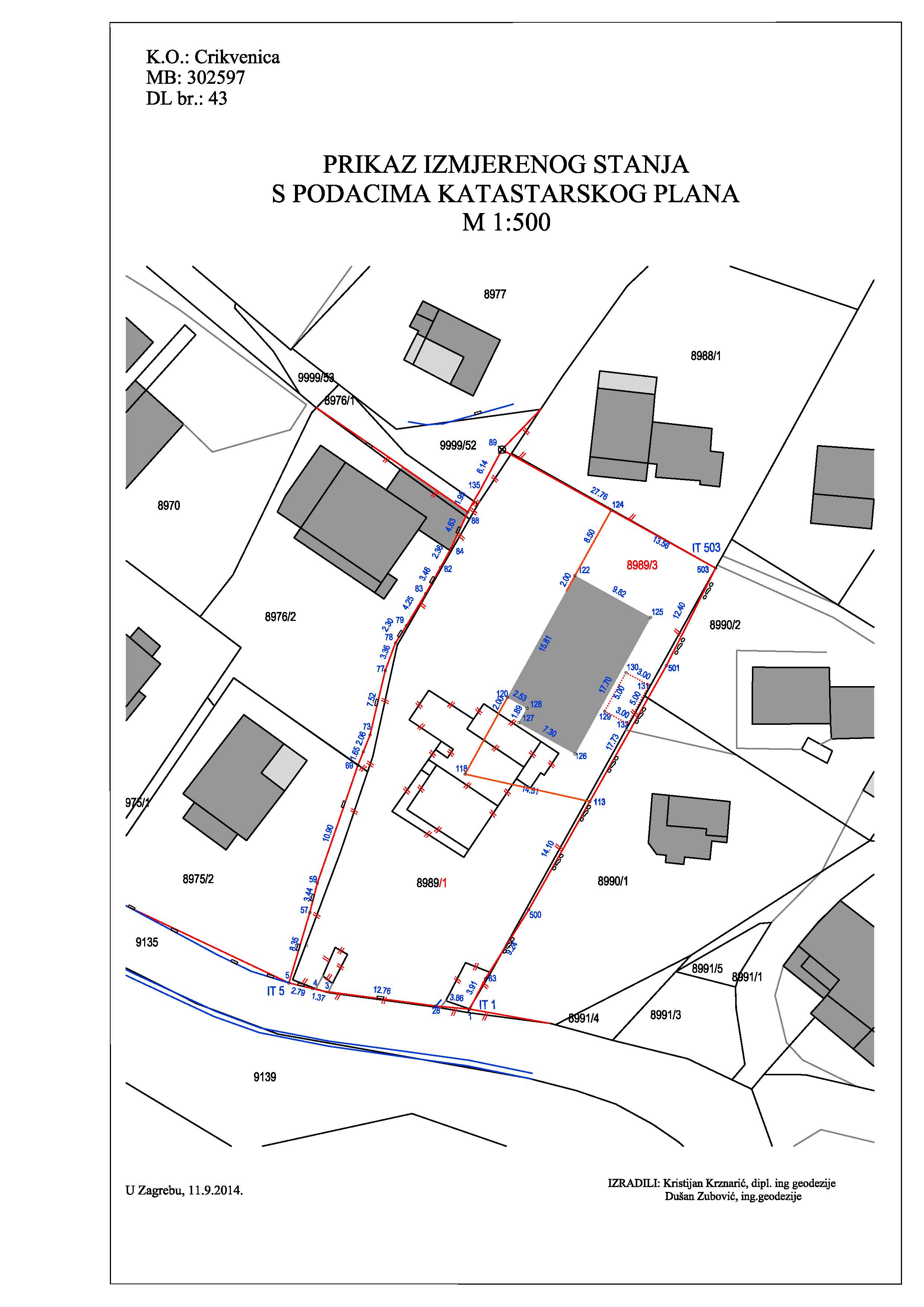
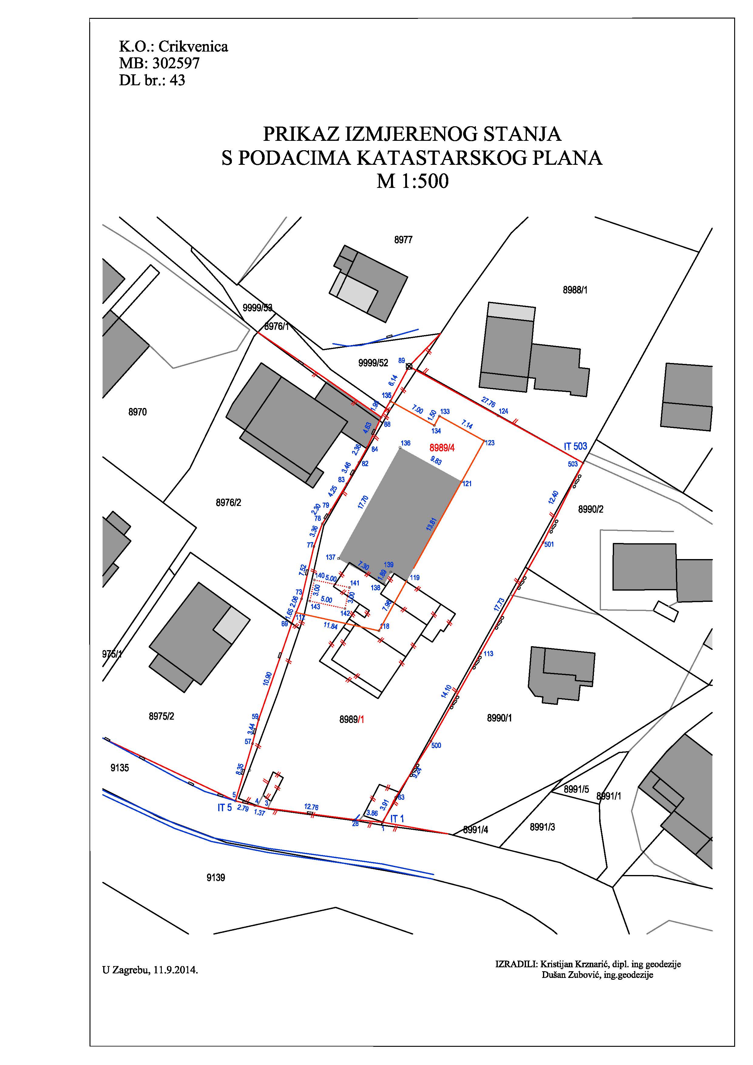
3 survey studies - Projekt MT - Crikvenica
PROJEKT MT d.o.o.
cadastral municipality Crikvenica
1500 m2
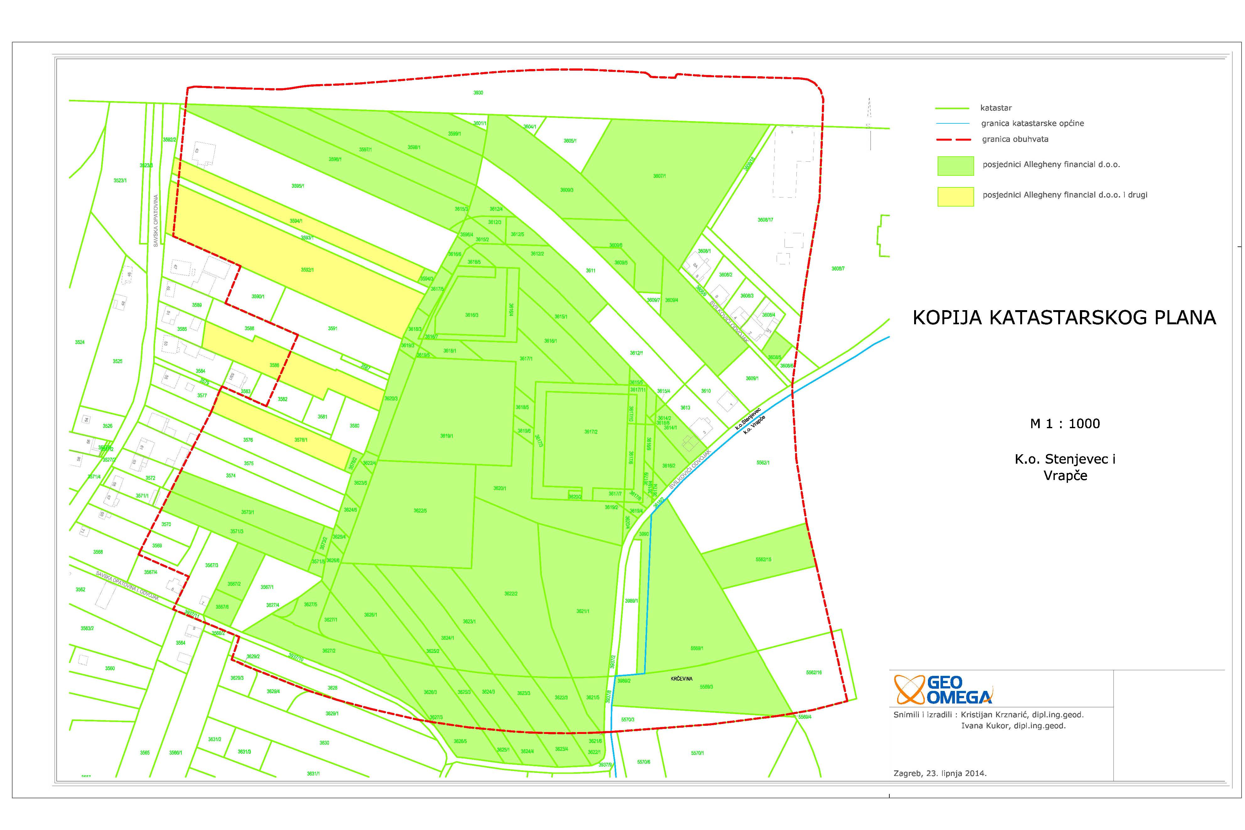
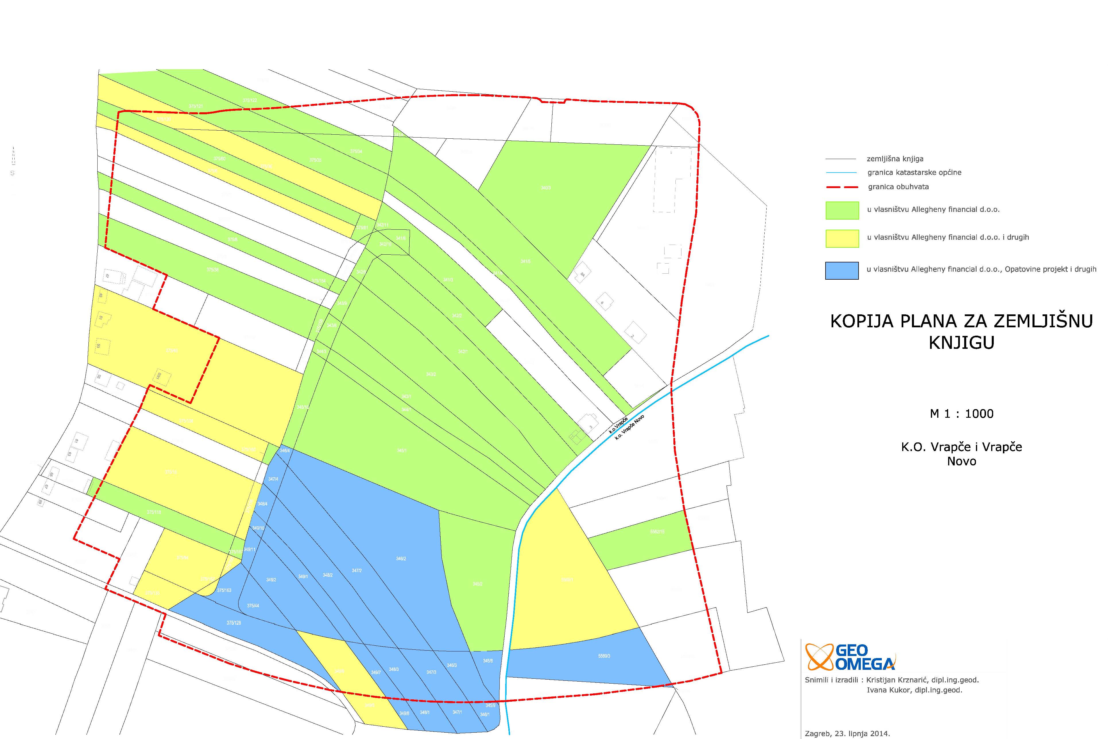
Analysis of Cadastre and Land registry
MAMIĆ PERIĆ REBERSKI RIMAC odvjetničko društvo d.o.o.
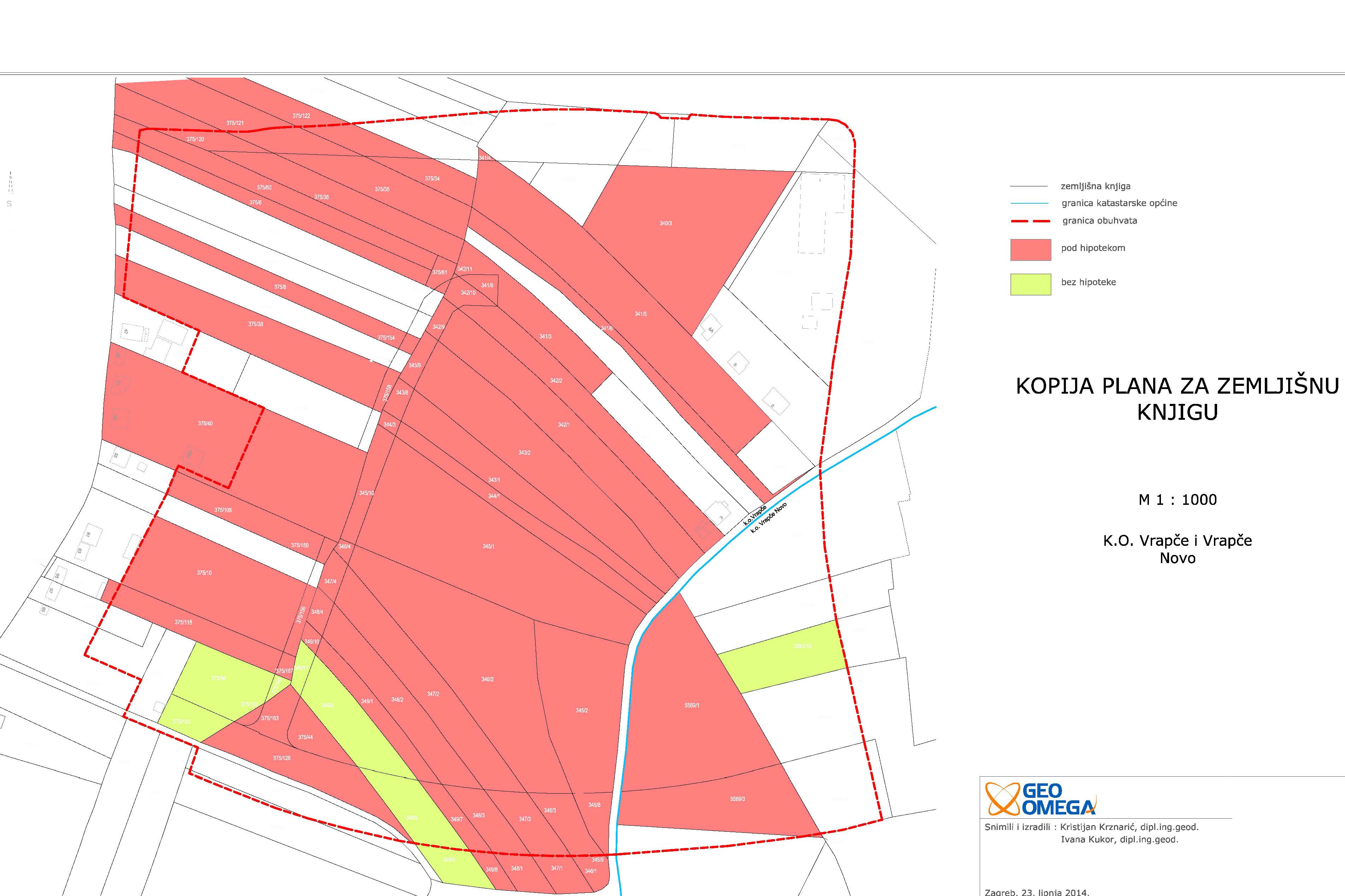
cadastral municipality Stenjevec i Vrapče
115000 m2
128 cadastral parcel(s) 192 land registry parcel(s)
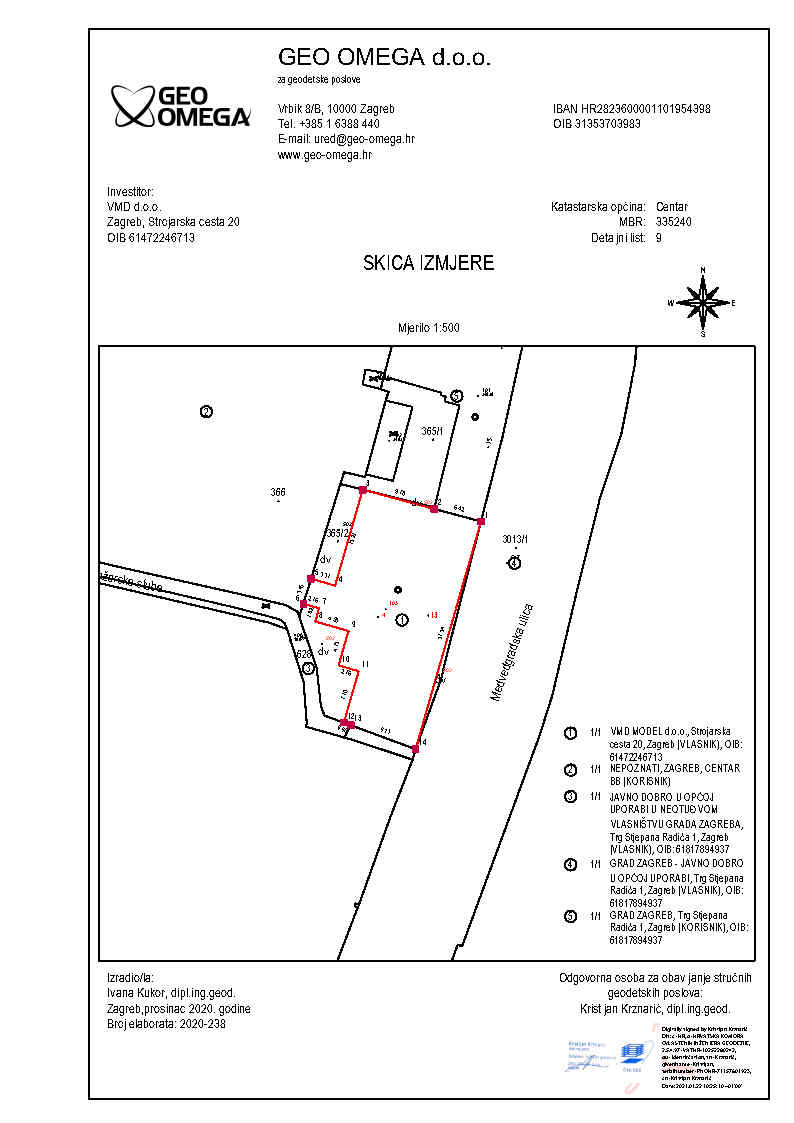
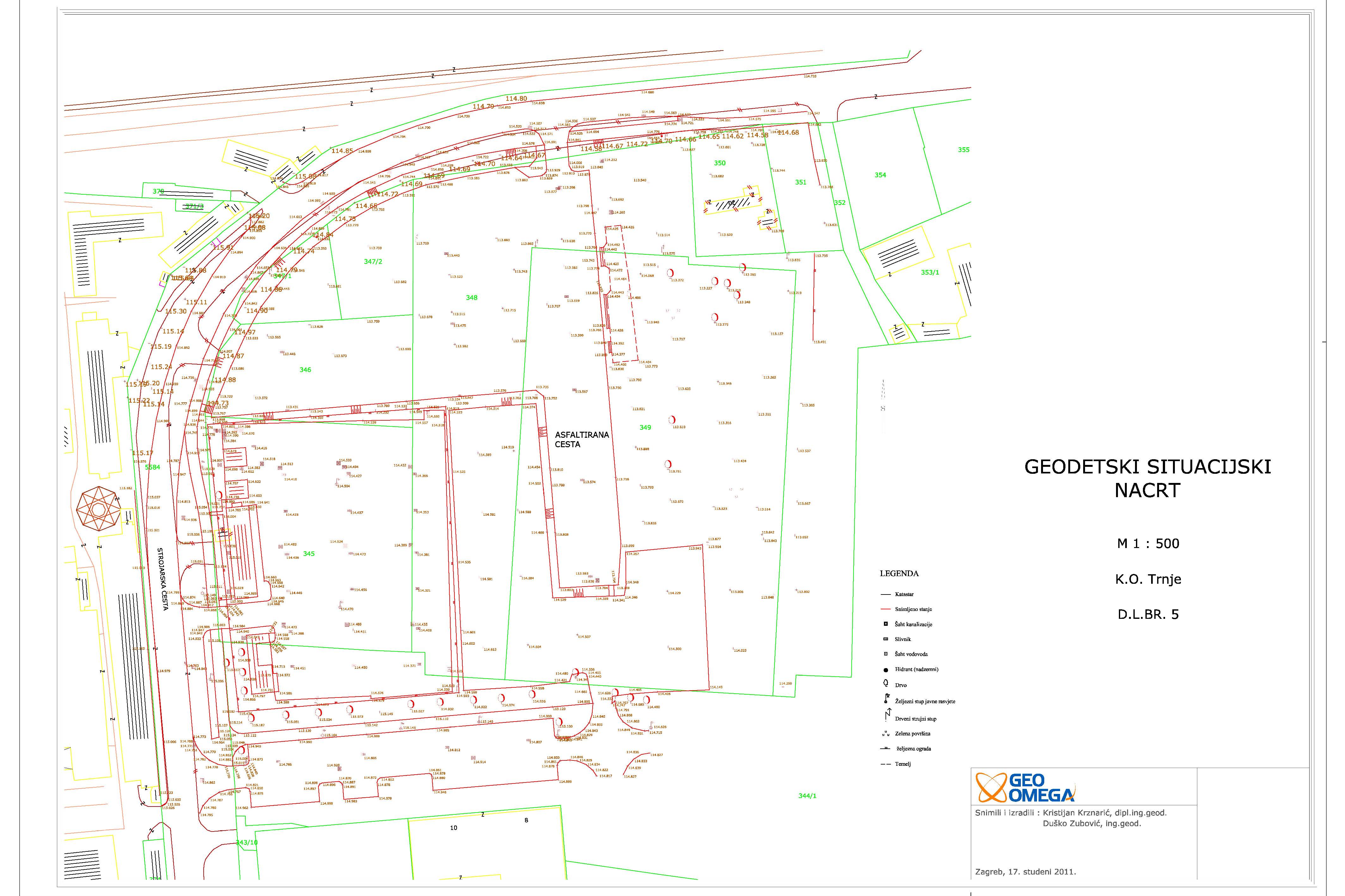
Survey study VMD Strojarska
VMD grupa d.o.o.
cadastral municipality Trnje
10200 m2
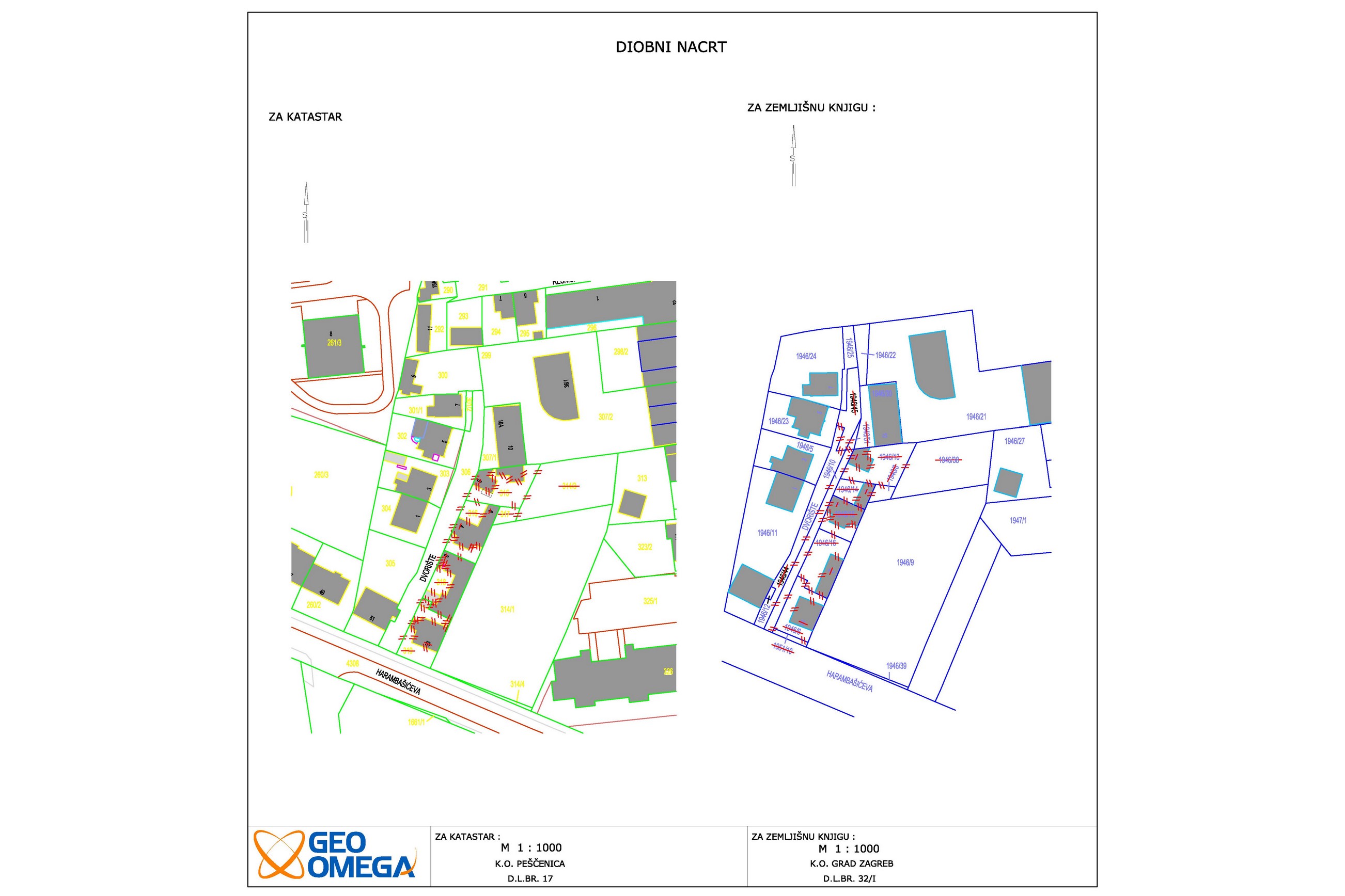
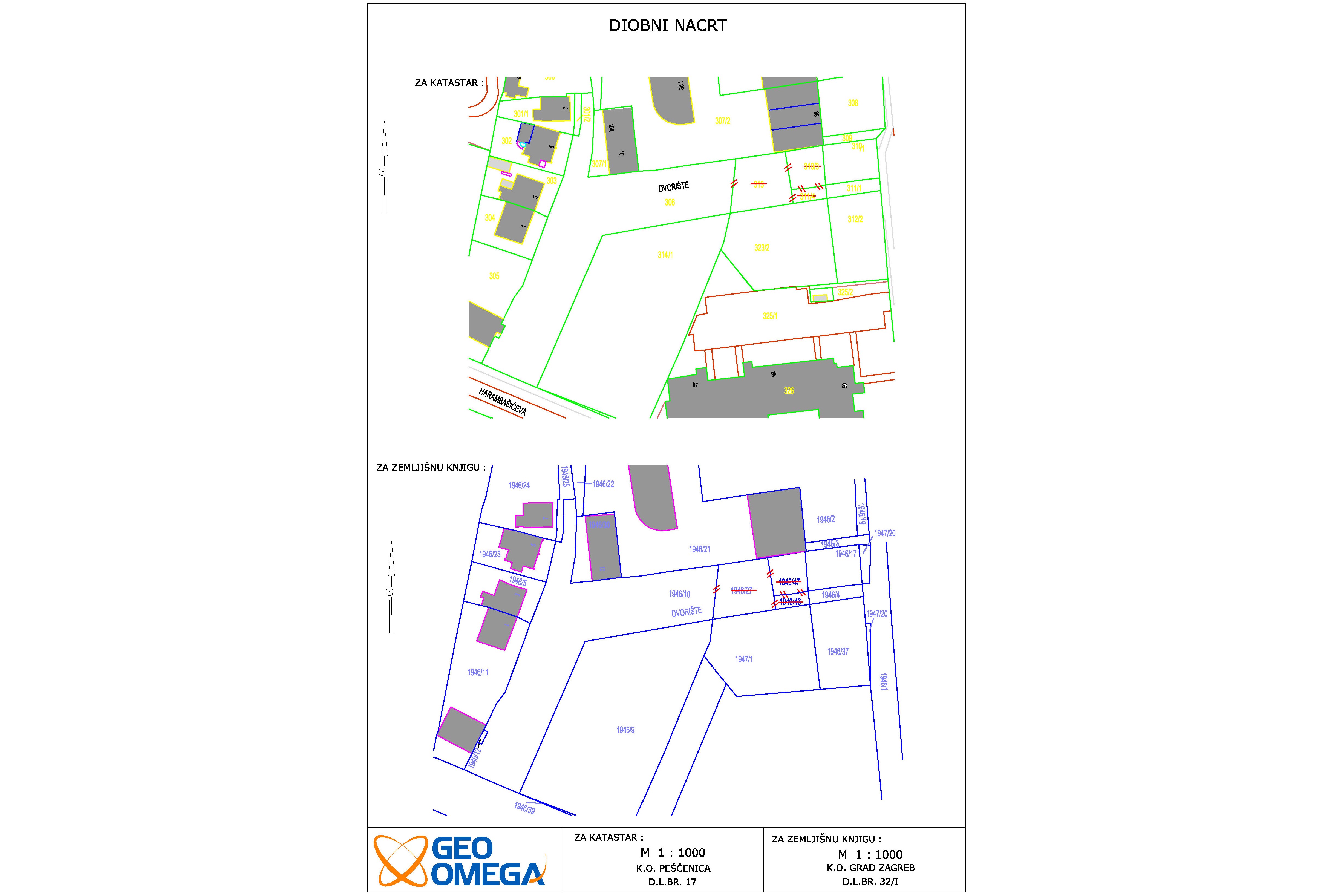
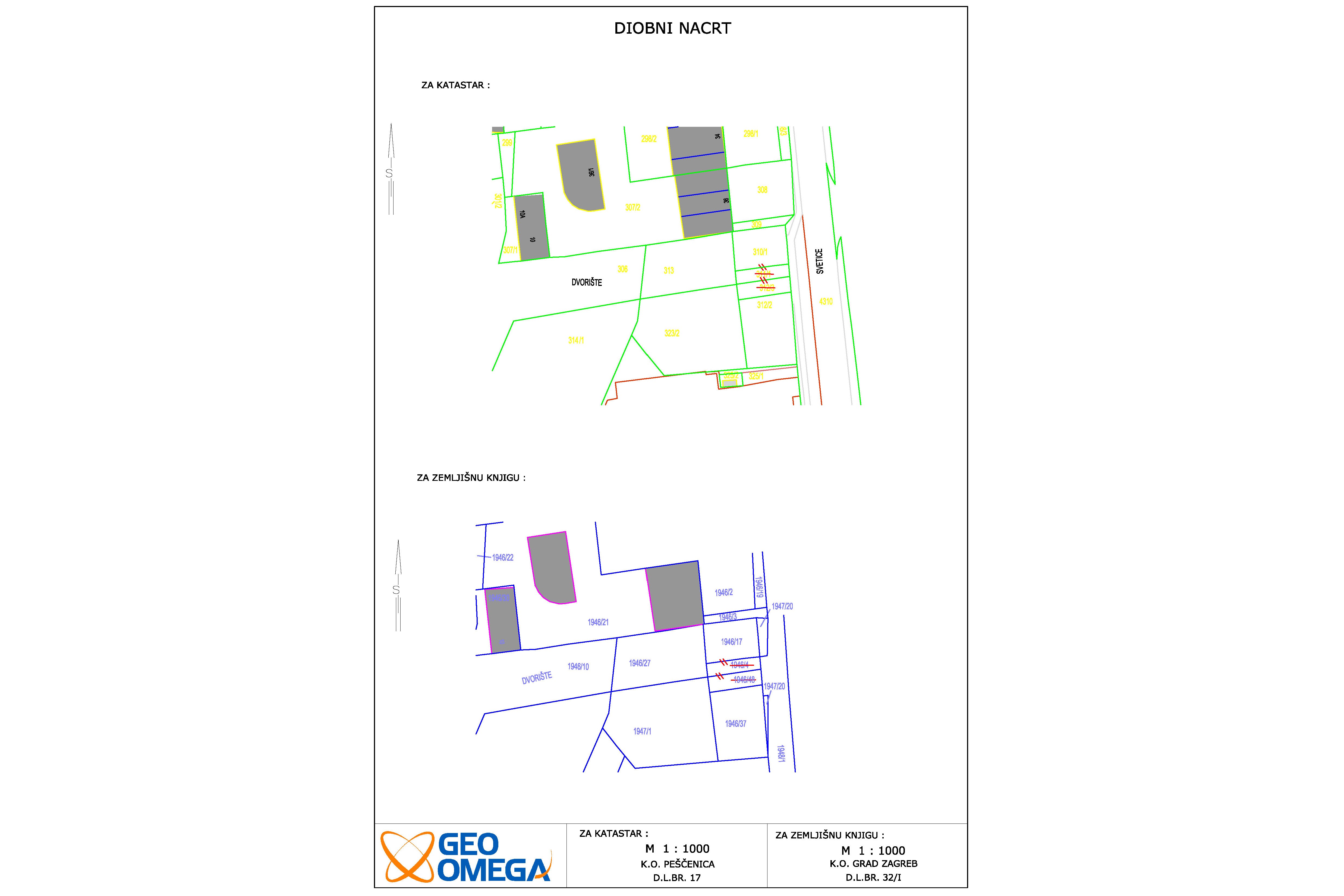
Parcelling of Dvorište street
Grad Zagreb
cadastral municipality Pešćenica
2000 m2
13 cadastral parcel(s) 18 land registry parcel(s)
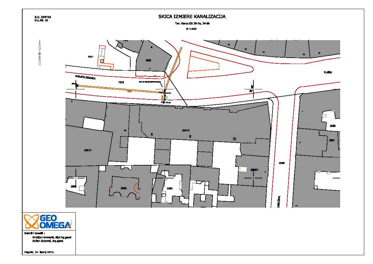
Utility projects study - Ban centar
CENTAR GRADSKI PODRUM d.o.o.
cadastral municipality Centar
100 m
Parcelling part of Gračanske dužice street
Grad Zagreb
cadastral municipality Gračani
4000 m2
14 cadastral parcel(s) 12 land registry parcel(s)
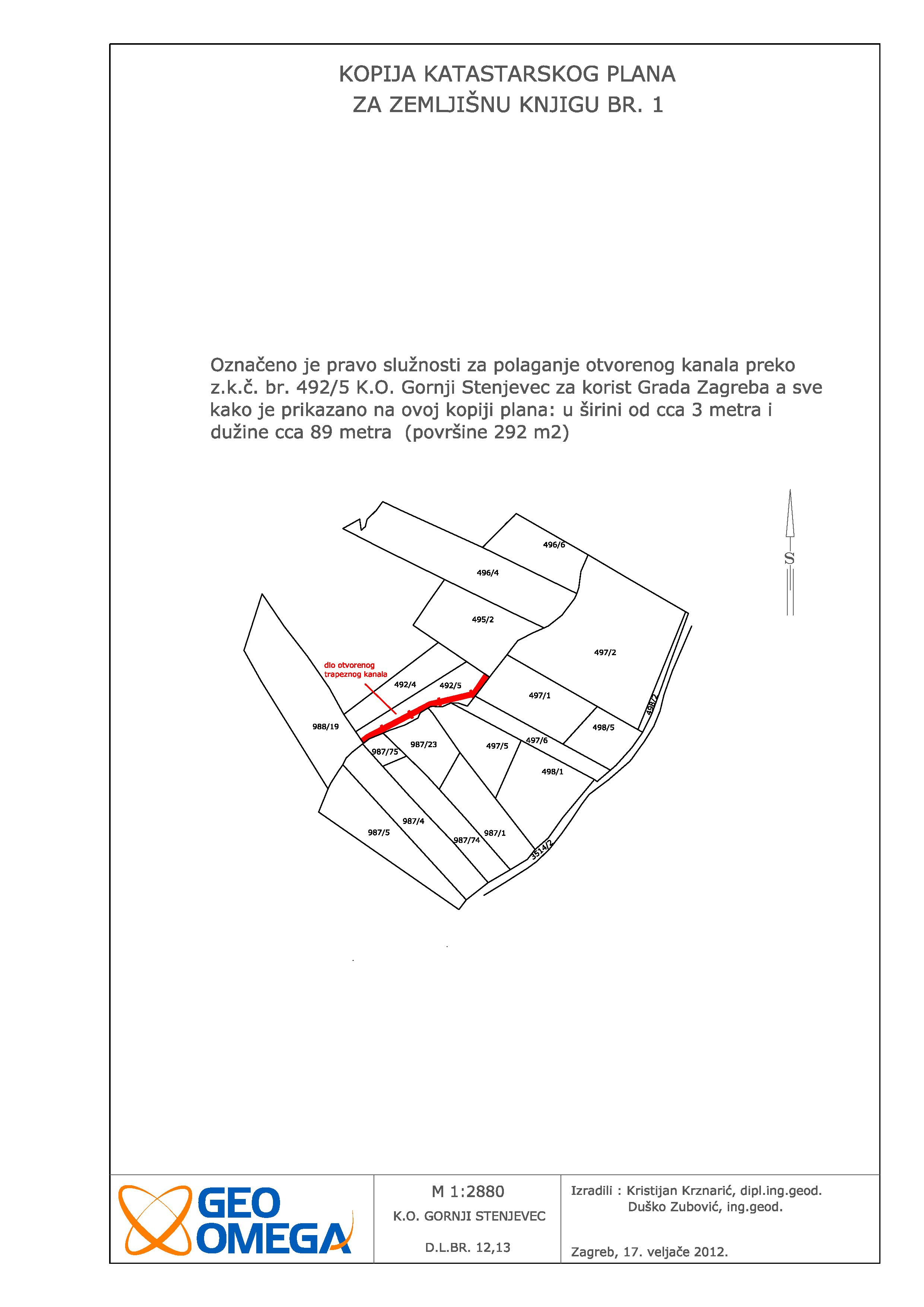
Easement study within sanation of landslide Šublinov Brijeg
Grad Zagreb
cadastral municipality Gornji Stenjevec
3000 m2
10 cadastral parcel(s) 9 land registry parcel(s)
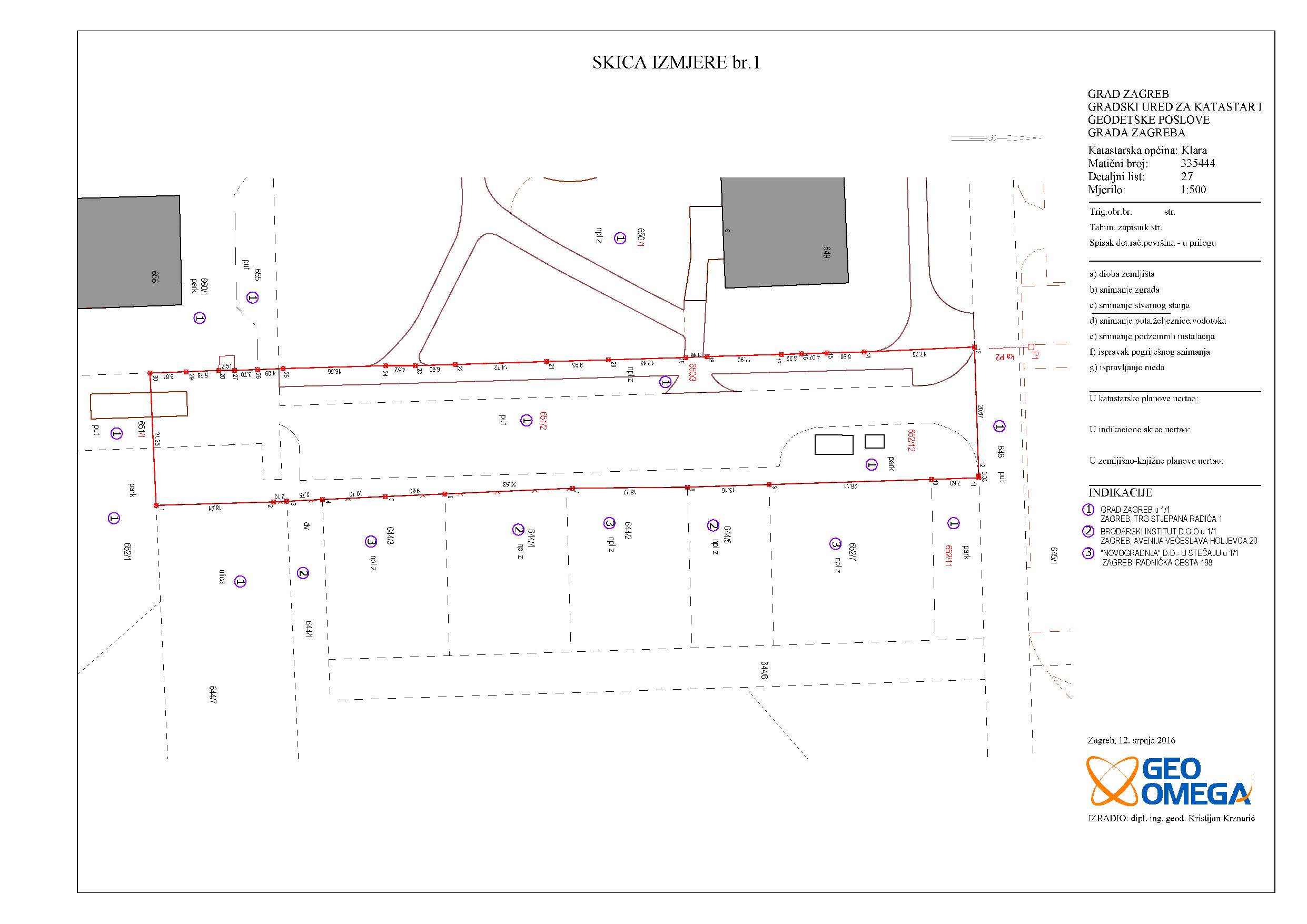
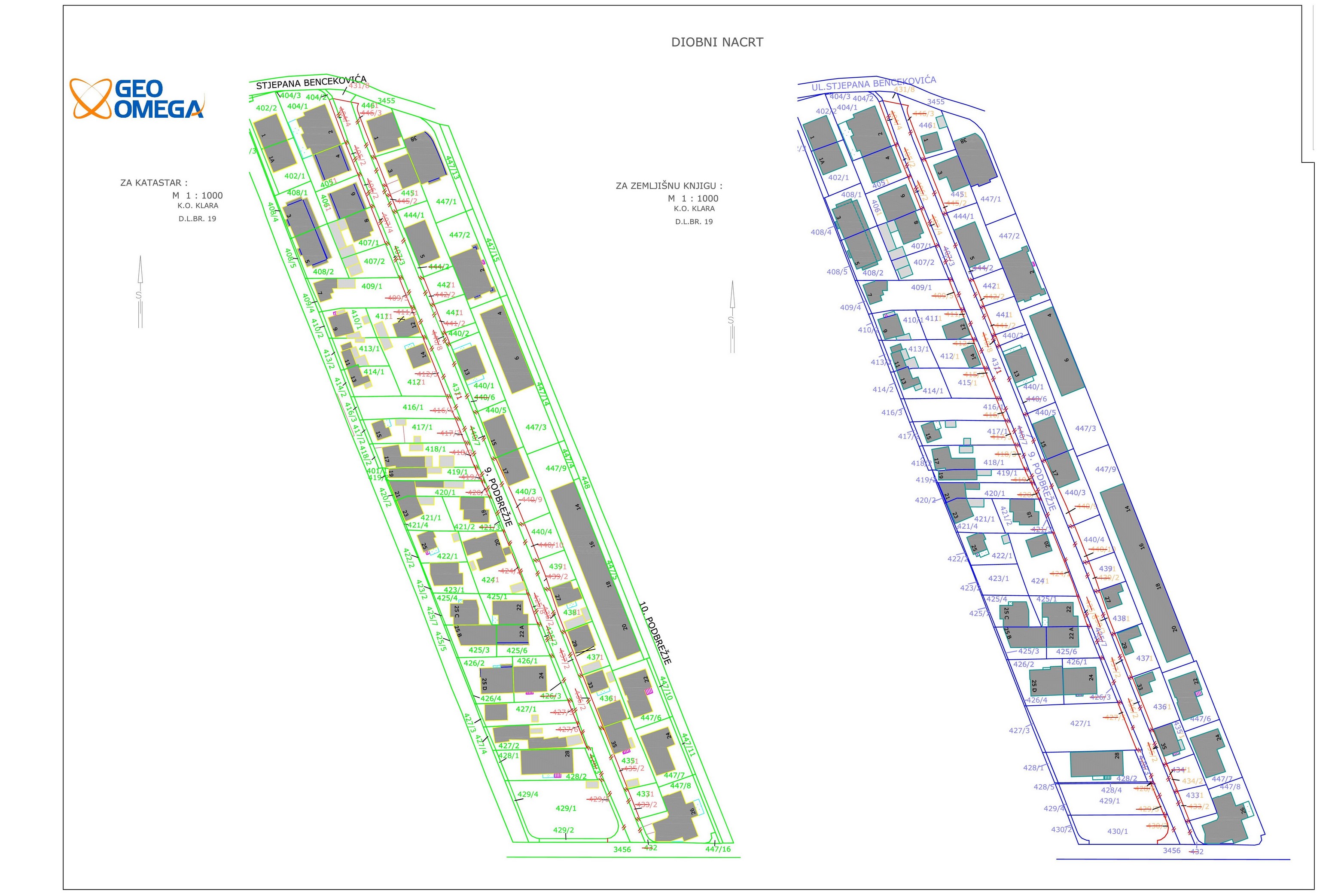
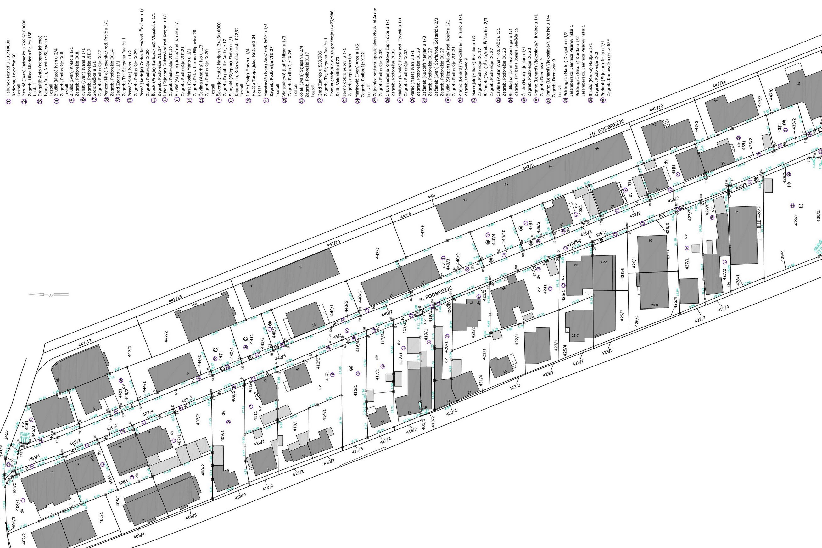
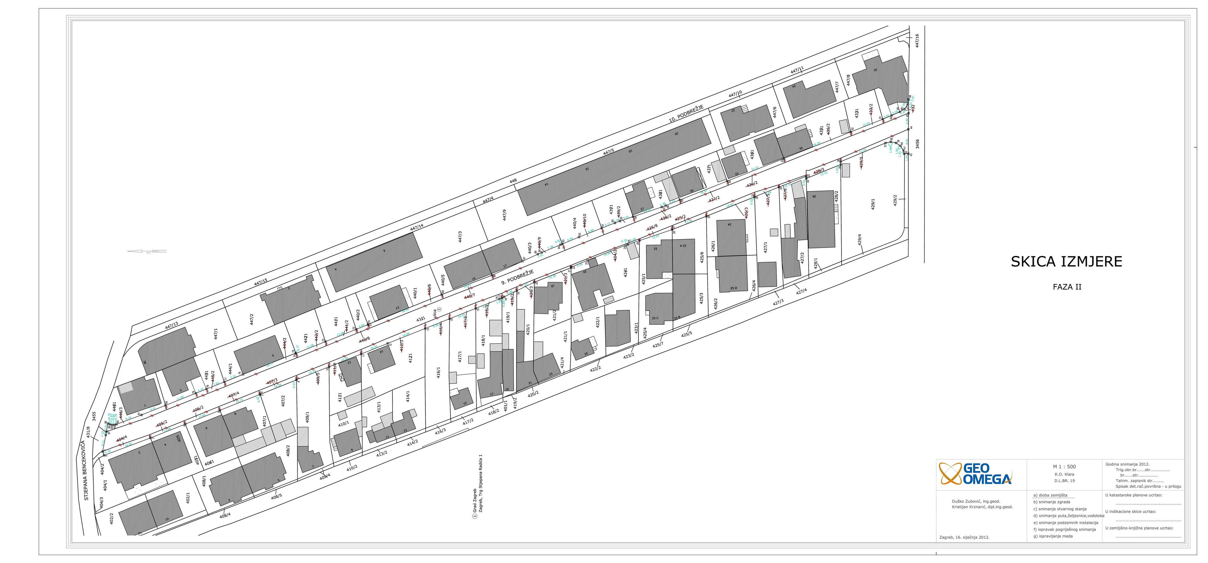
Parcelling of 9th Podbrežje street
Grad Zagreb
cadastral municipality Klara
2800 m2
40 cadastral parcel(s) 43 land registry parcel(s)
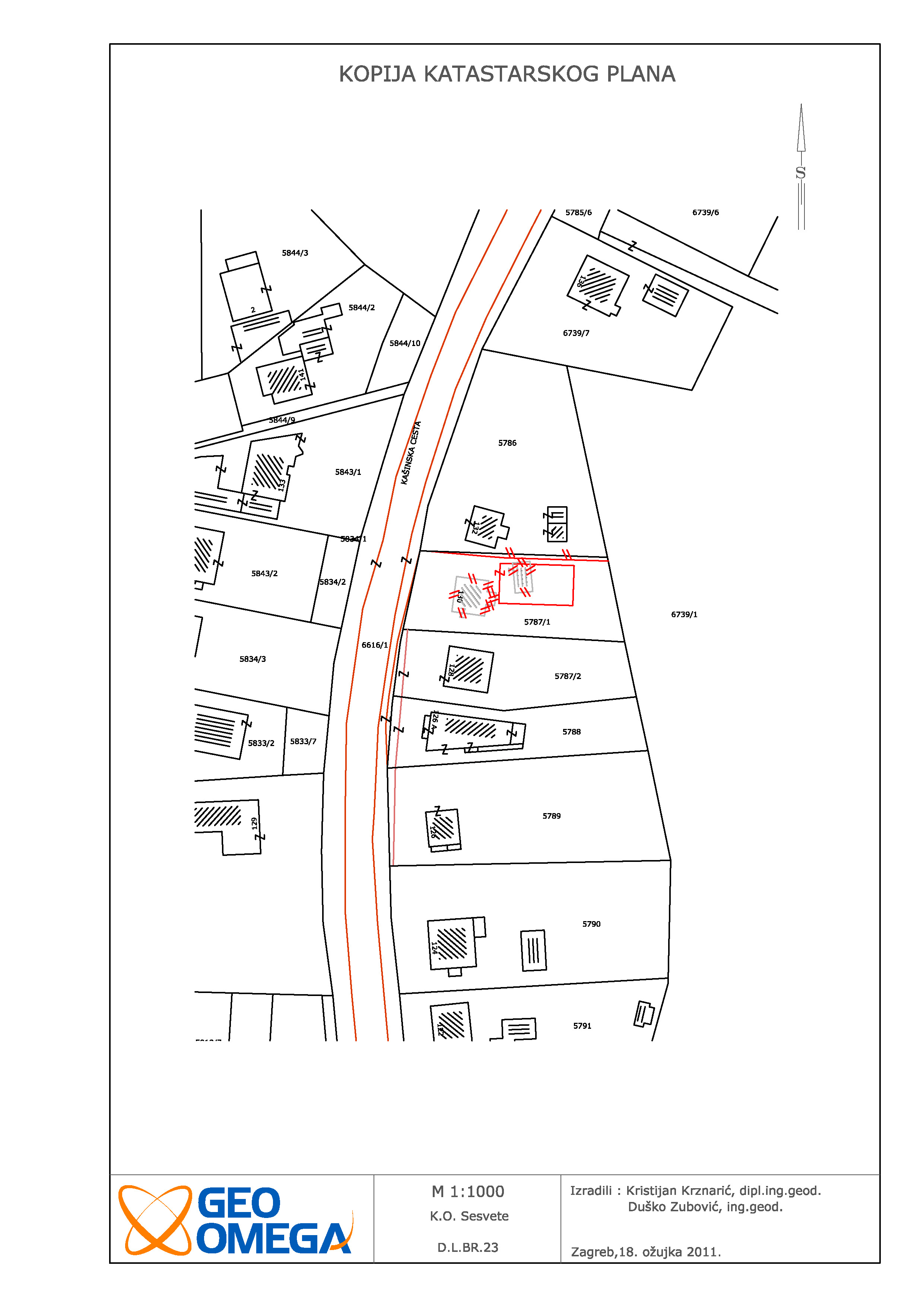
Technical reambulation study
DECORUM d.o.o.
cadastral municipality Sesvete
5500 m2
5 cadastral parcel(s) 5 land registry parcel(s)
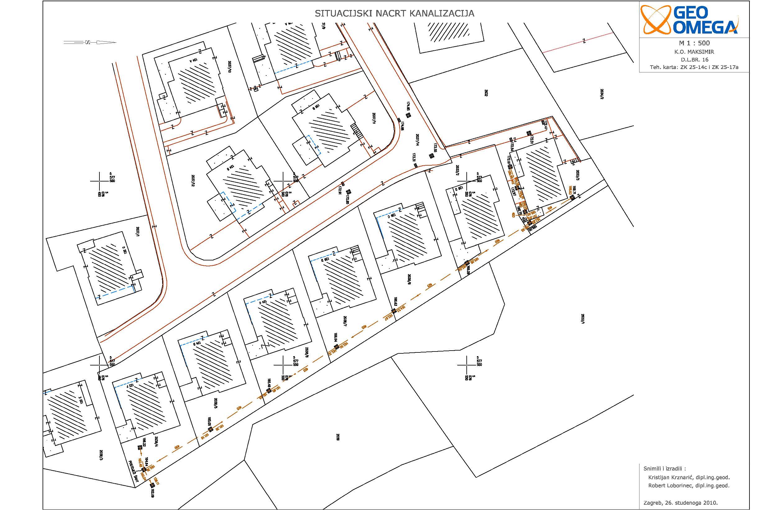
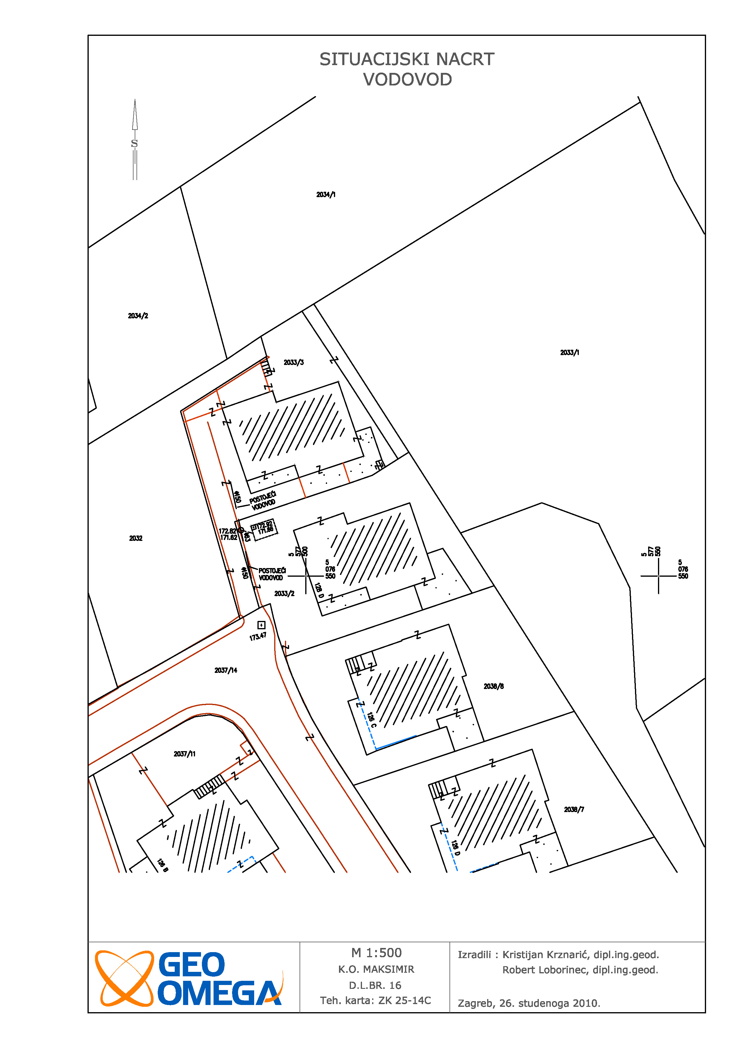
Utility projects study - sewage and water supply
INGRA d.d.
cadastral municipality Maksimir
150 m
Percelling of Oporovečka street
Oporovec gradnja d.o.o.
cadastral municipality Dubrava
17500 m2
30 cadastral parcel(s) 36 land registry parcel(s)
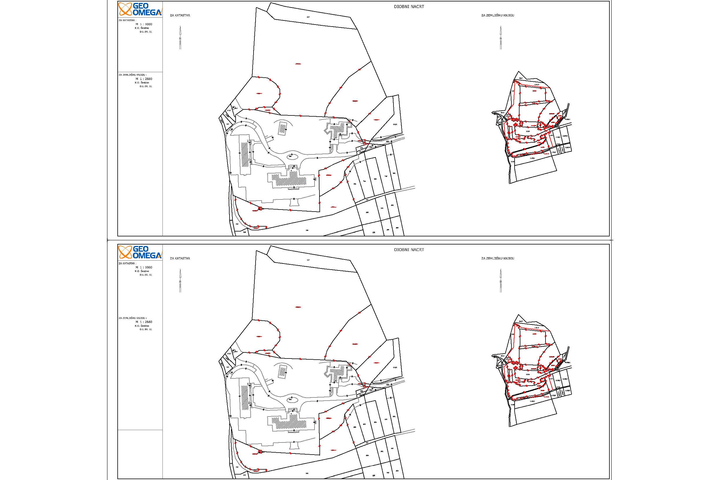
Parcelling - Kulmerovi dvori
Agrokor d.d.
cadastral municipality Šestine
39000 m2
13 cadastral parcel(s) 18 land registry parcel(s)
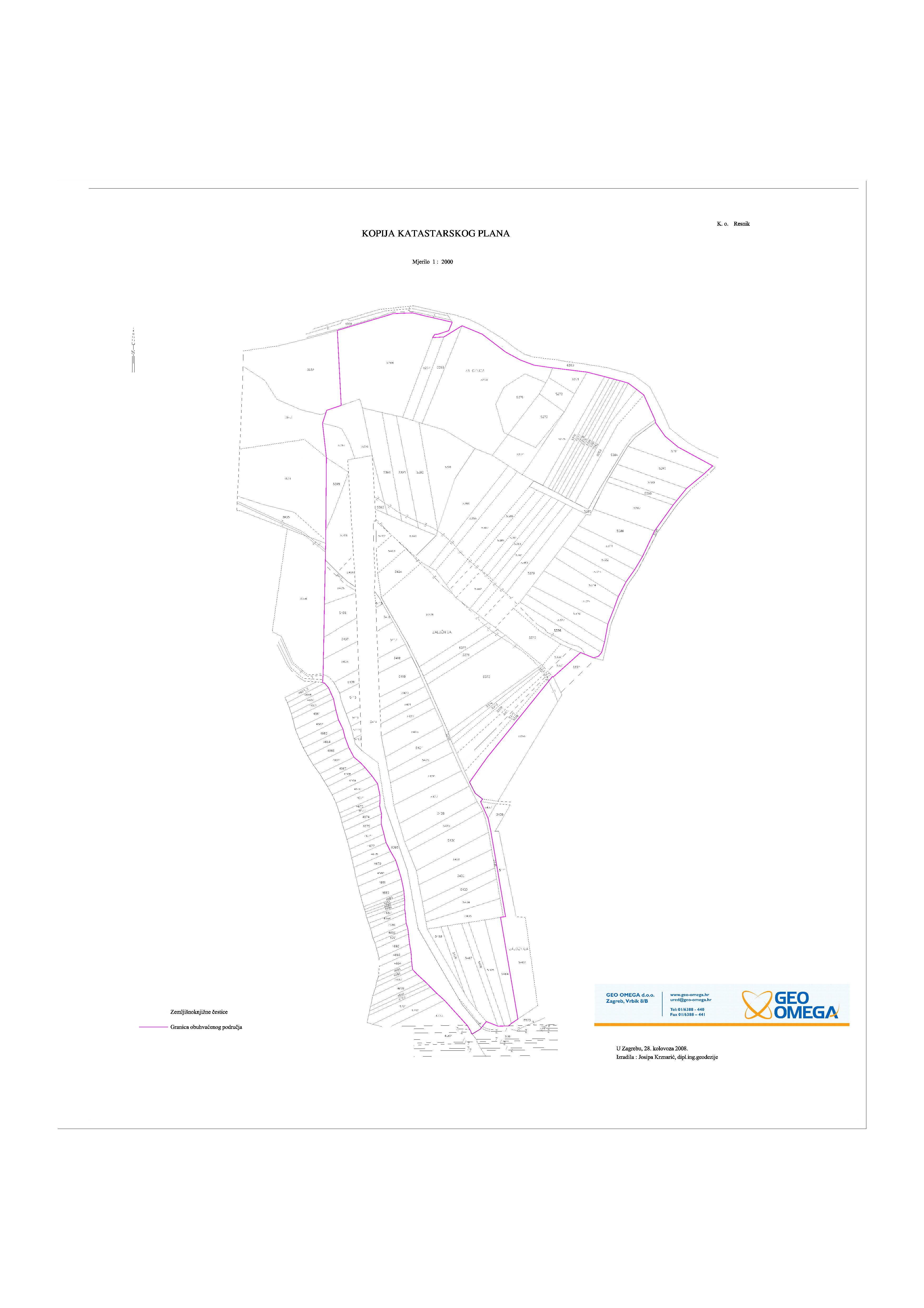
Analysis of Cadastre and Land registry - Resnik
KOM-EKO d.o.o.
cadastral municipality Resnik
240000 m2
135 cadastral parcel(s) 151 land registry parcel(s)
Analysis of Cadastre and Land registry - Centar
CCS ULAGANJA d.o.o.
cadastral municipality Centar
6000 m2
16 cadastral parcel(s) 21 land registry parcel(s)
Utility projects study - internal sewage
Bridgnorth d.o.o.
cadastral municipality Remete
50 m