Modeling the range of transmission
INDUSTROOPREMA d.o.o.
cadastral municipality Sesvete
10 ha
123
2.7 cm/pixel
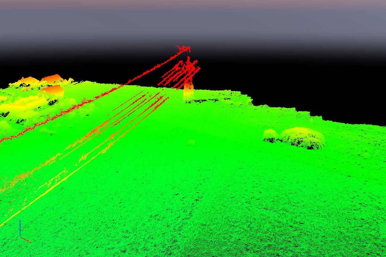
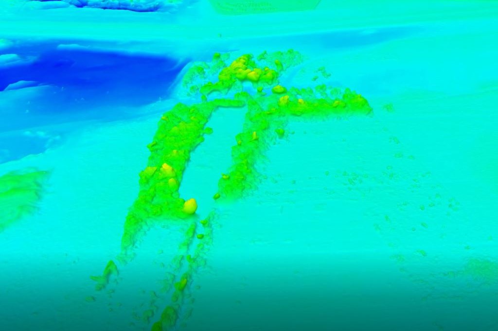
The project included modeling the range of transmission (2 transmission lines, wires between them, terrain and objects in the corridor in relation to the axis of the transmission line). A study of transmission lines interdependence between existing buildings and designed building has been made.
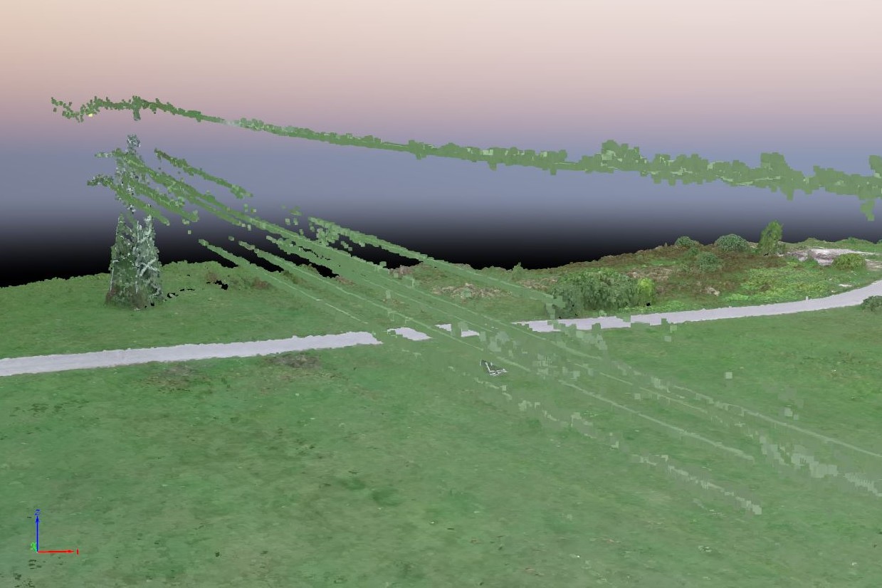
Point cloud
Heights
x
![]()
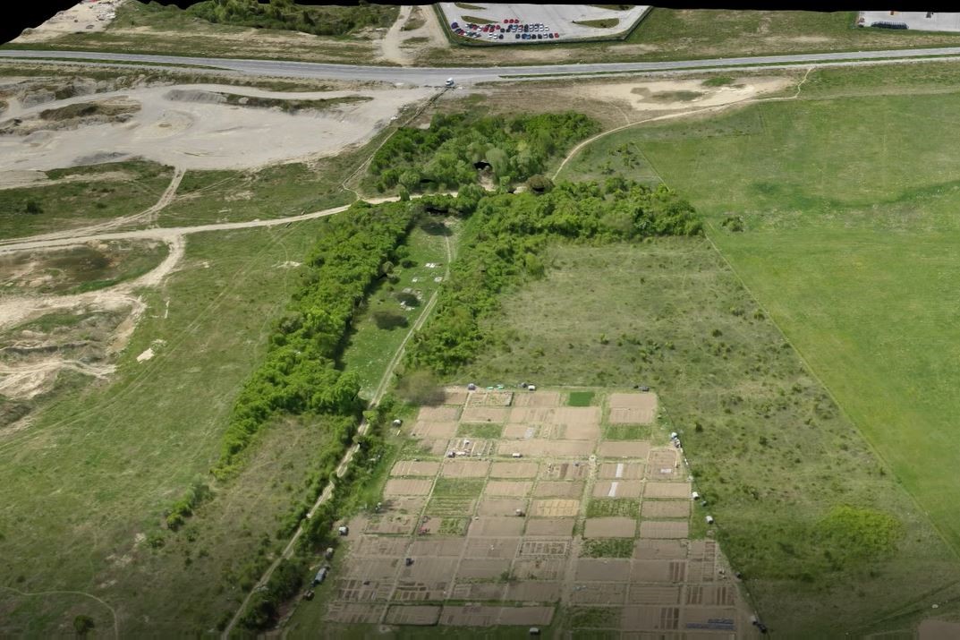
Digital terrain model for road design
PRONAD d.o.o.
cadastral municipality Stenjevec
25 ha
237
3.3 cm/pixel
Digital terrain model and orthomosaic were made for planning purposes of two roads and supporting infrastructure. Within mentioned a surveying project for roads has been made .
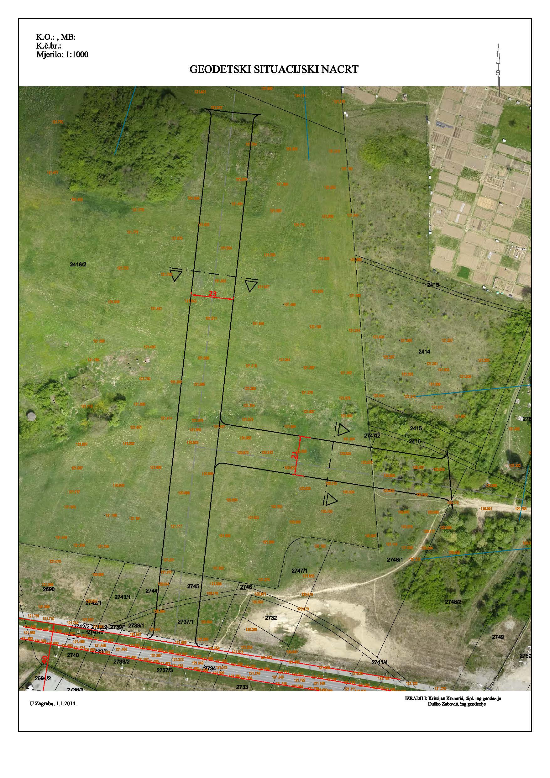
Orthomosaic in survey plan
3D model
Heights
x
![]()


